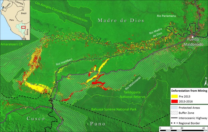
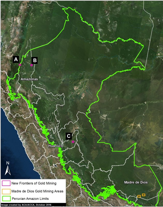
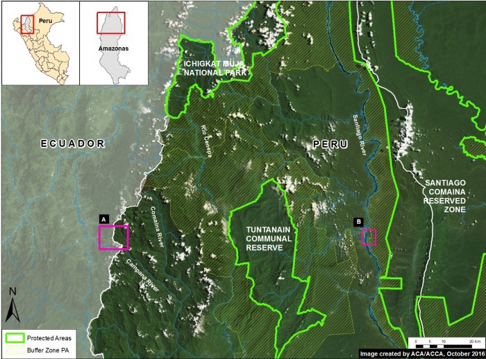
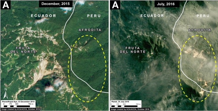
We analyzed hundreds of high-resolution satellite images to calculate the amount of recent (October 2012 – October 2016) gold mining deforestation in the southern Peruvian Amazon: 30,895 acres. Combining this finding with previous studies, we estimate the total gold mining deforestation of around 154,440 acres in the region. Image 50a shows the recent gold mining deforestation in red, and all previous gold mining deforestation in yellow.
Key findings include:
- The vast majority of the deforestation has occurred in the Madre de Dios region, but also has extended to the adjacent regions of Cusco and Puno.
- The rate of recent gold mining deforestation was much lower (42%) than during its peak, which occurred between 2010 and 2012 (6,640 vs. 15,650 acres/year).
- However, half of the recent gold mining deforestation (15,830 acres) occurred within the buffer zones of three protected areas (Tambopata National Reserve, Bahuaja Sonene National Park, and Amarakeari Communal Reserve).
- Moreover, recent gold mining deforestation invaded two protected areas (Tambopata and Amarakaeri).
Previously, Dr. Greg Asner and colleagues documented the deforestation of approximately 123,200 acres (50,000 hectares) by gold mining activities in the southern Peruvian Amazon through September 2012 (Asner et al 2013). We have updated this information by analyzing hundreds of recent (2016) high-resolution satellite images (see Methodology section below). We documented an additional 30,895 acres (12,503 hectares) of gold mining deforestation between October 2012 and October 2016. Thus, combining both studies, we estimate the total gold mining deforestation of around 154,440 acres (62,500 hectares).
Areas of Interest
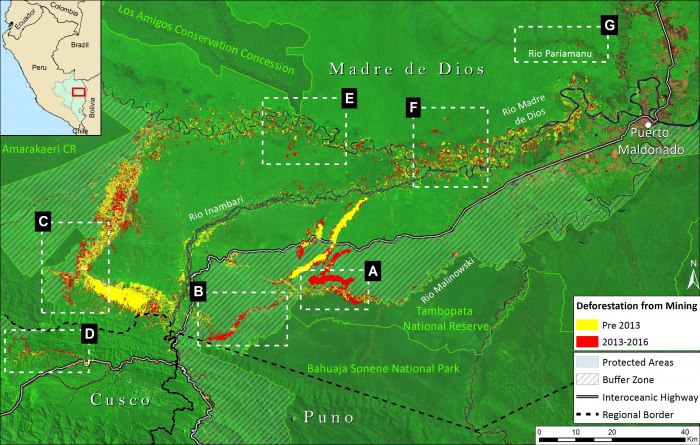
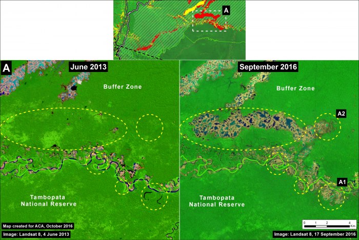
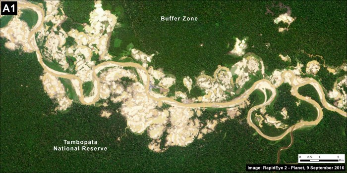
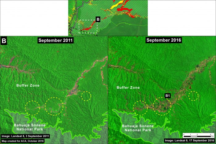
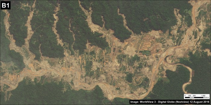
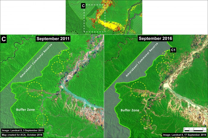
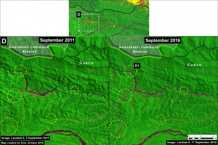
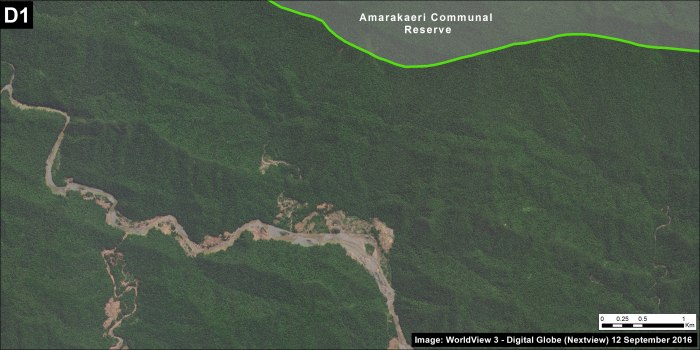
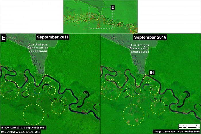
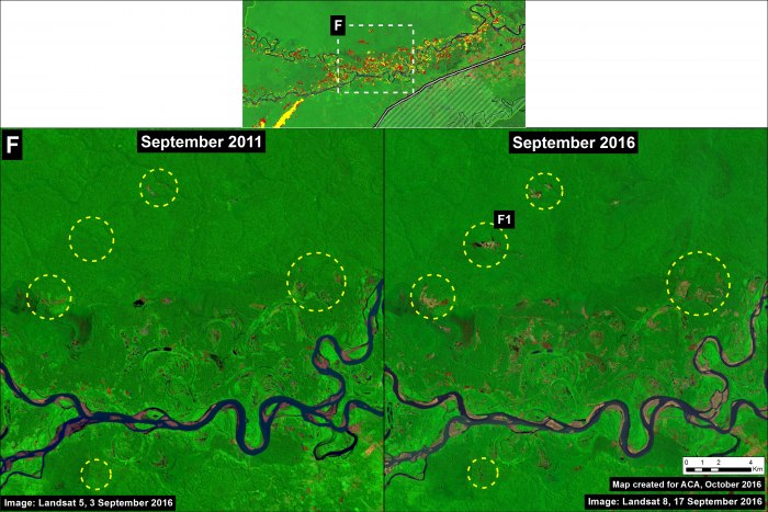
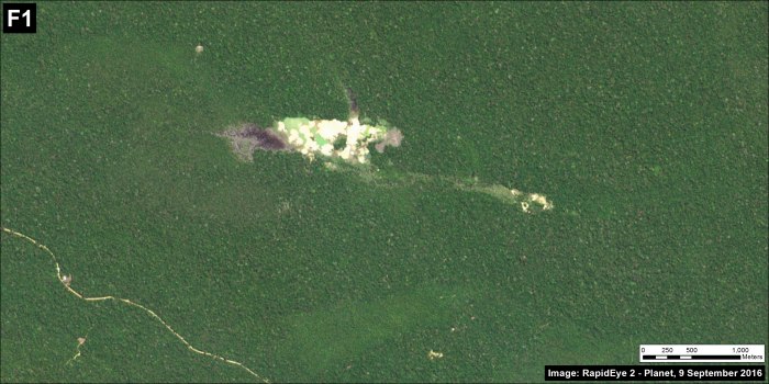
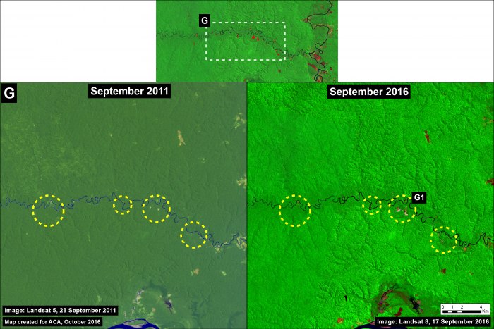
We have identified at least 7 areas of interest, characterized by high levels of gold mining deforestation between 2013 and 2016 (see Insets A-G in Image 50b). Below, for each of these areas, we briefly describe its situation and show a recent image from 2016 (right panel) in relation to an older image from between 2011 and 2013 (left panel). The yellow circles indicate the primary areas of gold mining deforestation between those dates. Also, we show a high resolution image that represents each area.
A. Tambopata National Reserve and Buffer Zone (La Pampa sector)
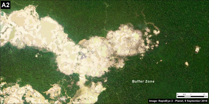
This area is the most serious in terms of the advance of deforestation in a protected area. As documented in MAAP #46, after the initial invasion in November 2015, illegal mining within the Tambopata National Reserve has now exceeded 450 hectares. Recently, the Peruvian Government has carried out a series of major raids against the illegal miners in this area (see MINAM 2016).
In regards to the buffer zone, there has been a sharp increase in the deforestation in the area known as La Pampa. In total, we estimate 9,720 acres of gold mining deforestation within the buffer zone of Tambopata National Reserve over the past four years.
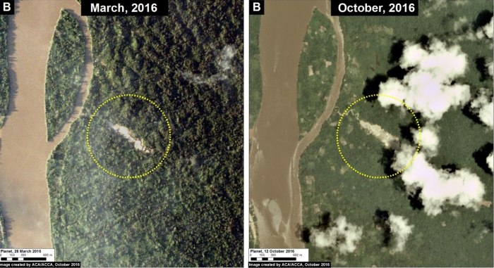
B. Upper Malinowski River (Bahuaja Sonene National Park buffer zone)
Upstream of the Tambopata National Reserve, illegal gold mining is also advancing along the upper Malinowski River. This area is located in the buffer zone of Bahuaja Sonene National Park. We estimate 2,256 acres of gold mining deforestation has occurred within this buffer zone over the past four years.
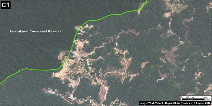
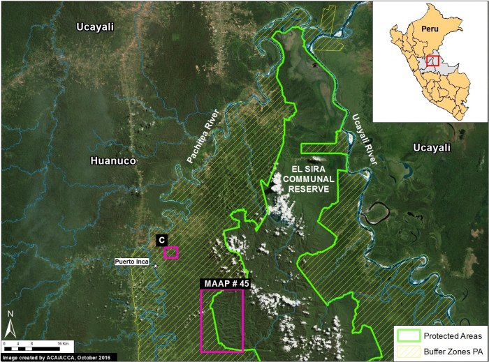
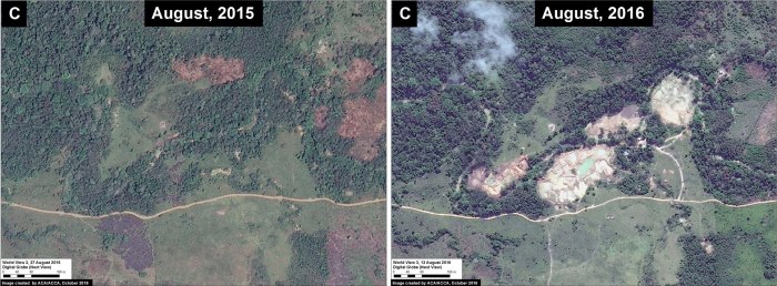
C. Delta-1/Amarakaeri Communal Reserve
An area known as Delta-1 has also experienced a recent increase in gold mining deforestation. This area is partially located within the buffer zone of the Amarakaeri Communal Reserve. As we reported in MAAP #6, illegal gold mining entered the Reserve between 2014 and 2015. The joint patrol and monitoring actions between the national government and indigneous representatives of the Reserve (ECA Amarakaeri) managed to stop the advance of mining deforestation within the Reserve in 2016 (MAAP #44). However, gold mining deforestation continues in the buffer zone of the Reserve, clearing 3,857 acres over the past four years.
D. Cusco: Camanti/Quince Mil
The advance of gold mining is not limited to Madre de Dios, as it has also expanded in the Cusco region. Most mining activity in Cusco occurs along the Araza and Nuciniscato Rivers in an area known as Camanti/Quince Mil (located between the southeastern sector of the Amarakaeri Communal Reserve and the Interoceanic Highway). We estimate that gold mining deforestation in Cusco reached 1,006 acres over the past four years.
E. Madre de Dios River (i)
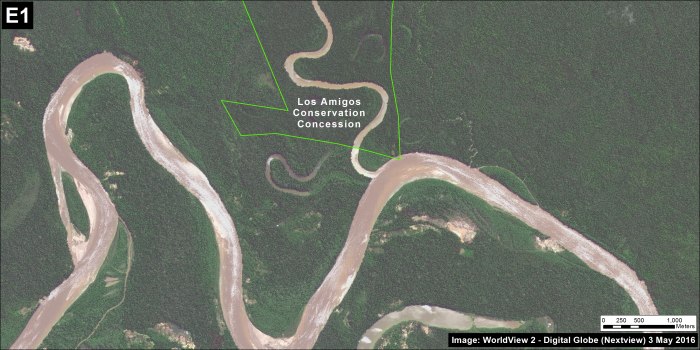
Gold mining deforestation also continues to advance along the Madre de Dios River, between the city of Puerto Maldonado and the area of Boca Colorado. Mining in this area is characterized by many small and scattered mining operations.
F. Madre de Dios River (ii)
G. Pariamanu River
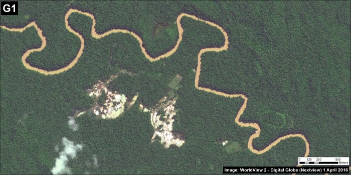
Finally, we documented the start of mining in a new area: along the Pariamanu river. We estimate that, so far, gold mining deforestation along this river has reached 170 acres.
Methodology
We used gold mining deforestation data from Asner et al 2013 as a pre-2013 base. We then added 2013-2014 forest loss data (Hansen et al 2013) and 2015-2016 GLAD alerts (Hansen et al 2016), both datasets generated by the University of Maryland and Google. The 2013-2016 data was filtered to only include forest loss directly caused by gold mining as determined by visual analysis of 2016 high-resolution satellite imagery. This included 0.5 m resolution imagery from Digital Globe and 3-5 m resolution imagery from Planet. In total, we analyzed 135 images from Digital Globe and 34 from Planet. Gold mining deforestation is suitable for this type of visual analysis because it leaves a unique footprint, quite distinct from other possible causes such as agriculture, cattle pasture, and natural river movement. As described in Asner et al 2013, “gold mining operations result in a unique combination of bare substrate and standing water[…]” Finally, we erased any overlapping mining deforestation data to avoid duplicating information between data sets. Displayed Landsat images are bands 753, made transparent over bands 432.
References
Asner GP, Llactayo W, Tupayachi R, Ráez Luna E (2013) Elevated rates of gold mining in the Amazon revealed through high-resolution monitoring. PNAS 46: 18454. They reported 46,417 hectares confirmed and 3,268 hectares suspected (49,865 ha total).
Hansen MC et al (2013) High-Resolution Global Maps of 21st-Century Forest Cover Change. Science 342: 850–53.
Hansen MC et al (2016) Humid tropical forest disturbance alerts using Landsat data. Environ Res Lett 11: 034008.
Citation
Finer M, Olexy T, Novoa S (2016) Gold Mining Deforests 32,000 Acres in southern Peruvian Amazon from 2013 to 2016. MAAP: 50.
