MAAP #44: Potential Recuperation of Illegal Gold Mining area in Amarakaeri Communal Reserve

In the previous MAAP #6, published in June 2015, we documented the deforestation of 11 hectares in the Amarakaeri Communal Reserve due to a recent illegal gold mining invasion. The Reserve, located in the Madre de Dios region of the southern Peruvian Amazon, is an important protected area that is co-managed by indigenous communities and Peru’s National Protected Areas Service (known as SERNANP). In the following weeks, the Peruvian government, led by SERNANP, cracked down on the illegal mining activities and effectively halted the deforestation within that part of the Reserve.
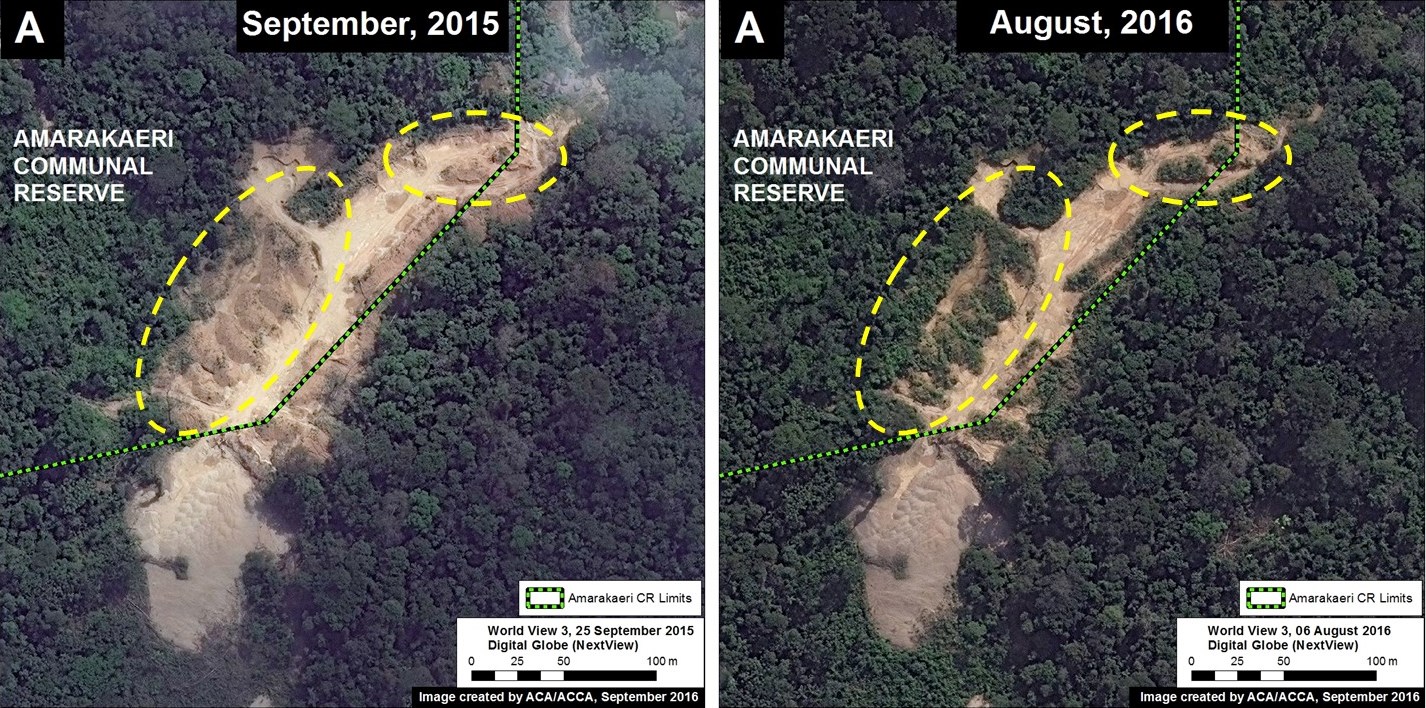
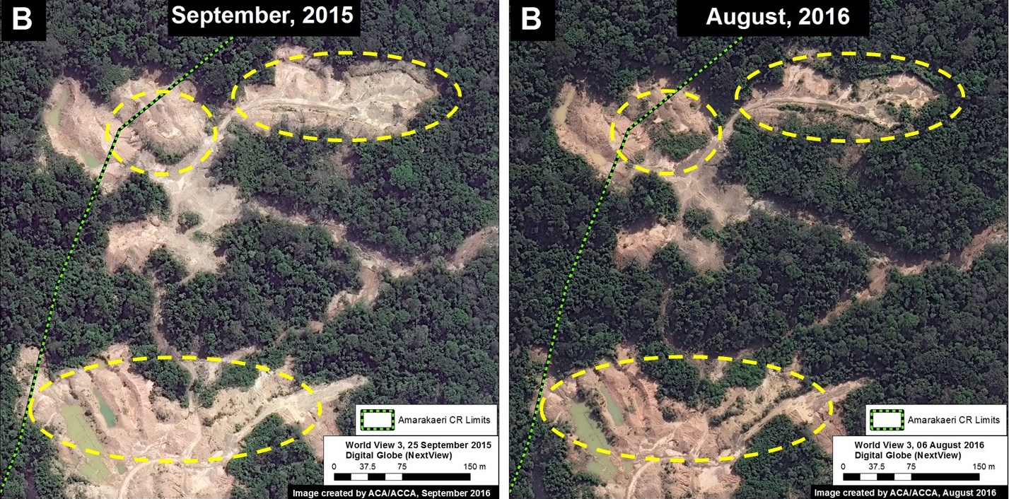
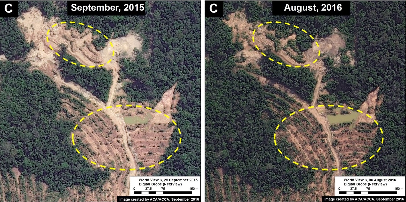
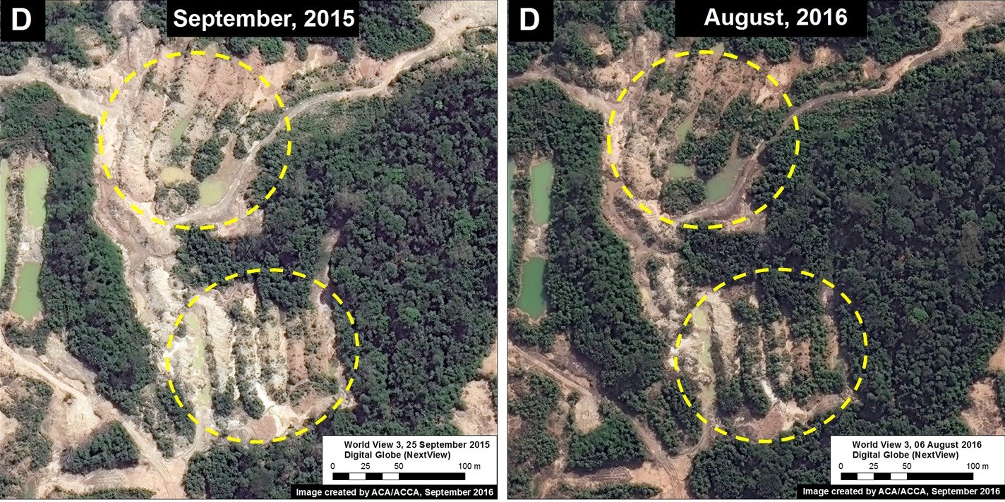
Here, we present high-resolution satellite images that show an initial vegetation regrowth in the invaded area. This finding may represent good news regarding the Amazon’s resilience to recover from destructive mining if it is stopped at an early stage. However, many questions and caveats remain regarding the nature of the regrowth and the long-term recovery potential of the degraded land, please see the Additional Information section below for more details.
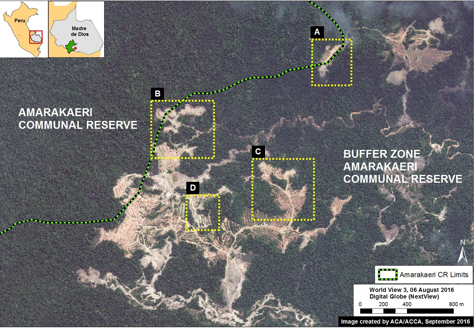
Image 44a shows the base map of the area invaded by illegal gold mining in the southeast sector of Amarakaeri Communal Reserve. Insets A–D indicate the areas featured in the high-resolution zooms below.
High-Resolution Zooms
Images 44b-e show, in high-resolution, areas where we detected vegetation regrowth between September 2015 (left panel) and August 2016 (right panel) following the gold mining invasion.
Additional Information
The natural vegetation regrowth observed in the images is not totally unexpected considering the area’s high biological diversity, the presence of nearby primary forest, and the relatively small area invaded prior to the government intervention. However, it’s important to consider that the regrowth has occurred mainly on the mounds of soil that were left behind by the mining activity. The regrowth is not yet evident in the other mining areas where the soil alteration was more severe. Further investigation is needed to better understand the characteristics of the regrowth and explore the true restoration potential of the area. Extreme degradation and mercury contamination left behind by mining activities may prevent many species from returning, allowing only the establishment of a few hardy colonizing specialist species.
Citation
Novoa S, Finer M, Román F (2016) Regeneration of Vegetation in Zone Affected by Gold Mining in the Amarakaeri Communal Reserve. MAAP: 44.
Download PDF of this article


