MAAP #151: Illegal Mining in the Ecuadorian Amazon


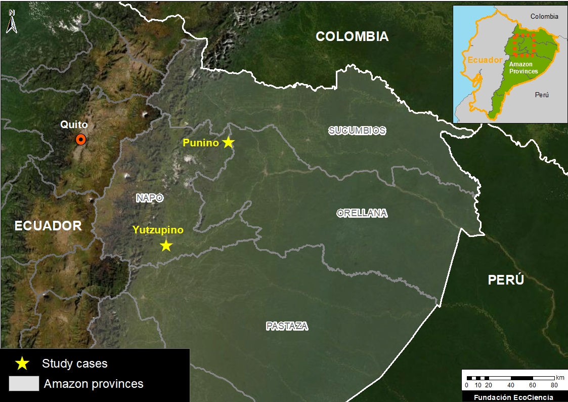
Base Map. The two case studies of illegal mining in the Ecuadorian Amazon: Yutzupino and Punino. Data: EcoCiencia.
In this report, we report on illegal gold mining activity in the Ecuadorian Amazon, building off our previous reports on Peru (MAAP #130) and Brazil (MAAP #116).
The Base Map shows the two new cases presented below: Yutzupino (Napo province) and Punino (border of Napo and Orellana provinces).
Both cases showed alarming expansion in 2021 and require continued action by authorities to minimize the impact in 2022.
This report is part of a series focused on the Ecuadorian Amazon through a strategic collaboration between the organizations Fundación EcoCiencia and Amazon Conservation, with the support of the Norwegian Agency for Development Cooperation (Norad).
Yutzupino
We have documented the rapid mining expansion of 70 hectares (173 acres) between October 2021 and January 2022, on the banks of the Jatunyacu River in the Napo province (see Image Yutzupino 1). Most of this activity occurred in December, highlighting the recent activity at the site.
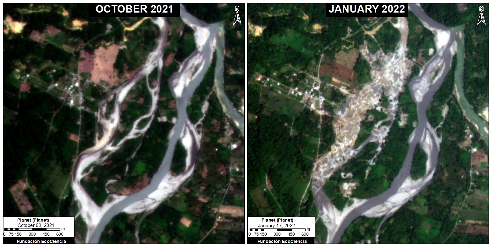
Image Yutzupino 1. Data: Planet.
The gold mining concession Confluencia is located in this area. However, the operating company TerraEarth Resources has stated that it is not responsible for this sudden mining expansion, indicating that the detected activity is illegal because it does not have the proper licenses.
On January 8 of this year (2022), the Ecuadorian government carried out a field intervention, confirming the illegal activity (see national news report). Despite this action, the illegal mining activity has continued to advance in January 2022, increasing by at least 6 hectares (15 acres).
To analyze this most recent activity, we obtained a very high-resolution satellite image (Skysat, 0.50 meters) from January 17 (2022). We identified the presence of at least 70 mining-related machines that still remained on site after the government’s field operation was carried out (see Image Yutzupino 2 and Zooms A-B).
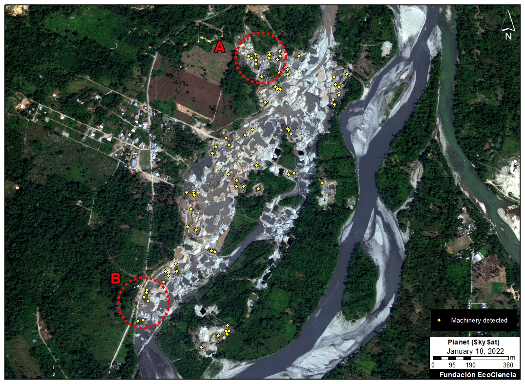
Image Yutzupino 2. Data: Planet, EcoCiencia.
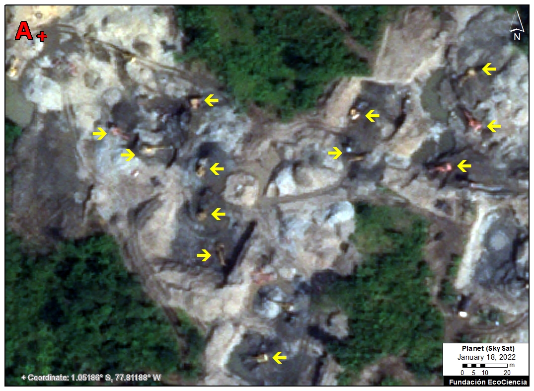
Skysat Zoom A. Data: Planet, EcoCiencia.
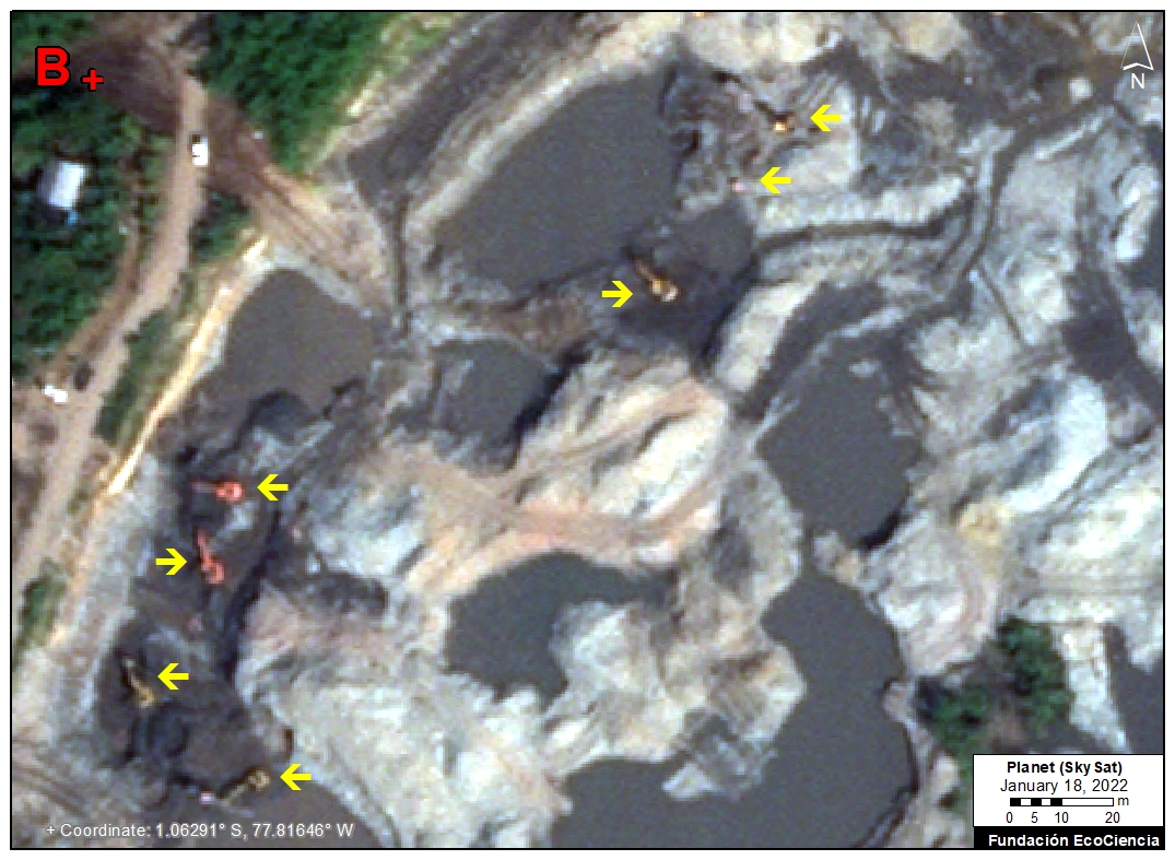
Skysat Zoom B. Data: Planet, EcoCiencia.
Punino
We have also documented the mining deforestation of 32 hectares (79 acres) between November 2019 and November 2021, on the banks of the Río Punino on the border between the provinces of Napo and Orellana (see Image Punino 1).
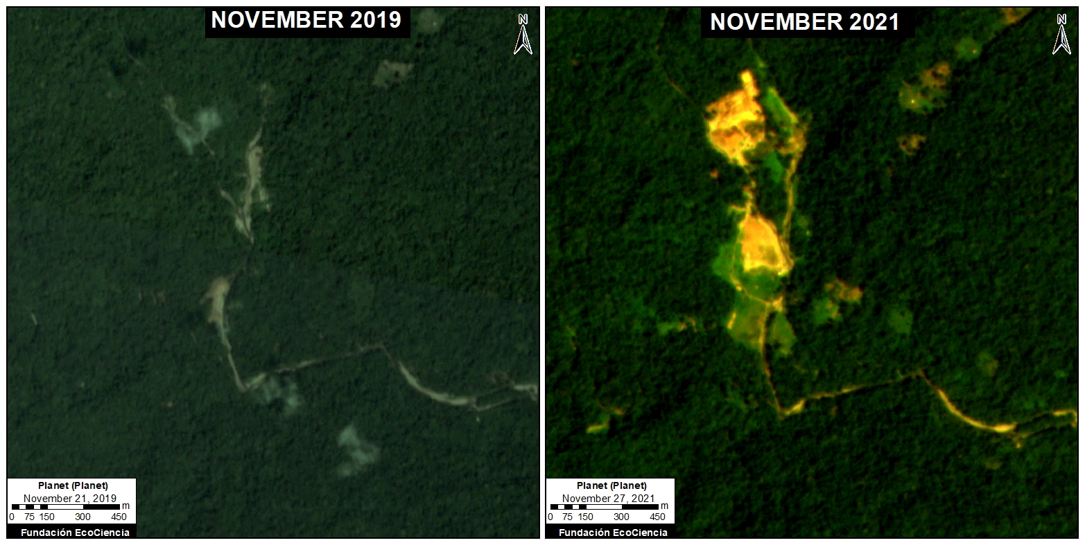
Image Punino 1. Data: Planet.
Two active gold mining concessions, Punino I and Punino II, are located in this area. However, nearly half (46%) of the detected mining deforestation (15 ha) is located outside these concessions, indicating that it is illegal activity (see Image Punino 2).
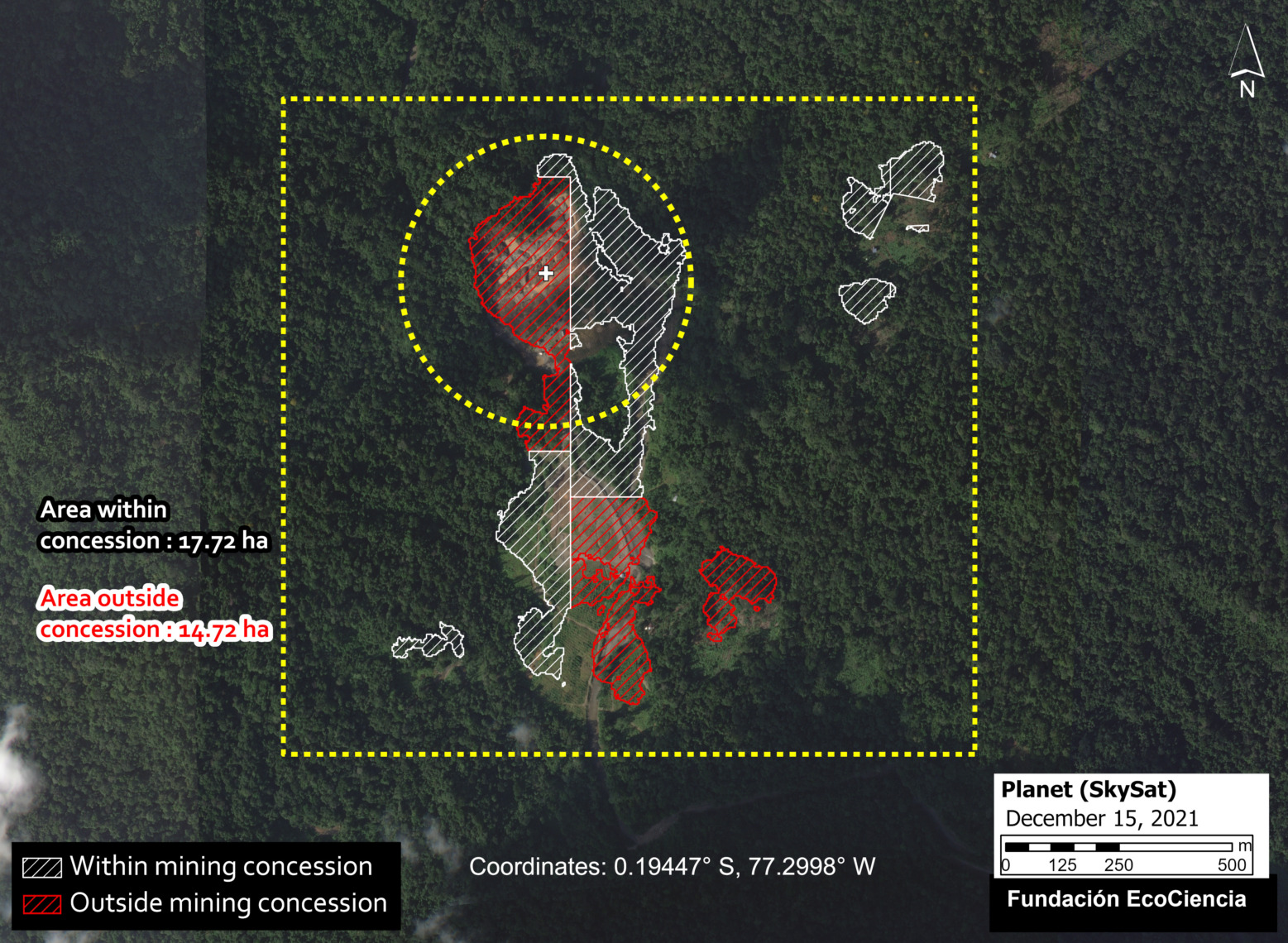
Image Punino 2. Data: EcoCiencia, Planet.
Para contextualizar dicha deforestación ilegal, hemos utilizado una imagen de muy alta resolución (Skysat, 0.50 metros) para mostrar en detalle la expansión minera fuera de las concesiones mineras, incluso con dragados, máquinas, y campamentos (ver Imagen Punino 3).
To analyze this most recent illegal mining deforestation, we obtained a very high-resolution satellite image (Skysat, 0.50 meters) from December 2021. We identified the details of the mining expansion outside the concessions, including machines and camps (see Image Punino 3).
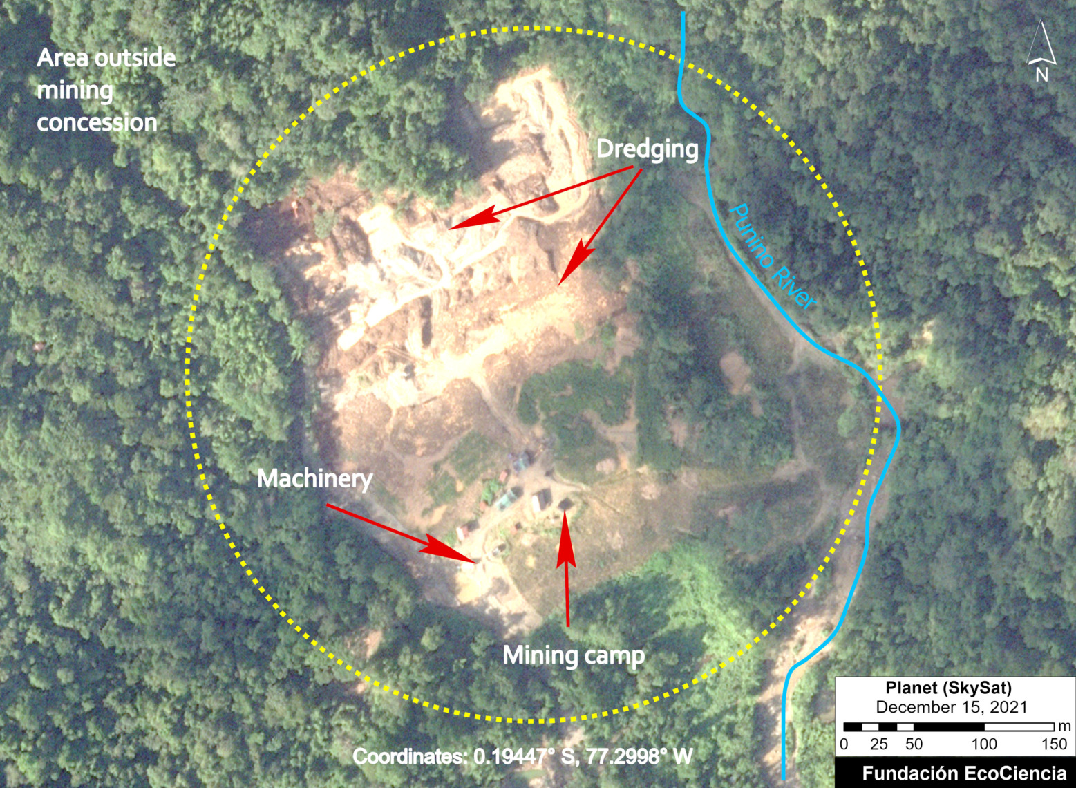
Image Punino 3. Data: EcoCiencia, Planet.
Acknowledgments
We thank C. Rivadeneyra (F. EcoCiencia), E. Ortiz (AAF), and A. Folhadella (ACA) for their contributions to this report.
This report is part of a series focused on the Ecuadorian Amazon through a strategic collaboration between the organizations Fundación EcoCiencia and Amazon Conservation, with the support of the Norwegian Agency for Development Cooperation (Norad).

![]()
Cita
Villacís S, Ochoa J, Borja MO, Josse C, Finer M, Mamani N (2022) Illegal Mining in the Ecuadorian Amazon. MAAP: #151.
Download PDF of this article