MAAP #192: Confirming Deforestation by Mennonites in the Peruvian Amazon

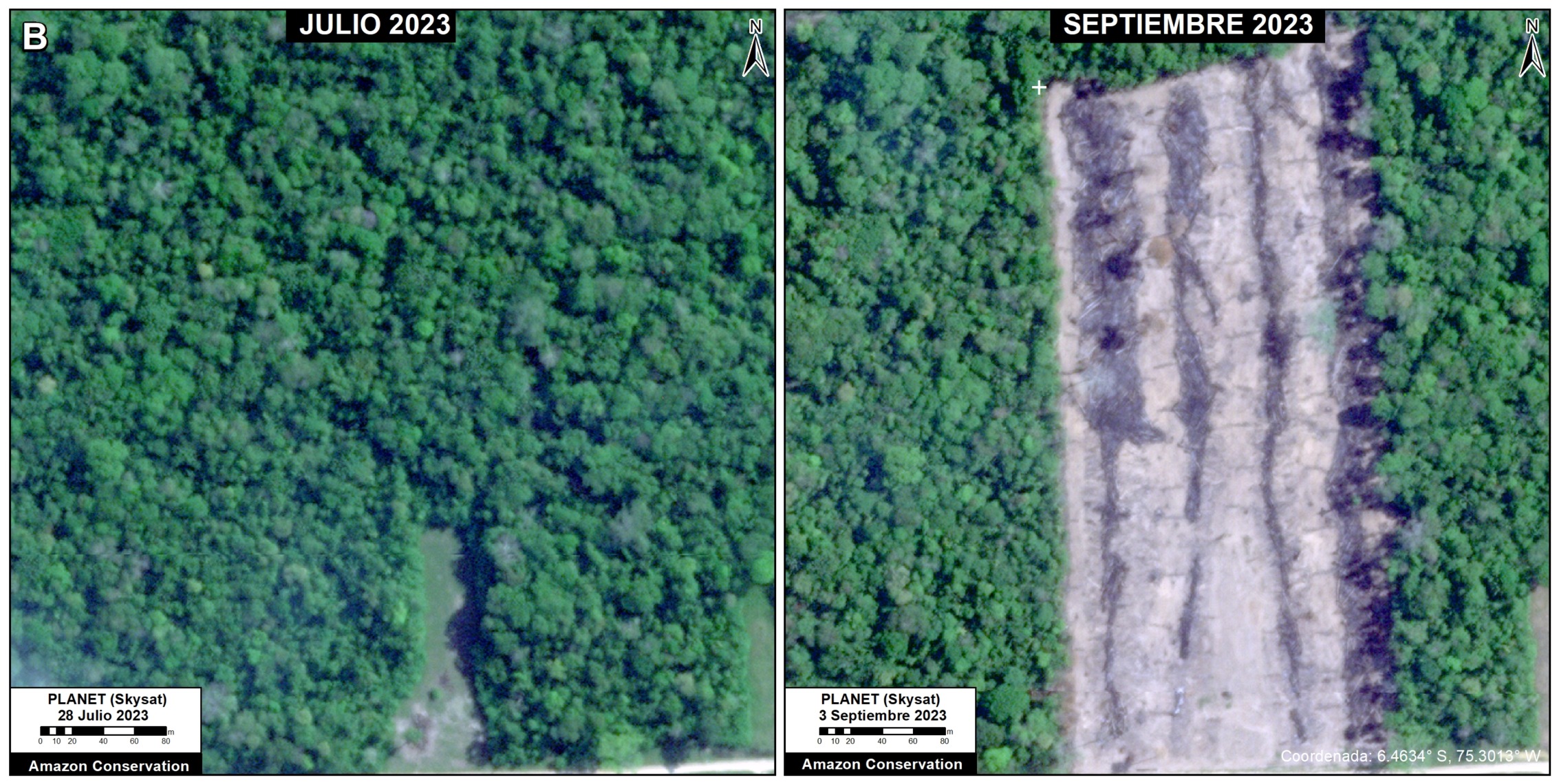
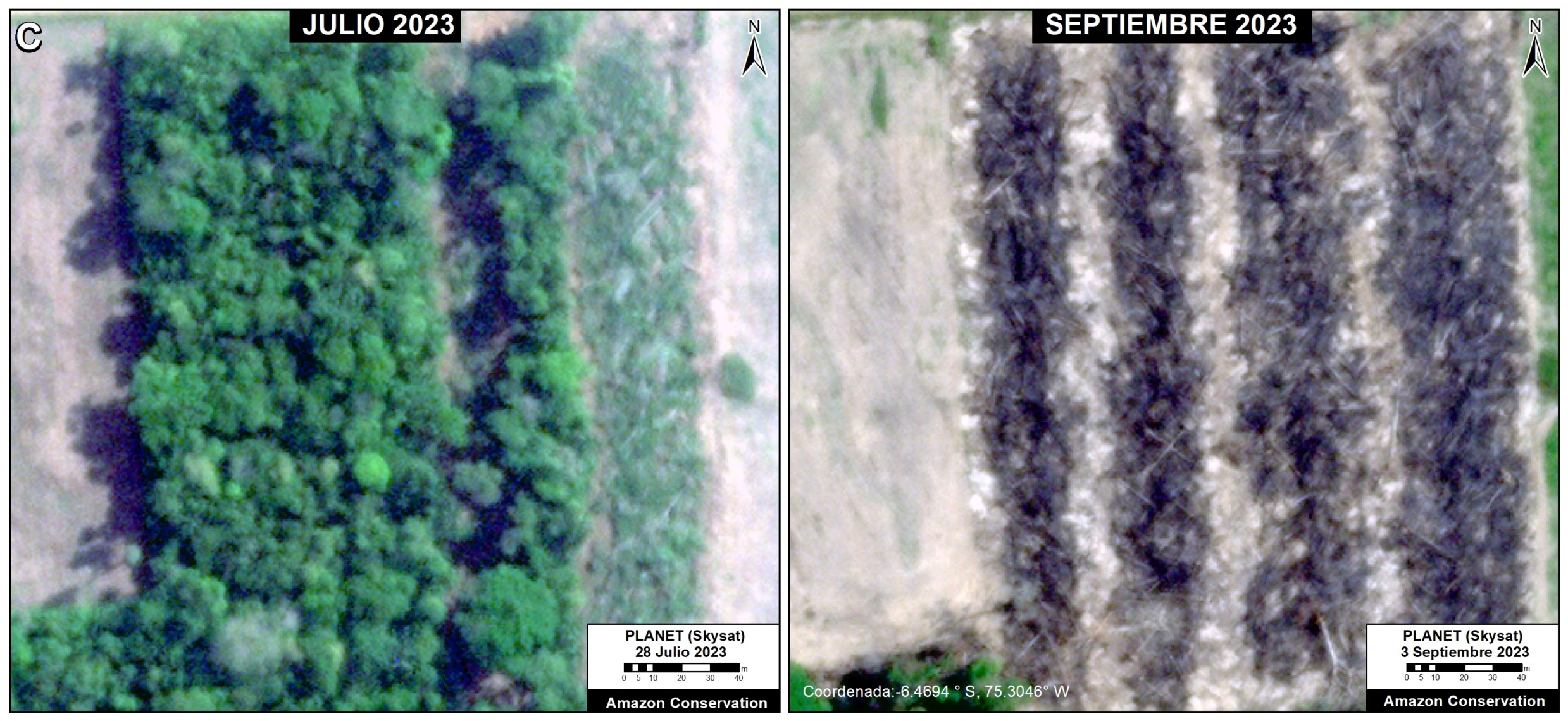
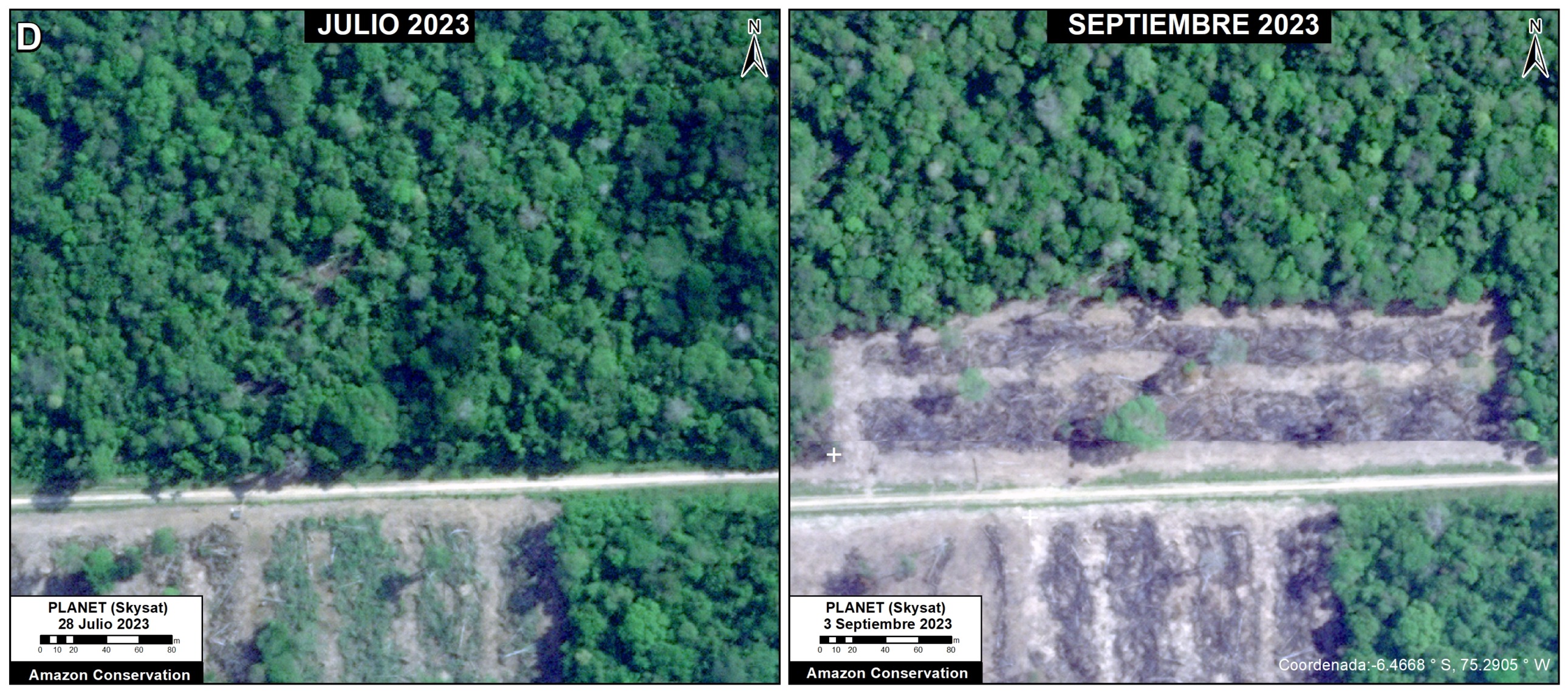
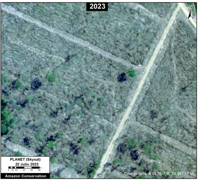
Example of recent 2023 deforestation of primary Amazon forest by Mennonite colony. Data: Planet (Skysat).

In a series of reports, we have documented the recent massive deforestation by Mennonite colonies in the Peruvian Amazon (see MAAP #188).

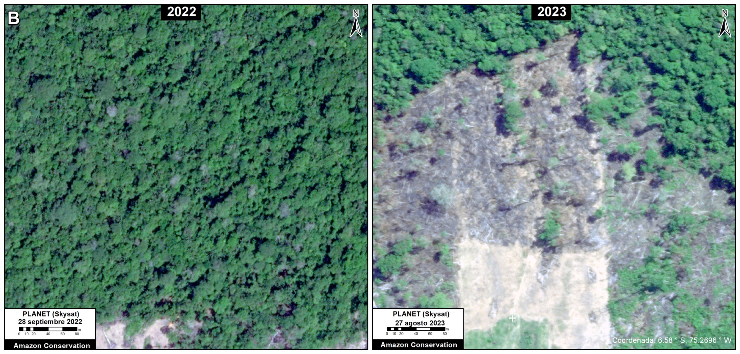
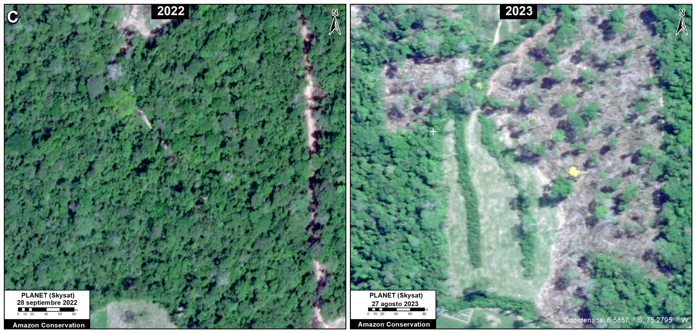
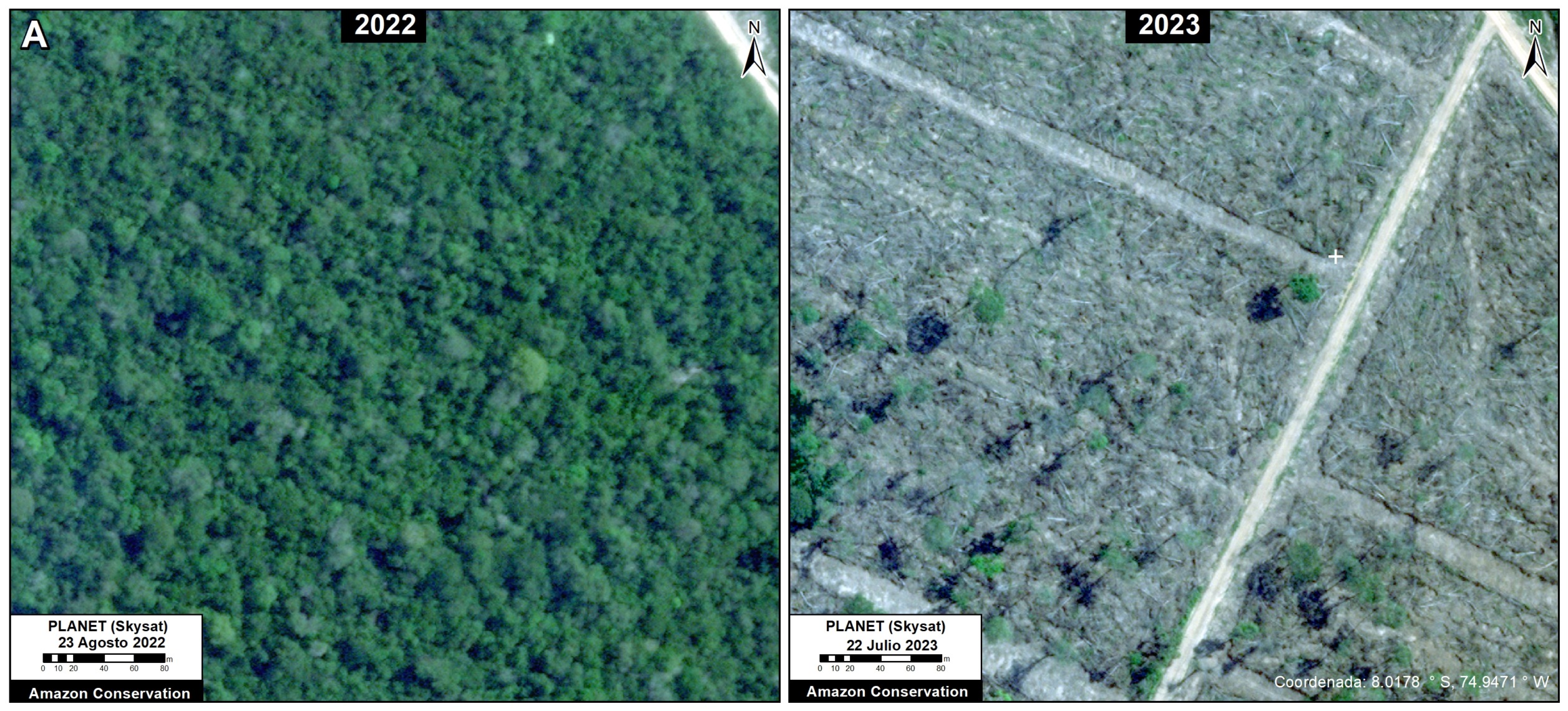
Here, we present additional evidence that Mennonites are currently clearing primary Amazon forests: very high-resolution satellite imagery (0.5 meters from Planet’s Skysat fleet).

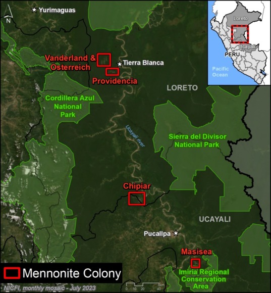
Specifically, we compare a series of very high-resolution satellite images tasked over the same area on different dates across three different Mennonite colonies (Chipiar, Providencia, and Vanderland), located in the regions of Loreto and Ucayali (see Base Map in the Annex).

These images conclusively confirm that Mennonites are actively clearing primary forest across multiple sites in the Peruvian Amazon during recent weeks in 2023.


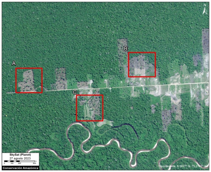
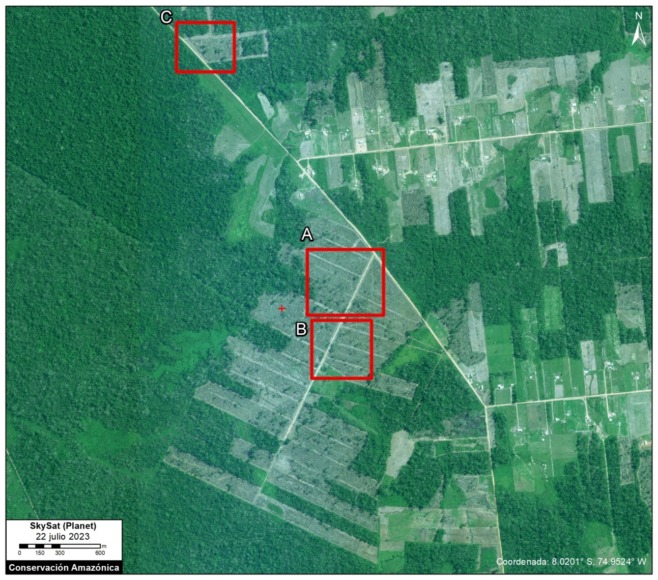
Base Map – Chipiar Mennonite Colony. Data: Planet (Skysat), ACA (MAAP)

Chipiar Colony

The following image serves as a base map of the recent deforestation in the Chipiar Mennonite colony, located on the border between Loreto and Ucayali.

Insets A-C correspond to the zooms below.

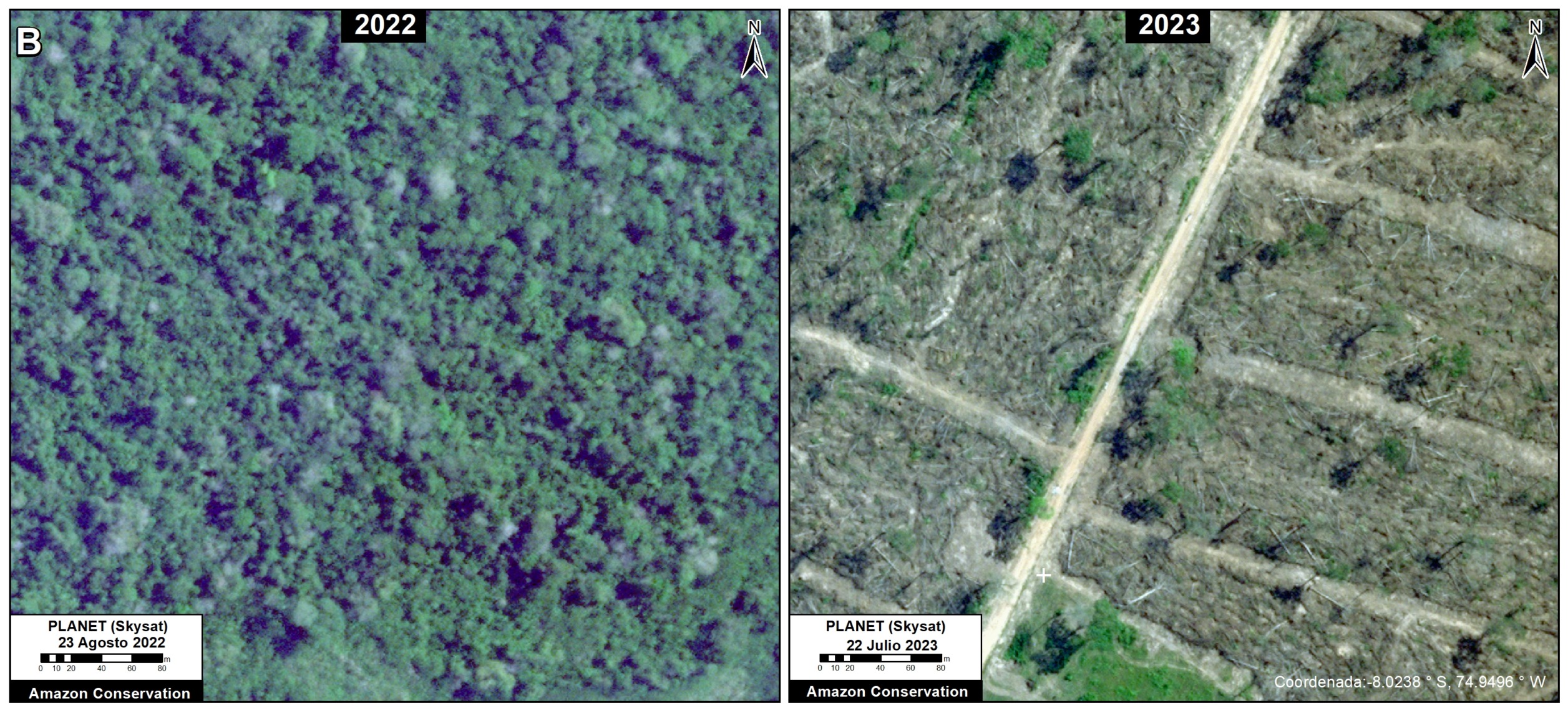
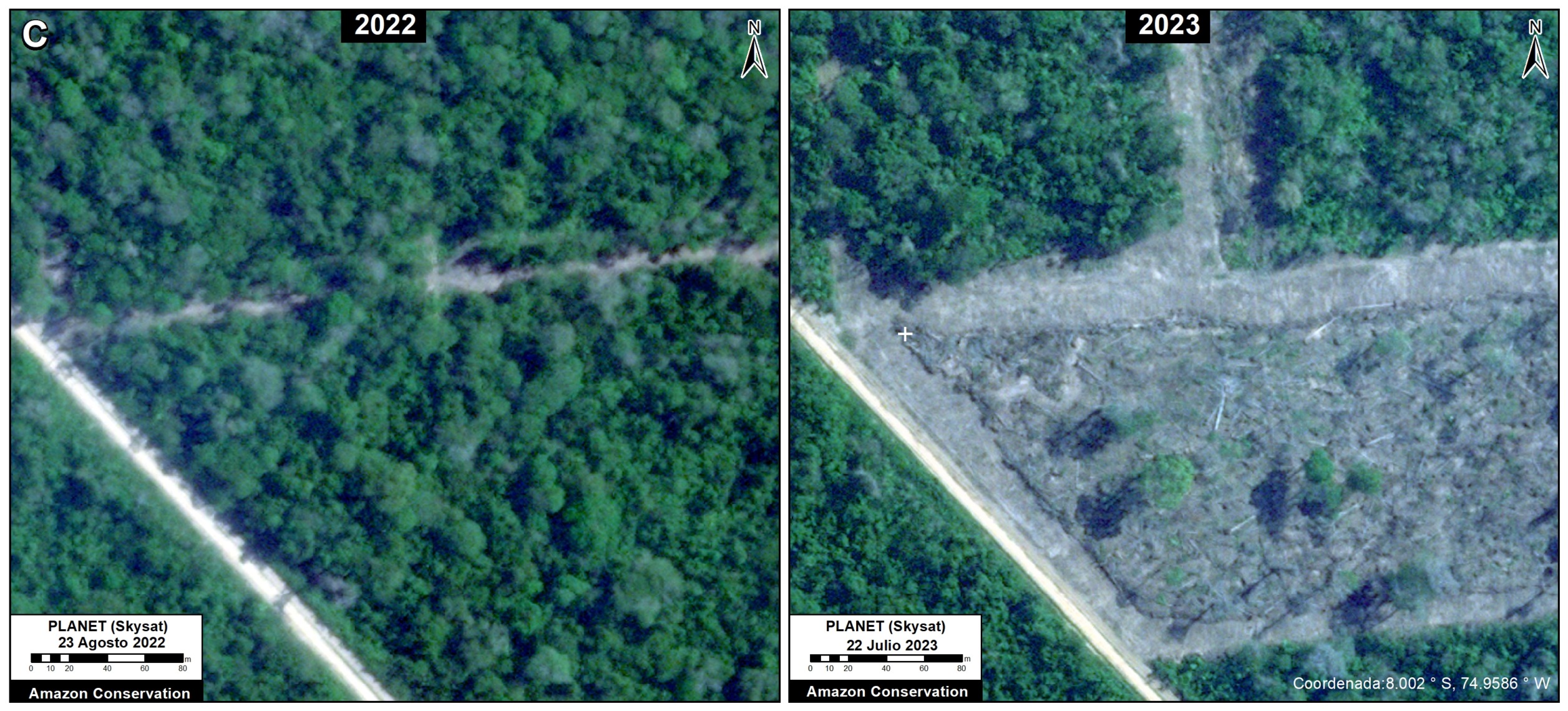
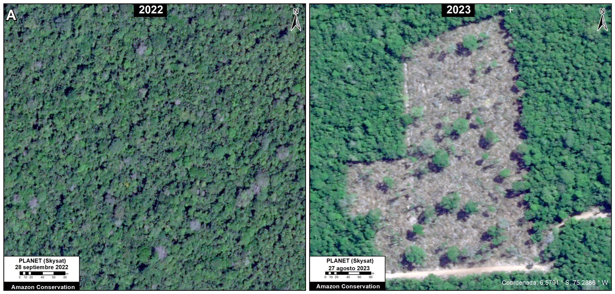
In each of these zooms, we compare very high-resolution images (0.5 meters) obtained in August 2022 (left panels) and July 2023 (right panels).


Zoom A. Chipiar Mennonite Colony. Data: Planet (Skysat)
Zoom B. Chipiar Mennonite Colony. Data: Planet (Skysat)
Zoom C. Chipiar Mennonite Colony. Data: Planet (Skysat)
Base Map – Providencia Mennonite Colony. Data: Planet (Skysat), ACA (MAAP)

Providencia Colony

The following image serves as a base map of the recent deforestation in the Providencia Mennonite colony, located in Loreto.

Insets A-C correspond to the zooms below.

In each of these zooms, we compare very high-resolution images (0.5 meters) obtained in September 2022 (left panels) and August 2023 (right panels).


Zoom A. Providencia Mennonite Colony. Data: Planet (Skysat)
Zoom B. Providencia Mennonite Colony. Data: Planet (Skysat)
Zoom C. Providencia Mennonite Colony. Data: Planet (Skysat)
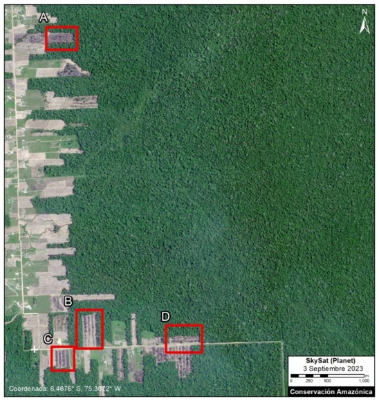
Base Map – Vanderland Mennonite Colony. Data: Planet (Skysat), ACA (MAAP)

Vanderland Colony

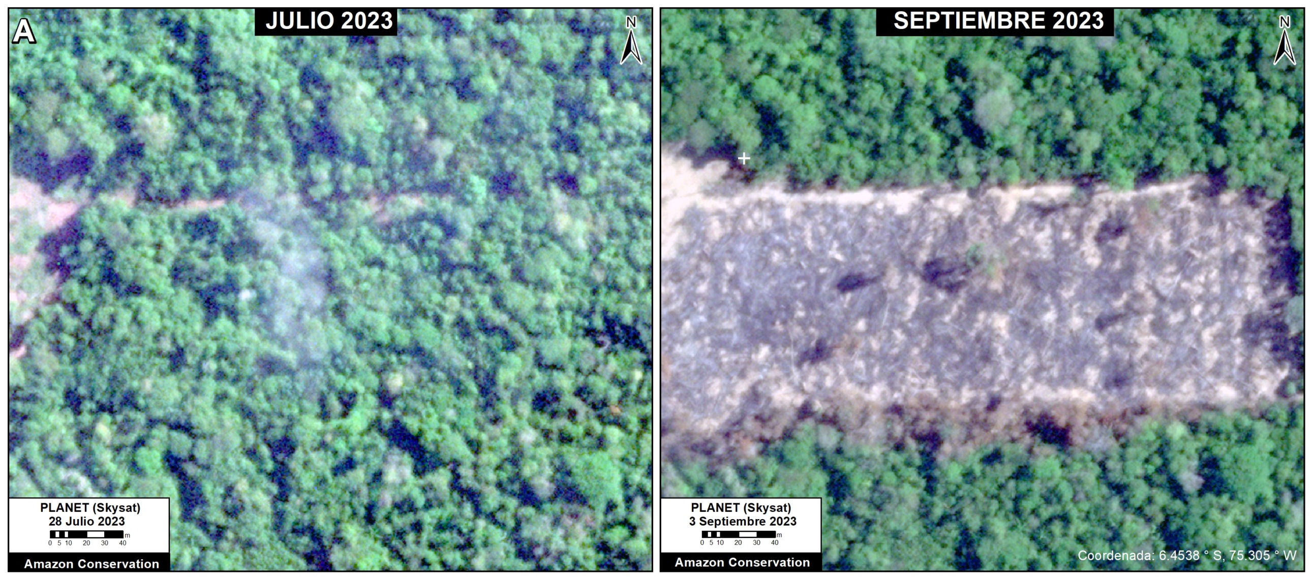
The following image serves as a base map of the recent deforestation in the Vanderland Mennonite colony, also located in Loreto. Insets A-D correspond to the zooms below. In each of these zooms, we compare very high-resolution images (0.5 meters) obtained in July 2023 (left panels) and September 2023 (right panels).


Zoom A. Vanderland Mennonite Colony. Data: Planet (Skysat)
Zoom B. Vanderland Mennonite Colony. Data: Planet (Skysat)
Zoom C. Vanderland Mennonite Colony. Data: Planet (Skysat)
Zoom A. Vanderland Mennonite Colony. Data: Planet (Skysat)

Annex – Base Map of Mennonite Colonies in the Peruvian Amazon

Citation

Finer M, Ariñez A, Mamani N (2023) Confirming Deforestation by Mennonites in the Peruvian Amazon. MAAP: 192.
MAAP #191: Protecting Free-flowing & Intact River Corridors in the Ecuadorian Amazon

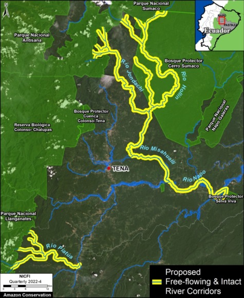
Base Map. Proposal of free-flowing and intact riparian forest corridors in the northern Ecuadorian Amazon.

Here, we present a model conservation strategy, developed by the Ecuadorian Rivers Institute, that aims to protect river corridors that are both free-flowing and maintain riparian forest cover in the critical transition zone between the Andes mountains and the Amazon lowlands.

There are few remaining intact Andes-Amazon corridors, so this initiative is urgently needed in Ecuador and throughout the region.

The proposal targets strategic corridors that have three major characteristics:

1) Free-flowing, that is no major dams completely disrupting water flow from its source in the Andes down to the Amazon lowlands.

2) Intact riparian forest that extends at least 500 meters on each side of river.

3) No mining activity in the river or adjacent riparian zone.

This combination is estimated to be the minimum criteria needed to preserve the integrity of the biodiversity, aquatic ecosystems, and scenic landscapes of key river corridors in the tropical Andes.

The Base Map illustrates the first two proposed corridors in Ecuador.

The first is the Jondachi-Hollín-Misahuallí-Napo Ecological Corridor. This multi-pronged corridor flows from the headwaters of the Jondachi and Hollin rivers (which originate in a series of protected areas, including Sumaco and Antisana National Parks), ultimately down to an intact stretch of the Napo River. This corridor totals 193 km of river and 18,675 hectares (46,145 acres) of riparian forest.

The second is the Piatua River Ecological Corridor, which channels water originating in Llanganates National Park. This corridor is shorter, totaling 46 km of river and 4,378 hectares (10,818 acres) of riparian forest.

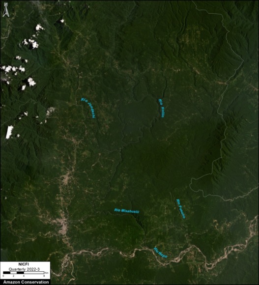
Below is a recent satellite image of the Jondachi-Hollín-Misahuallí-Napo Ecological Corridor. Note the intact river and forest core to the east of the major road network, and north of the Napo River.

Recent satellite image of the Jondachi-Hollín-Misahuallí-Napo Ecological Corridor

Social Component

This proposal would be accompanied by efforts to generate sustainable economic revenues for inhabitants of the region through low-impact tourism activities (such as kayaking, rafting, mountain biking, bird watching, and hiking) and financial incentives (such as land grants and carbon credits) to take pressure off of the increasing encroachment into riparian forests for wood harvesting and agricultural expansion.

There would also be programs to promote intensive reforestation in the degraded areas outside of the corridor as a way of creating employment opportunities for the local communities.

Below is an aerial photo of a section of the corridor, highlighting some of the key components of the proposal: free-flowing river, intact riparian corridor, and sustainable, low-impact tourism.

Citation

Terry M, Finer M, Ariñez A (2023) Protecting Free-flowing & Intact River Corridors in the Ecuadorian Amazon. MAAP: 191.