Norad
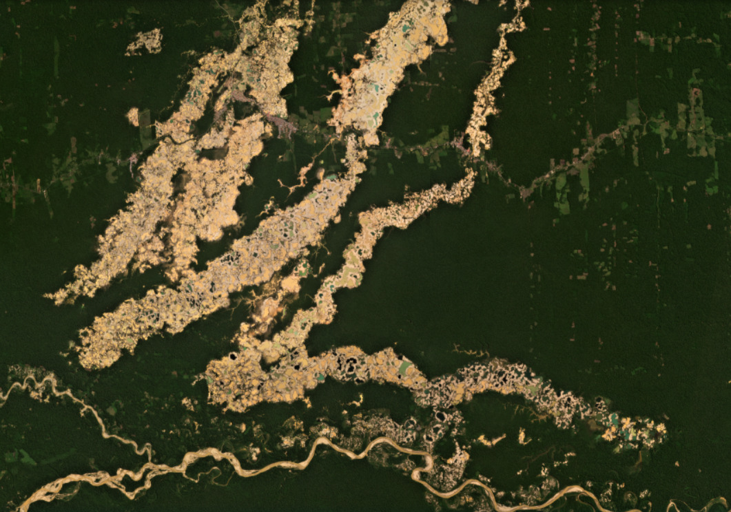
With Norad’s support, we work with local governments and civil society to operate active, effective, and transparent real-time deforestation monitoring systems, as well as train local stakeholders on using technical tools needed in this process. These efforts help counteract increasing deforestation in the Peruvian and Ecuadorian Amazon by boosting real-time monitoring capabilities of government, civil society, Indigenous groups, and local landholders. Click here to learn more about projects with Norad.
Visit Website
USAID
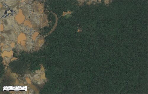
With USAID’s support, we work with the government of Peru and civil
society to address the complex challenge of improving conditions to prevent and combat environmental crimes, working with Peruvian officials and government institutions to build capacities and institute necessary reforms to reduce illegal deforestation and nature crimes. Click here to read more about USAID’s Prevent Project.
Visit Website
International Conservation Fund of Canada (ICFC)
With ICFC’s support, MAAP advances its efforts to link real-time deforestation monitoring with policy action in the Andes Amazon. Together we disseminate precise information on where and why deforestation is occurring, helping our local partner The Kayapo Project stop illegal deforestation in the Kayapo Indigenous territory in Brazil.
Visit Website
The Overbrook Foundation
With The Overbrook Foundation’s support, we detect and act upon deforestation threats in the Colombian Amazon, by providing government entities and local NGOs with vital data that enables them to use satellite technologies to apply the law to stop illegal deforestation in key protected areas across the country.
Visit Website
The DN Batten Foundation
With The D.N. Batten Foundation’s support, we have expanded our institutional vision of making an impact across the entire Amazon Basin through building and strengthening our network of on-the-ground partners.
Visit Website
The Sheldon & Audrey Katz Foundation
With The Sheldon and Audrey Katz Foundation’s support, we have expanded our institutional vision of making an impact across the entire Amazon Basin through building and strengthening our network of on-the-ground partners.
Visit Website
Amazon Andes Fund
With Andes Amazon Fund’s support, we have developed cutting-edge analyses that scientifically show the importance of protected areas and Indigenous territories in the fight against illegal deforestation across the Amazon.
Visit Website
Global Conservation
With Global Conservation’s support, we have conducted real-time, satellite-based monitoring of key protected areas and empowered local actors to take action against instances of illegal incursions and deforestation.
Visit Website