MAAP #152: Major Deforestation Continues in Chiribiquete National Park (Colombian Amazon)
March 15, 2022
Deforestation within and around Chiribiquete National Park represents one of the most critical threats to primary forests in the Colombian Amazon.
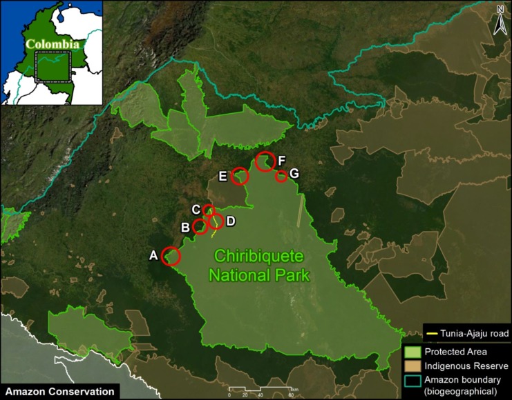
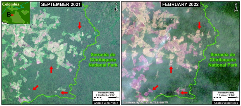
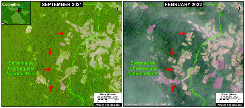
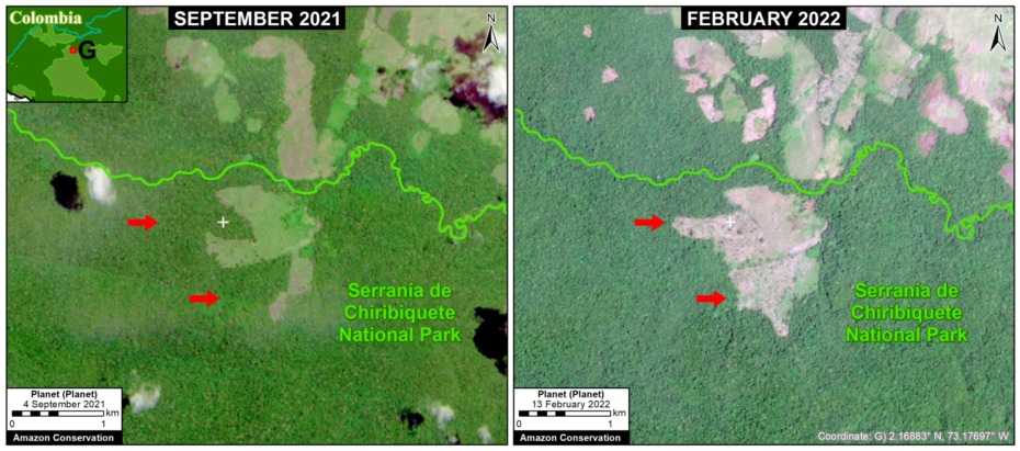
In this report, we document the recent deforestation of more than 2,000 hectares (4,950 acres) across seven fronts within Chiribiquete National Park, between September 2021 and February 2022 (see Base Map).
In addition, we estimate the total deforestation of more than 6,000 hectares (14,800 acres) within the Park since its expansion in 2018.
It is important to note that many of the major fires during February 2022 in the Colombian Amazon were actually burning recently deforested areas like these.
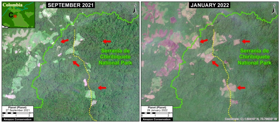
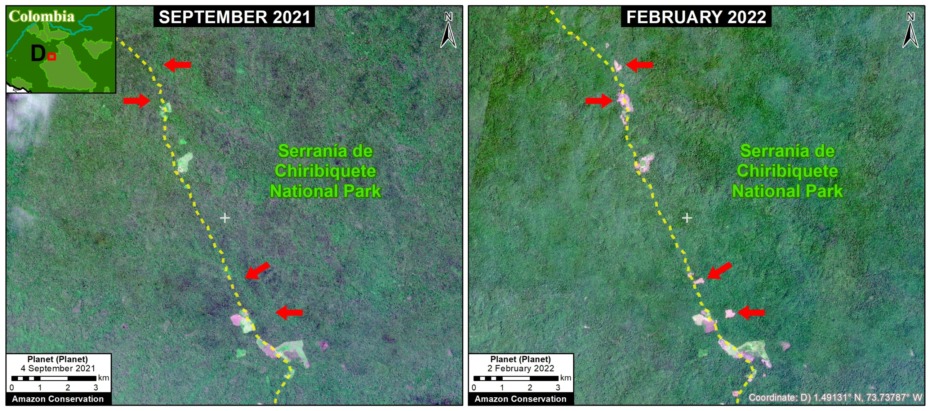
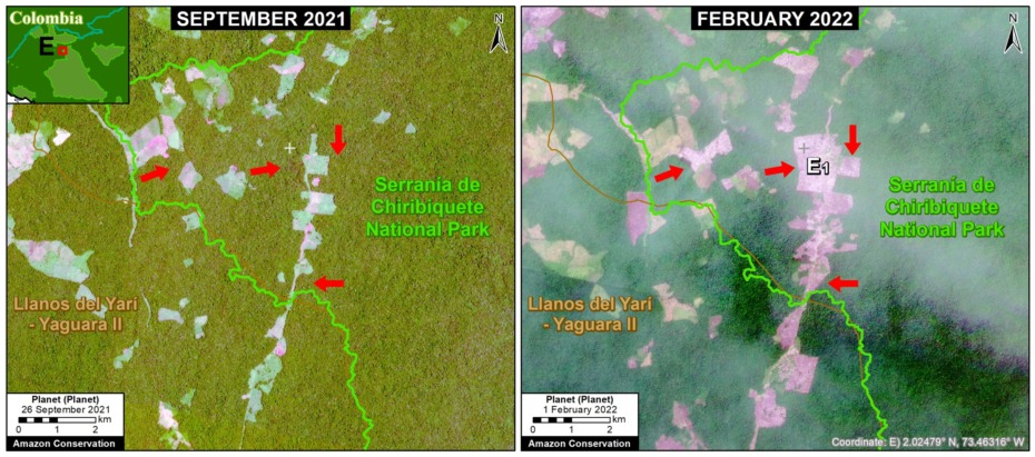
Below, we zoom in on the 7 deforestation fronts (Letters A-G on the Base Map) with both high resolution (3 meters) and very high resolution (0.5 meters) satellite images.
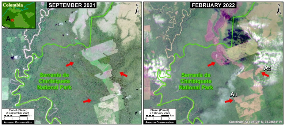
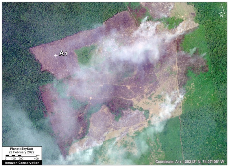
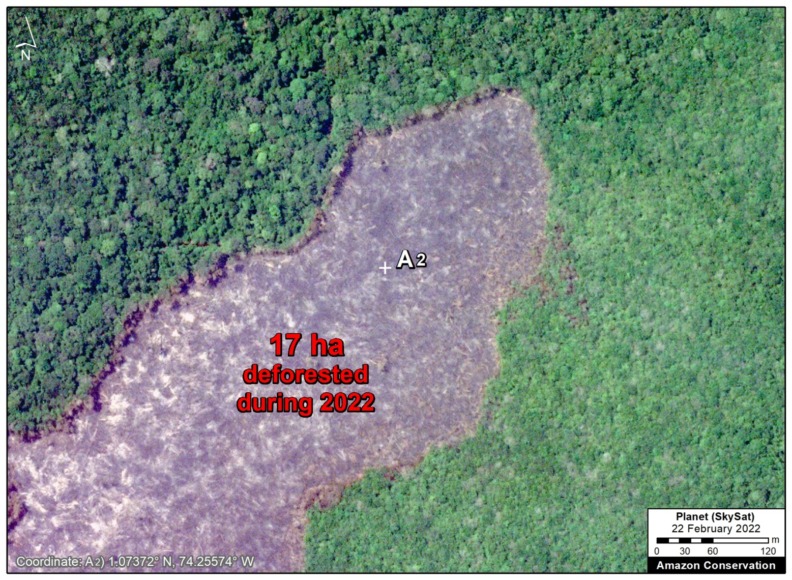
Zoom A shows the recent deforestation of 158 hectares (390 acres) in perhaps the most severe front, located in the western sector of the Park. Surrounding the park is an additional 243 hectares (600 acres) of forest loss. We also include a pair of very high-resolution images of the most recently deforested areas surrounded by intact but threatened primary forest (Zooms A1 and A2).
Zoom B shows recent deforestation of 0.5 hectares within the park, but there is an advancing deforestation front just outside the Park (more than 600 hectares, or 1,480 acres).
Zoom C shows the recent deforestation of 222 hectares (550 acres). Note the presence of the Tunia-Ajaju road. Surrounding the park is an additional 300 hectares (740 acres) of forest loss.
Zoom D shows the additional deforestation of 64 hectares (158 acres) further down the Tunia-Ajaju road.
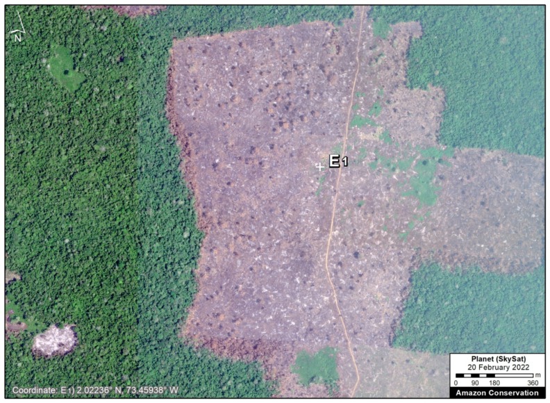
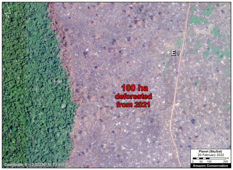
Zoom E shows the recent deforestation of 388 hectares (960 acres) along the Cachicamo-Tunia road. Surrounding the park is an additional 660 hectares (1,630 acres) of forest loss. We also include a couple of very high-resolution images of the most recently deforested areas surrounded by intact but threatened primary forest (Zoom E1).
Zoom F shows the recent deforestation of 314 hectares (775 acres) in the northern sector of the Park. Surrounding the park is an additional 450 hectares (1,112 acres) of forest loss.
Finally, Zoom G shows the recent deforestation of 58 hectares (143 acres) in the northeast sector of the Park.
Acknowledgments
We thank L.A. Gómez and R. Botero for their contributions to this report.
This report is part of a series focused on the Colombian Amazon through a strategic collaboration between the Amazon Conservation and FCDS (Fundación para la Conservación y el Desarrollo Sostenible), with the support of the International Conservation Fund of Canada (ICFC).
Citation
Finer M, Mamani N (2022) Major Deforestation Continues in Chiribiquete National Park (Colombian Amazon). MAAP: 152.
