MAAP #45: Threats to El Sira Communal Reserve in central Peruvian Amazon
September 21, 2016
El Sira Communal Reserve, located in the central Peruvian Amazon (regions of Pasco, Huánuco and Ucayali), aims to protect the biological diversity of the El Sira Mountain Range in benefit of the native communities of the area (Ashaninka, Yanesha, and Shipibo-Conibo indigenous groups).
This report presents an initial threat assessment for this large national protected area, which covers more than 615,000 hectares (1.5 million acres).
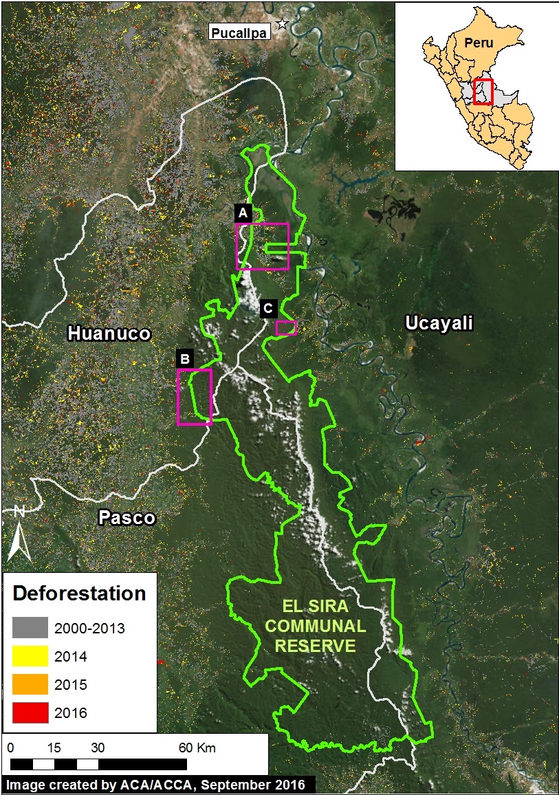
We identified 3 threatened sectors of the Reserve, as indicated in Image 45a (see Insets A-C).
We found that the principal drivers of deforestation in these three sectors are agriculture & cattle pasture (Insets A and C) and illegal gold mining (Inset B).
It is important to note that the deforestation for agriculture & cattle pasture continues to rapidly increase – 1,600 hectares (3,950 acres) since 2013 – while the deforestation for gold mining has been limited due to regular interventions by the Peruvian government.
Below, we show high-resolution satellite images of the recent deforestation in all three threatened sectors. Click each image to enlarge.
Inset A: Increasing Deforestation in the Northern Sector
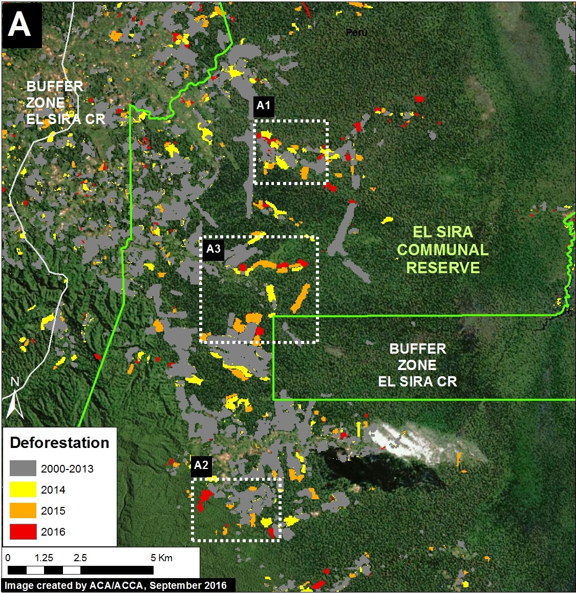
Image 45b illustrates the increasing deforestation in the northern sector of the El Sira Communal Reserve.
We documented the deforestation of 285 hectares (700 acres) within the Reserve thus far in 2016 (as of late August). Over 90% of this loss comes from small-scale deforestation events (less than 5 hectares).
We calculated an additional deforestation of 1,320 hectares (3,260 acres) within the Reserve between 2013 and 2015.
Thus, we documented a total deforestation of 1,600 hectares (3,950 acres) within the northern sector of the Reserve since 2013.
Based on the analysis of high-resolution imagery, we found that the principal driver of this deforestation was agriculture & cattle pasture.
Note that this sector is near the deforestation hotspot described in MAAP #37, where we determined that cattle pasture was the principal driver of deforestation.
Insets A1 – A3 indicate the location of the high-resolution zooms described below.
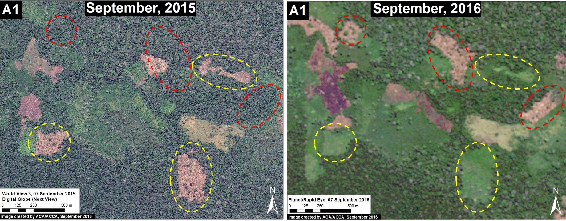
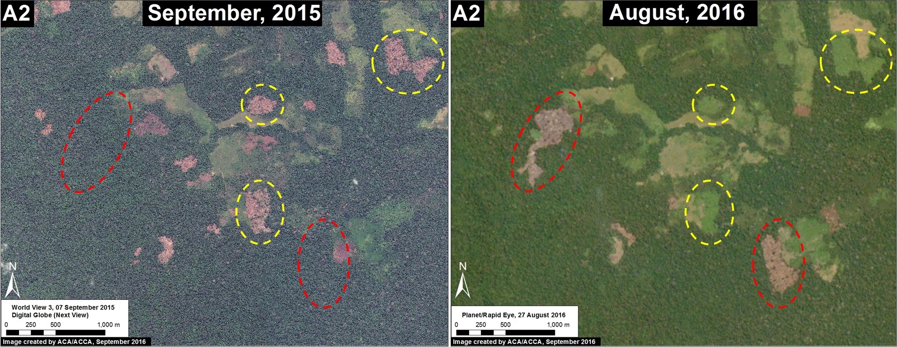
Images 45c-45d show examples of deforestation between September 2015 (left panel) and August/September 2016 (right panel). The red circles indicate newly deforested areas in 2016. The yellow circles indicate areas deforested in 2015 and subsequently converted to cattle pasture in 2016.
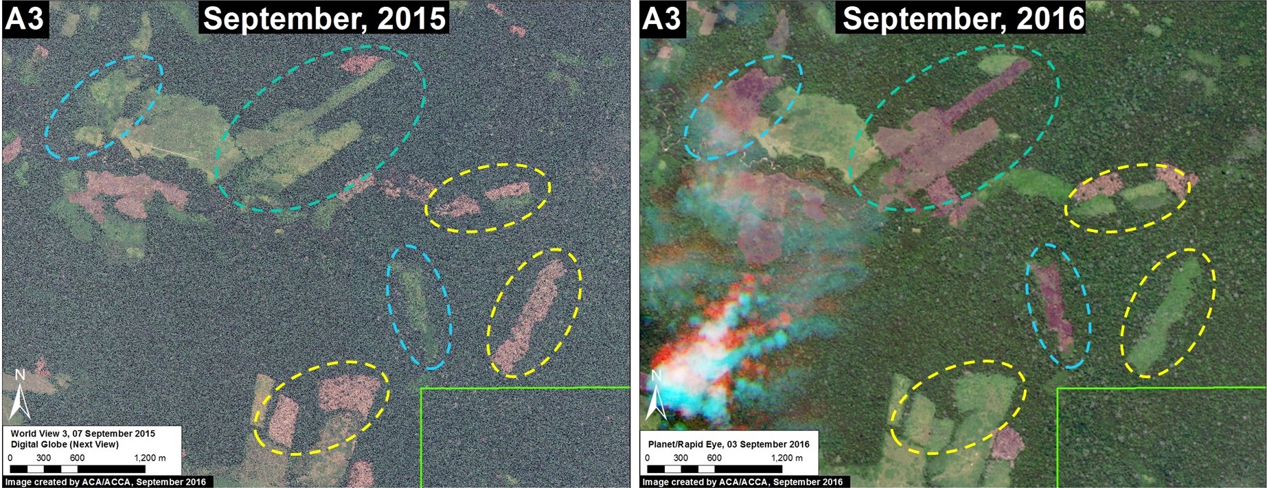
Image 45e shows examples of deforestation between September 2015 (left panel) and August/September 2016 (right panel). The yellow circles indicate areas deforested in 2015 and subsequently converted to cattle pasture in 2016. The blue circles indicate recently burned areas (note the smoke in the right) panel. This type of annual burning pattern is characteristic of cattle-grazing areas.
Inset B: Illegal Gold Mining Activity
Illegal gold mining currently threatens the upper Negro River, located in the northwest sector of the Reserve (see Inset B of Image 45a).
During 2015 and 2016, the Peruvian government has carried out several interventions against this illegal mining.
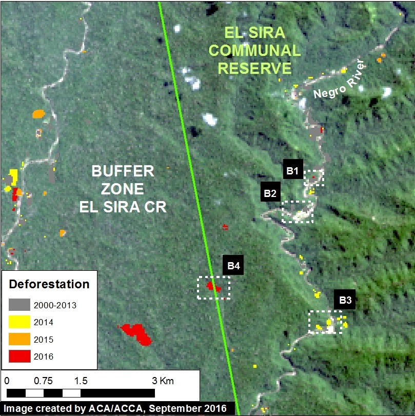
Image 45f shows the recent deforestation along the upper Negro River. Insets B1-B3 indicate the areas detailed below in high resolution.
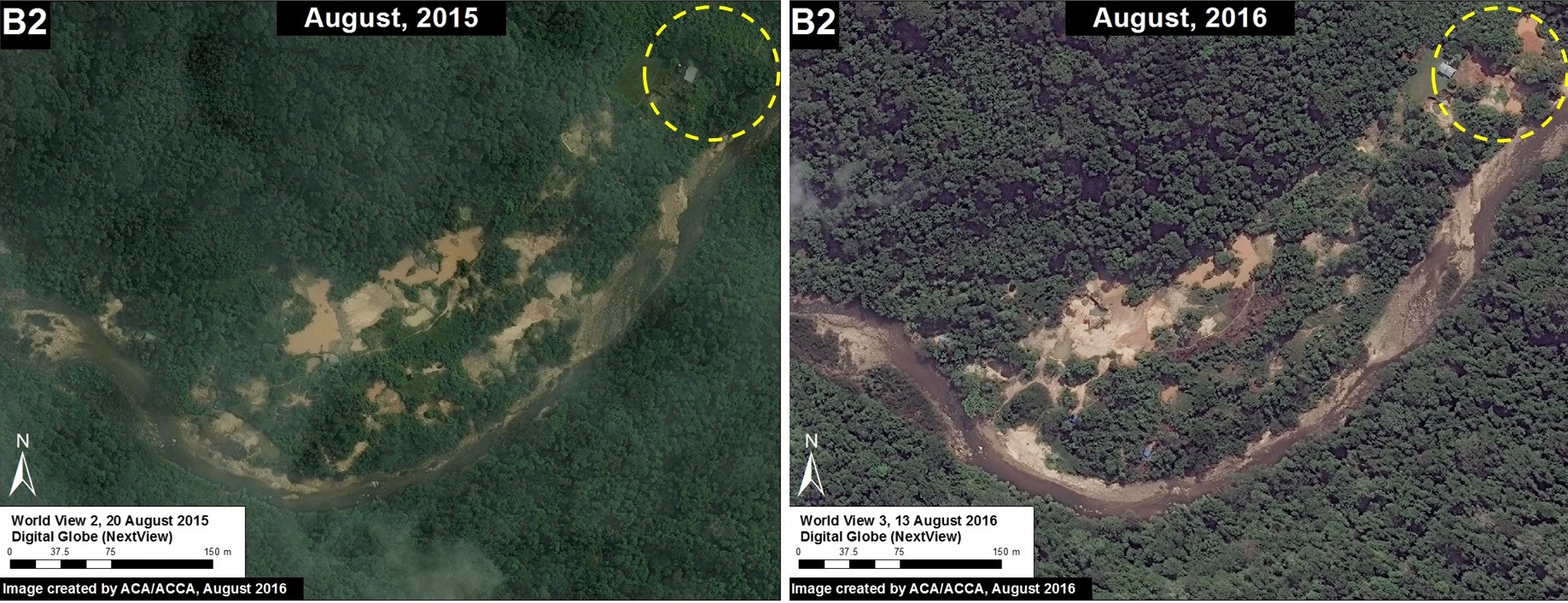
Images 45g-h show recently deforested areas (indicated by yellow circles) between 2015 (left panel) and 2016 (right panel). These areas have been the target of recent government interventions; note that within the red circles the mining machinery has been eliminated between August and September 2016.
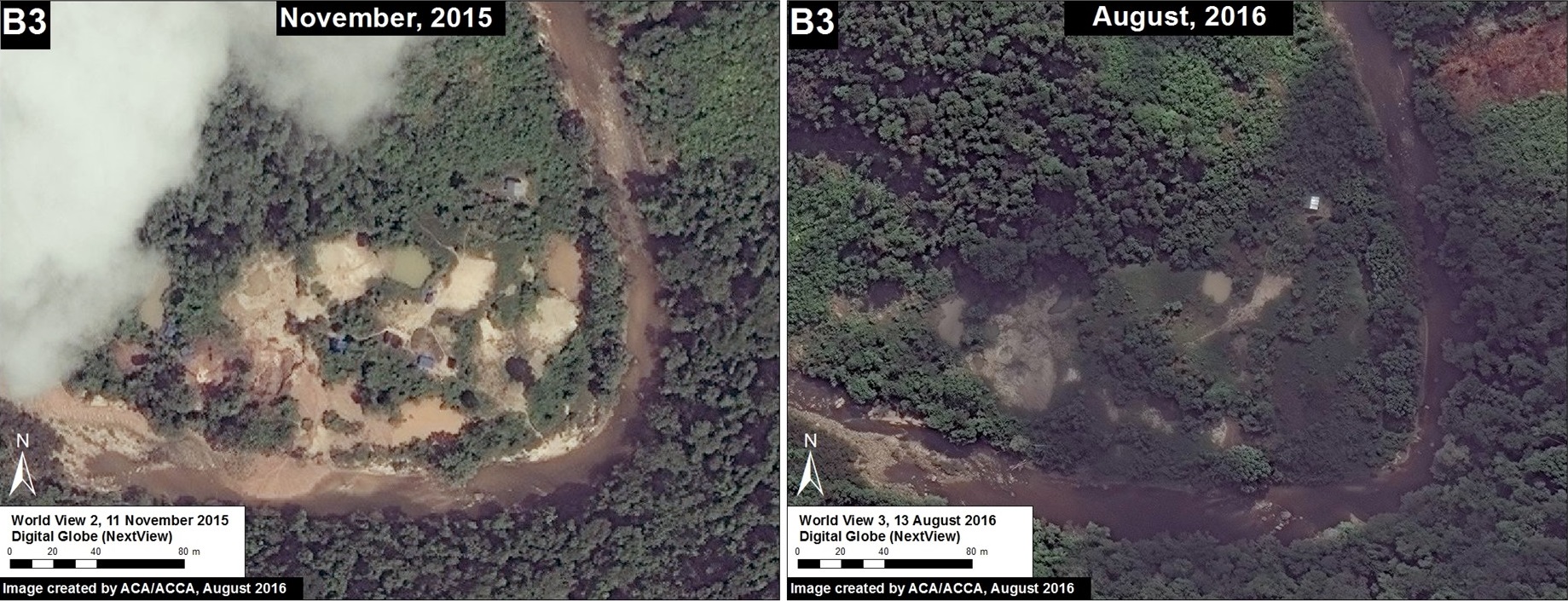
Image 45i shows a mining area abandoned between 2015 and 2016.
New Deforestation Zones
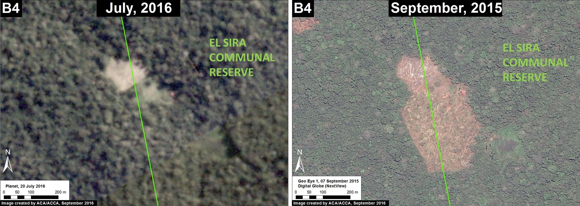
Image 45j shows the recent deforestation of 8.6 hectares (21 acres) between August (left panel) and September (right panel) 2016, within the area indicated by Inset B4 in Image 45f.
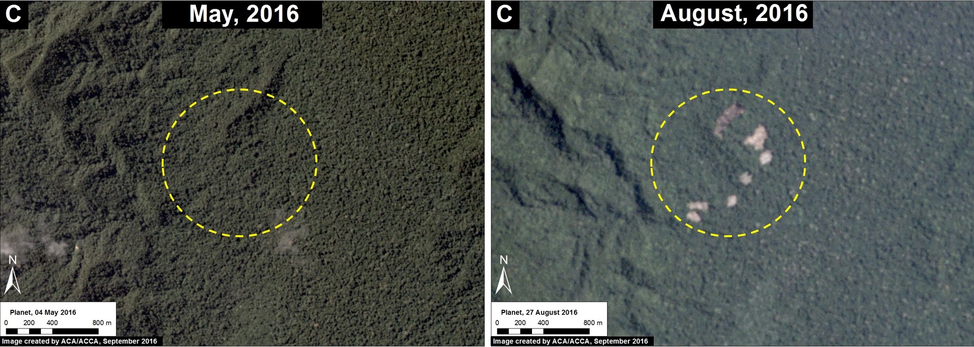
Image 45k shows the recent deforestation of 12 hectares (30 acres) within a remote area located in the northeast sector of the Reserve (see Inset C in Image 45a for context).
Citation
Novoa S, Finer M, Snelgrove C (2016) Threats to Peru’s El Sira Communal Reserve. MAAP: 45
