MAAP: Fires in the Bolivian Amazon 2020
October 4, 2020
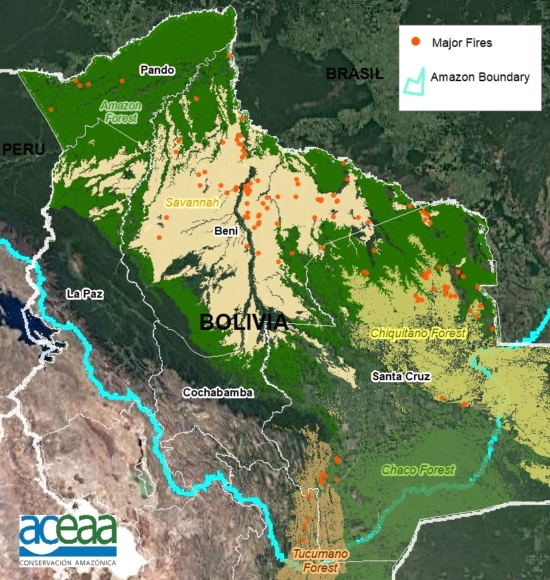
We have detected 120 major fires this year in the Bolivian Amazon, as of the first of October (see Base Map).*
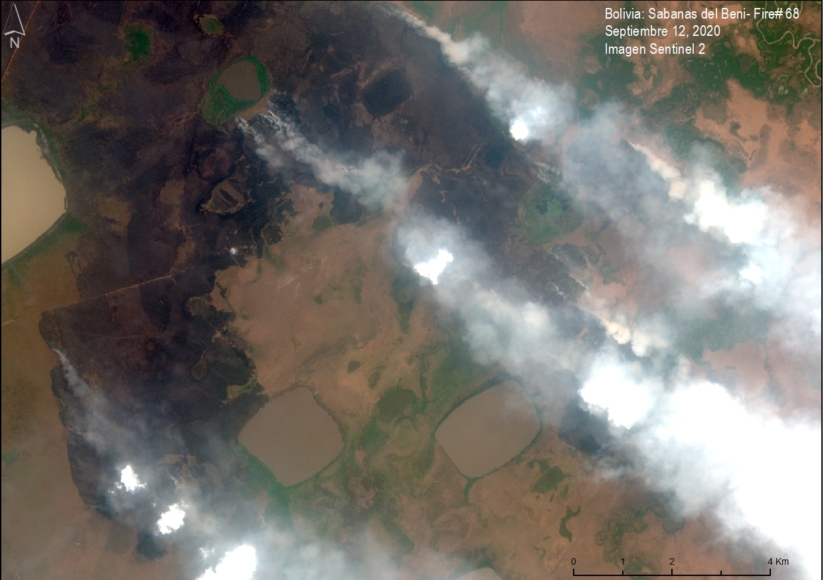
The majority of these fires (54%) occurred in savannas, located in the department of Beni.
Another 38% of the major fires were located in forests, mostly in the dry forests of the Chiquitano.
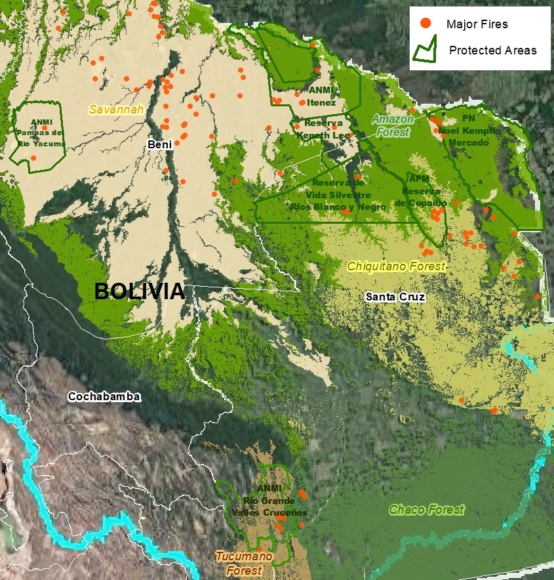
We emphasize that 25% of the major fires were located in Protected Areas (see below)..
*The data, updated through October 1, is based on our novel real-time Amazon Fires Monitoring app, which is based on the detection of elevated aerosol emissions (by the European Space Agency’s Sentinel-5 satellite) that indicate the burning of large amounts of biomass (defined here as a “major fire”).
Major Fires in Protected Areas
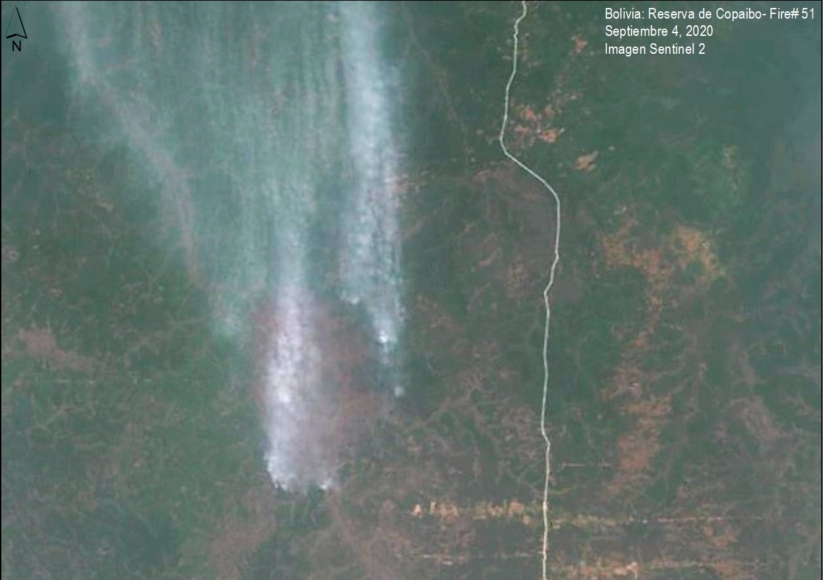
The most impacted Protected Areas are Noel Kempff Mercado National Park (21,000 acres burned), and Copaibo Municipal Protected Area (99,000 acres burned).
Other impacted Protected Areas impacted include Iténez National Park, Keneth Lee Reserve and Pampas del Río Yacuma Integrated Management Natural Area.
Satellite Images of the Major Fires in the Bolivian Amazon
We present a series of high-resolution satellite images of the major fires in the Bolivian Amazon.
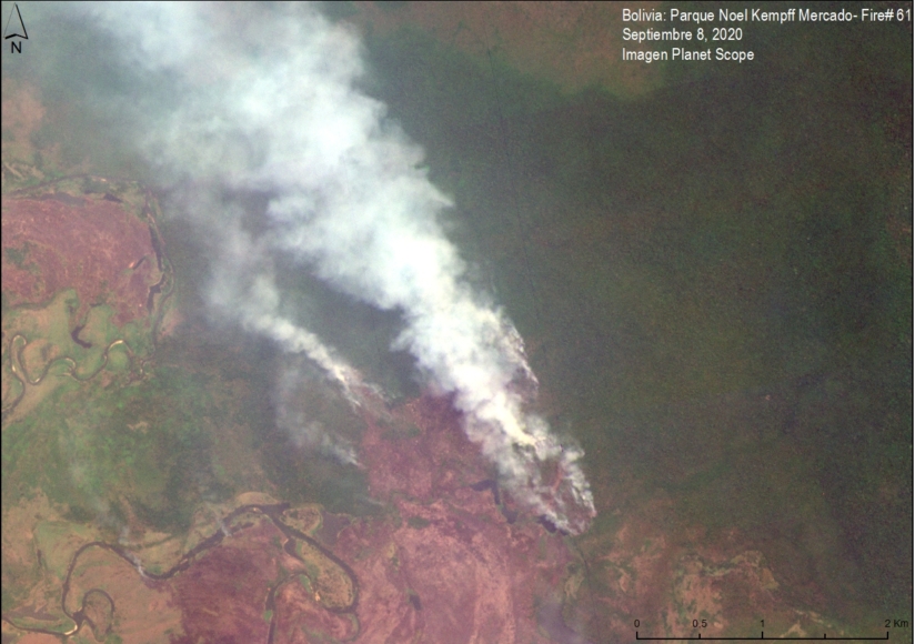
Image 1 shows a major fire in the extreme northwest of Noel Kempff Mercado National Park in September. Note that the fires are burning in the transition between Amazon forest and savanna.
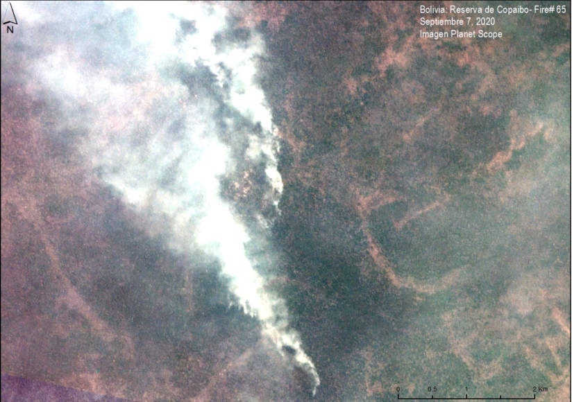
Image 2 shows a major fire in Copaibo Municipal Protected Area in September. Note that it is located in the transition zone of the moist Amazon forest and Chiquitano dry forest.
Image 3 shows another major fire in Copaibo Municipal Protected Area, also in the transition zone of the Amazon forest and the Chiquitano dry forest.
Image 4 shows a major fire in the savannas of Beni.
Citation
Finer M, Ariñez A (2020) Fires in the Bolivian Amazon 2020. MAAP.
