MAAP #56: Major Flooding in Northern Peru from Coastal El Niño
April 3, 2017
Intense rainfall is causing severe and deadly flooding along the northern coast of Peru.
The cause is likely “coastal El Niño,” a phenomenon produced by abnormal ocean warming along the equatorial coast of the Pacific Ocean.
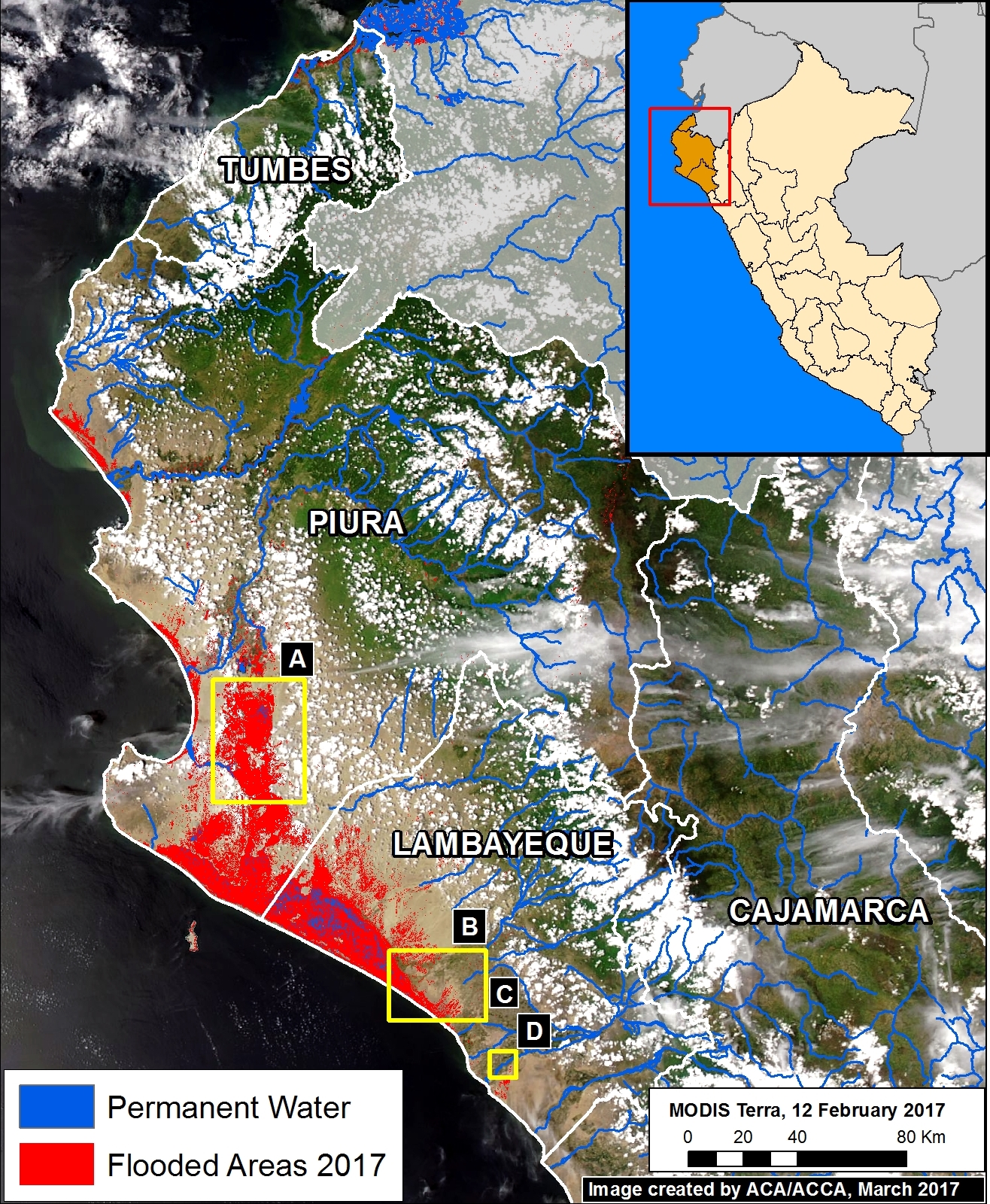
Image 56 shows a preliminary estimate of the flooded areas along the northern coast (in red). We created this estimation via an analysis of radar images (Sentinel-1) that identified areas saturated with water.
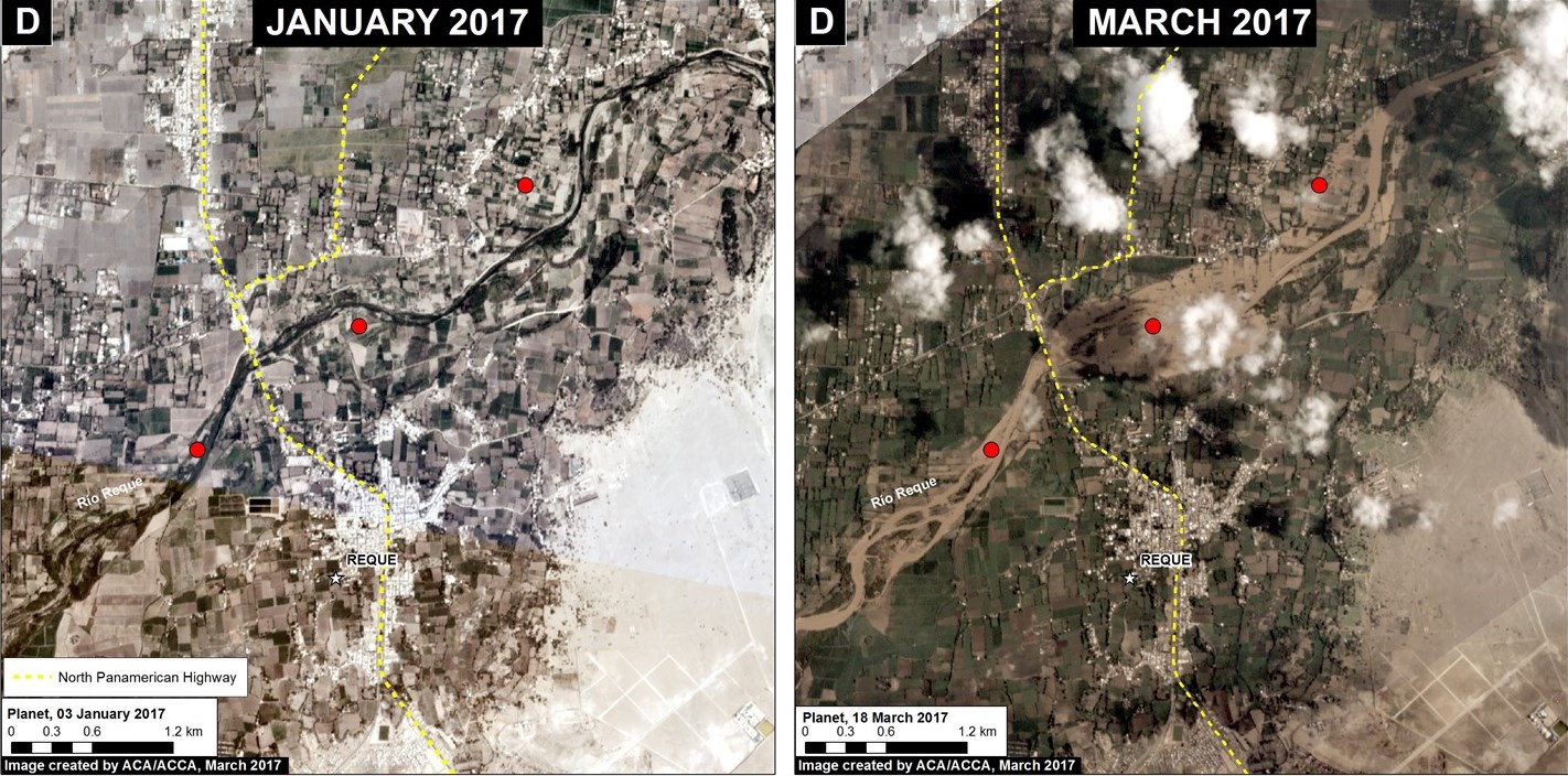
Below, we show satellite images of the areas indicated by Insets A-D, which represent examples of flooding events.
Note that the red points indicate the same spots between panels.
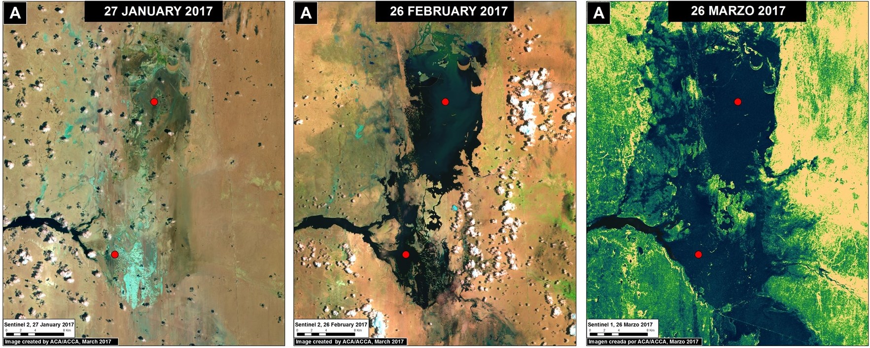
Formation of Temporary Lagoons
An indicator of intense rains in northern Peru is the formation of the temporary lagoons La Niña and La Niña Sur, in the region of Piura. Image 56a shows the rapid formation of the lagoons between late January (left panel) and March 2017 (right panel).
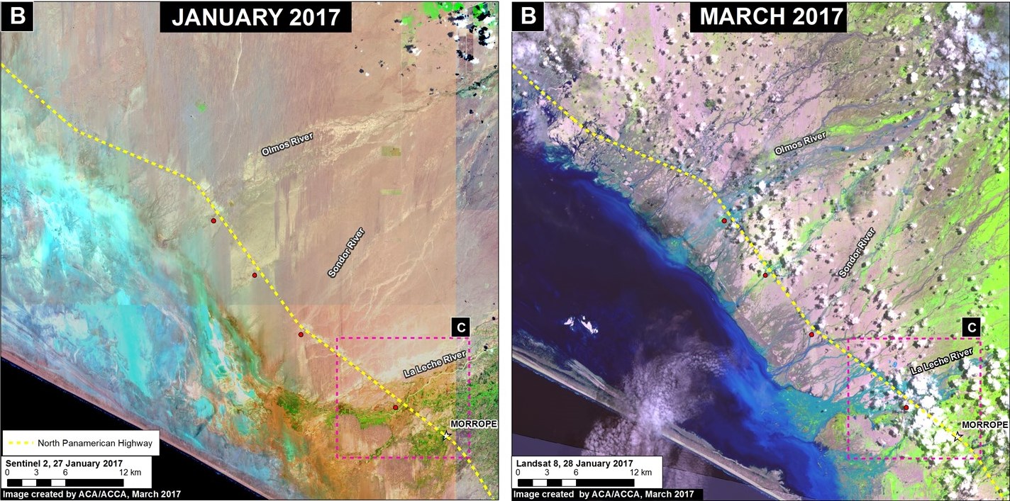
Floods that affect Towns, Infrastructure, and Crops
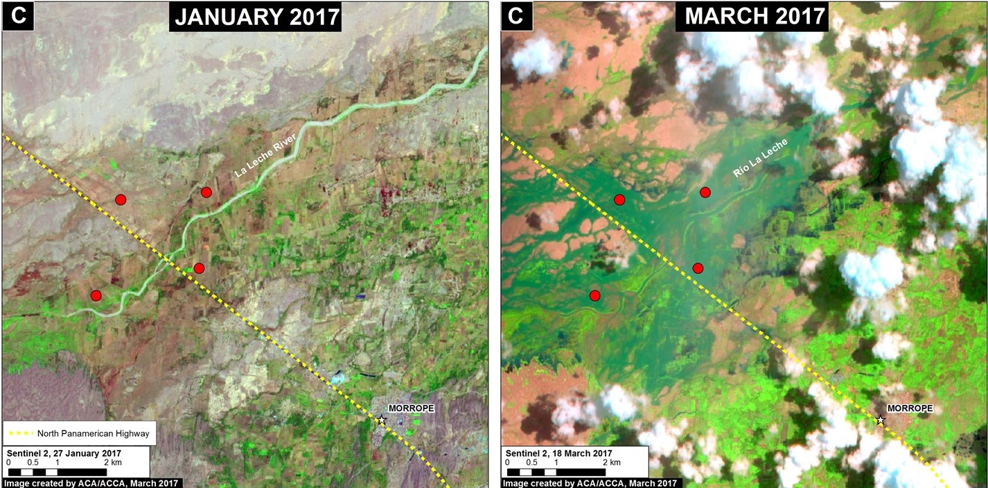
Image 56b shows areas where flooding has affected the Pan-American highway between January (left panel) and March (right panel) in the Lambayeque region. Image 56c shows a zoom of the overflowing La Leche River and the flooding of agricultural areas around the highway. Image 56d shows the flooding of the Reque River and the impact on agricultural areas and urban zones.
References
Citation
Novoa S, Finer M (2017) Major Flooding in Northern Peru from Coastal El Niño. MAAP: 56.