MAAP: What satellites show us about Peru’s flooding
April 14, 2017
Satellites provide unique information that is critical to understanding events on Earth, including the recent deadly flooding in northern Peru.
In the previous MAAP #56, we showed a series of satellite images of the deadly floods that recently hit northern Peru.
Here, we highlight how satellites can show us the extent, indicators, impacts, and causes of the flooding.
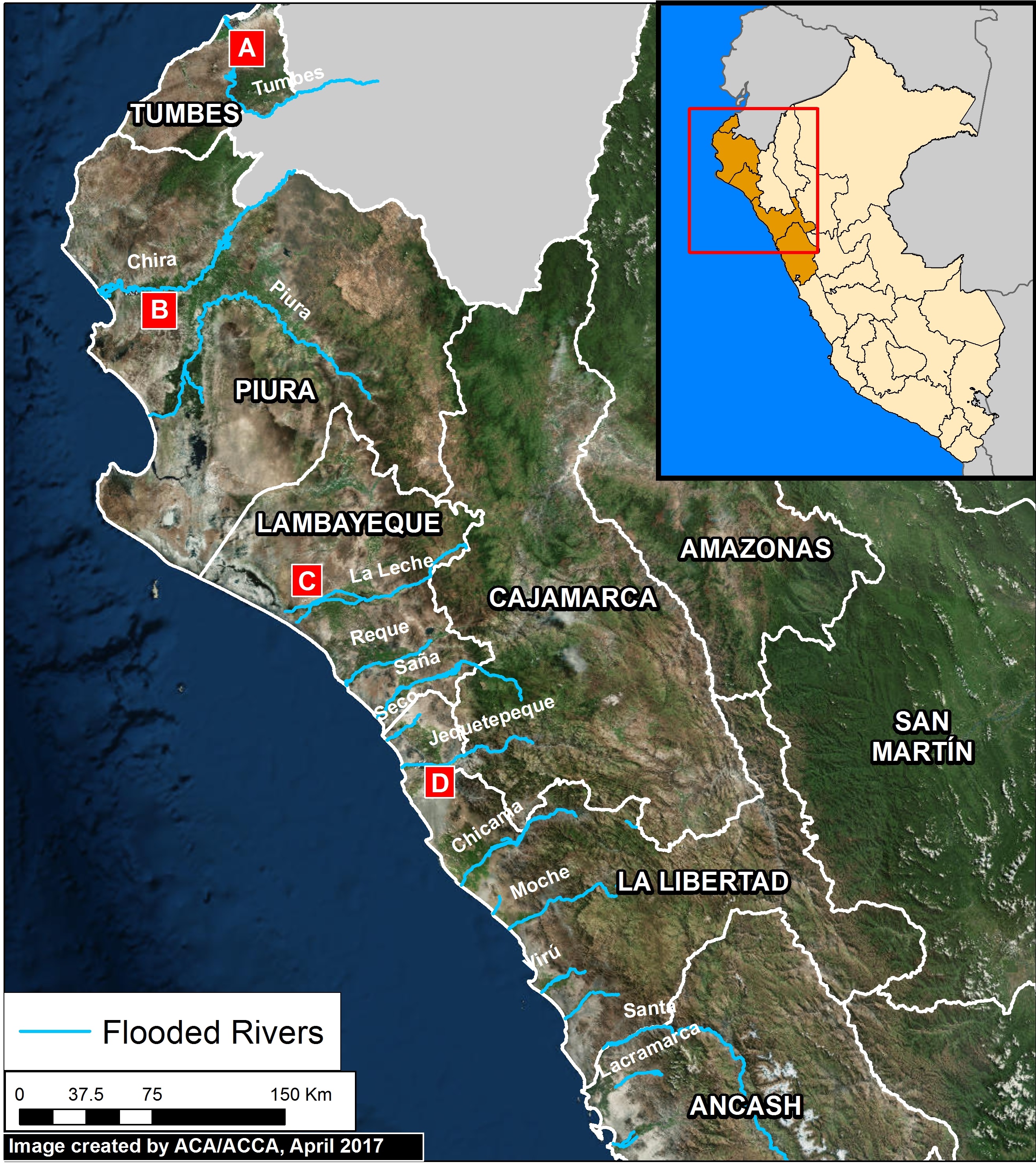
Image A (see left) shows the general extent of the flooding in northern Peru. Analyzing satellite imagery, we identified 13 major rivers that flooded, indicated in blue.
Indicators of Flooding
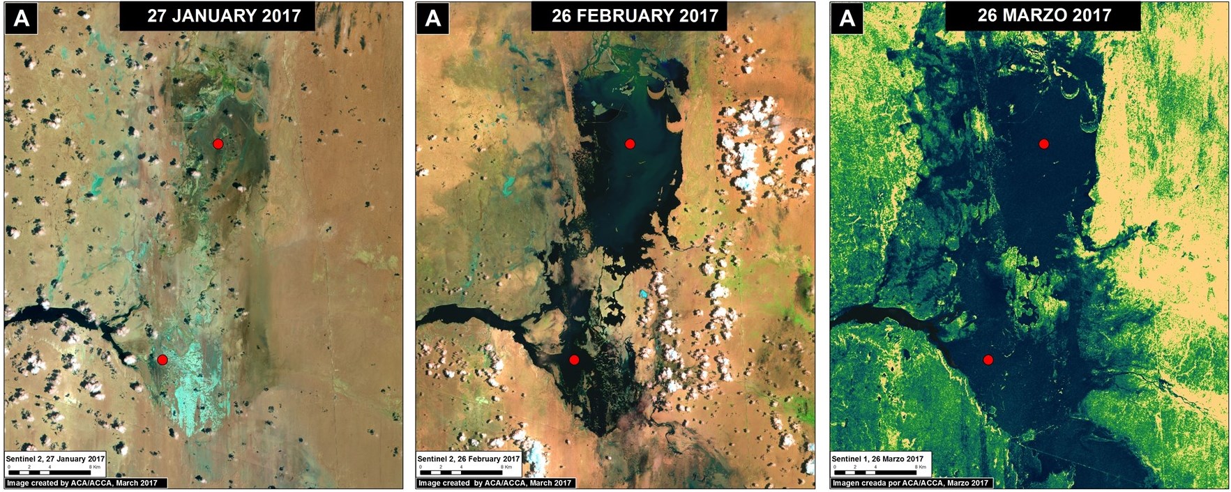
An indicator of intense rains and flooding in northern Peru is the formation of the temporary lagoons La Niña and La Niña Sur, in the region of Piura. Image B shows the rapid formation of the lagoons between late January (left panel) and March 2017 (right panel).
Impact of Flooding
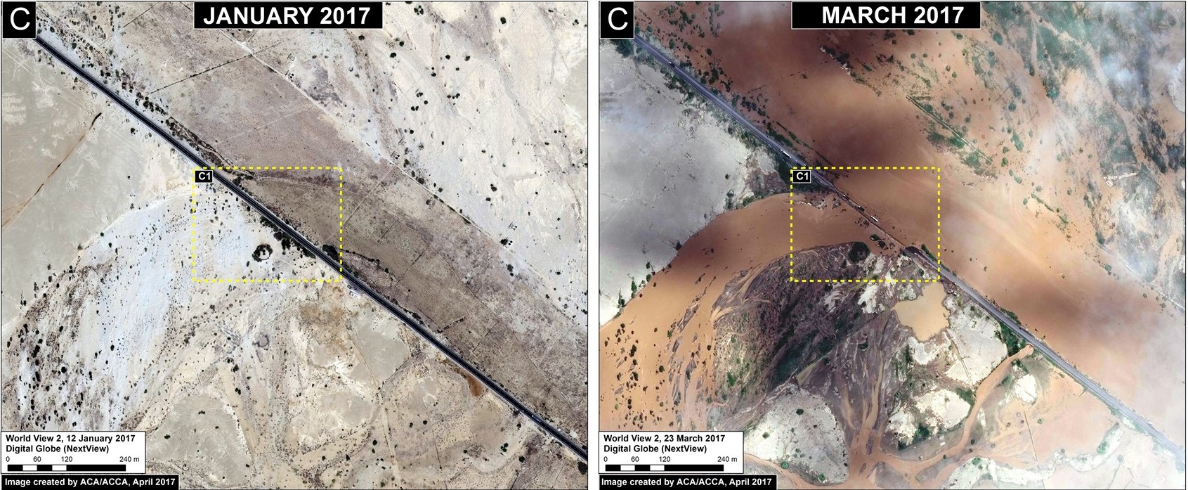
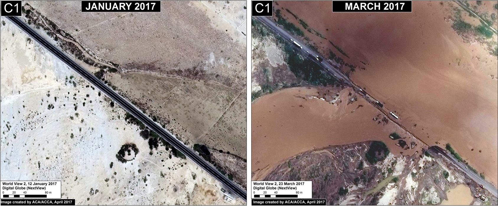
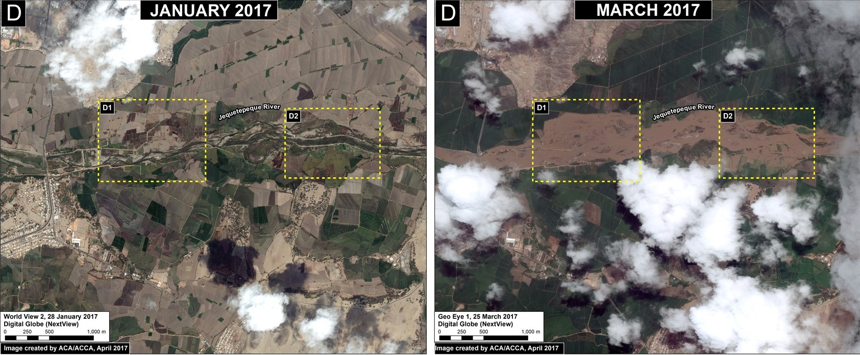
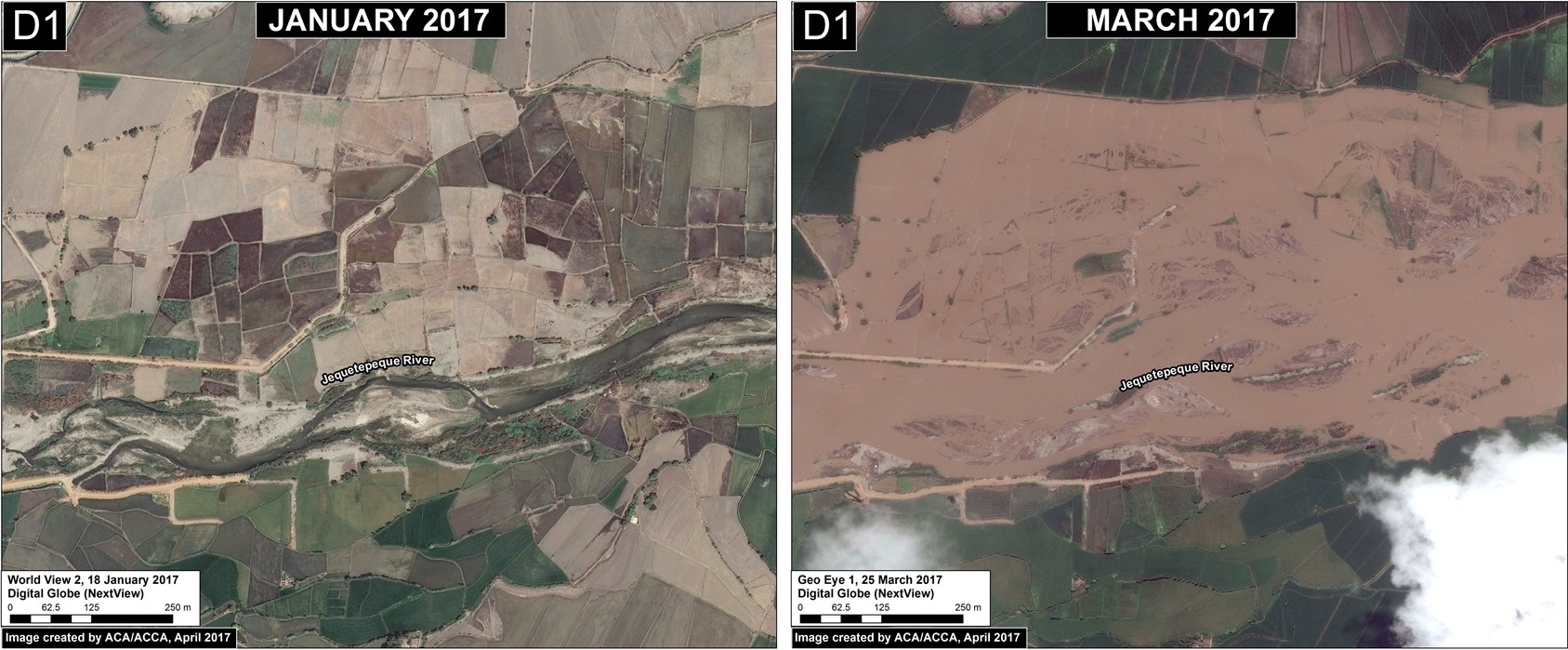
The centerpiece of our analysis is a series of high resolution satellite images of the flooding. Images C and D show, in striking detail, some of the local impacts to the Panamerican Highway and croplands between January (left panel) and March (right panel) 2017.
Causes of Flooding
Satellites also provide data about the link between ocean water temperature and the heavy rains causing the floods. Image E shows the warming of the northern Peruvian coastal waters immediately before and during the heavy rains and flooding. Peruvian experts have referred to this phenomenon as “coastal El Niño”.
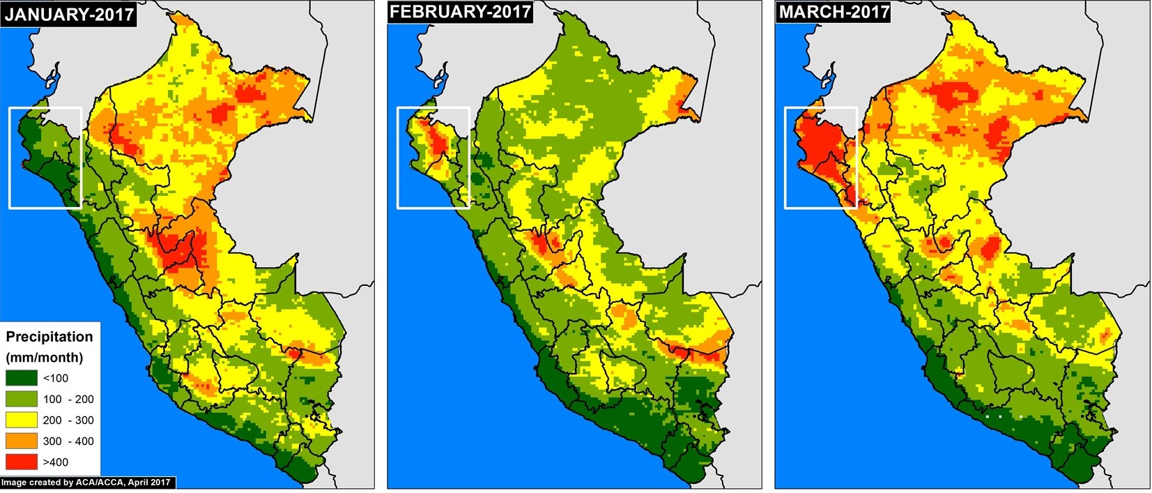
Image F shows the resulting accumulated monthly precipitation totals (white inset box indicates primary flooding zone). In January, as expected, the dry northern coast had much lower precipitation than the Amazon region to the east. In February and March, however, the northern coast experienced abnormally intense rainfall, even more than many parts of the Amazon.
Citation
Novoa S, Finer M (2017) What satellites show us about Peru’s flooding. MAAP.
