MAAP #53: Wildfire Hotspots in the Peruvian Amazon in 2016
January 31, 2017
During 2016, Peru experienced an intense wildfire season, exacerbated by widespread drought conditions across the country.
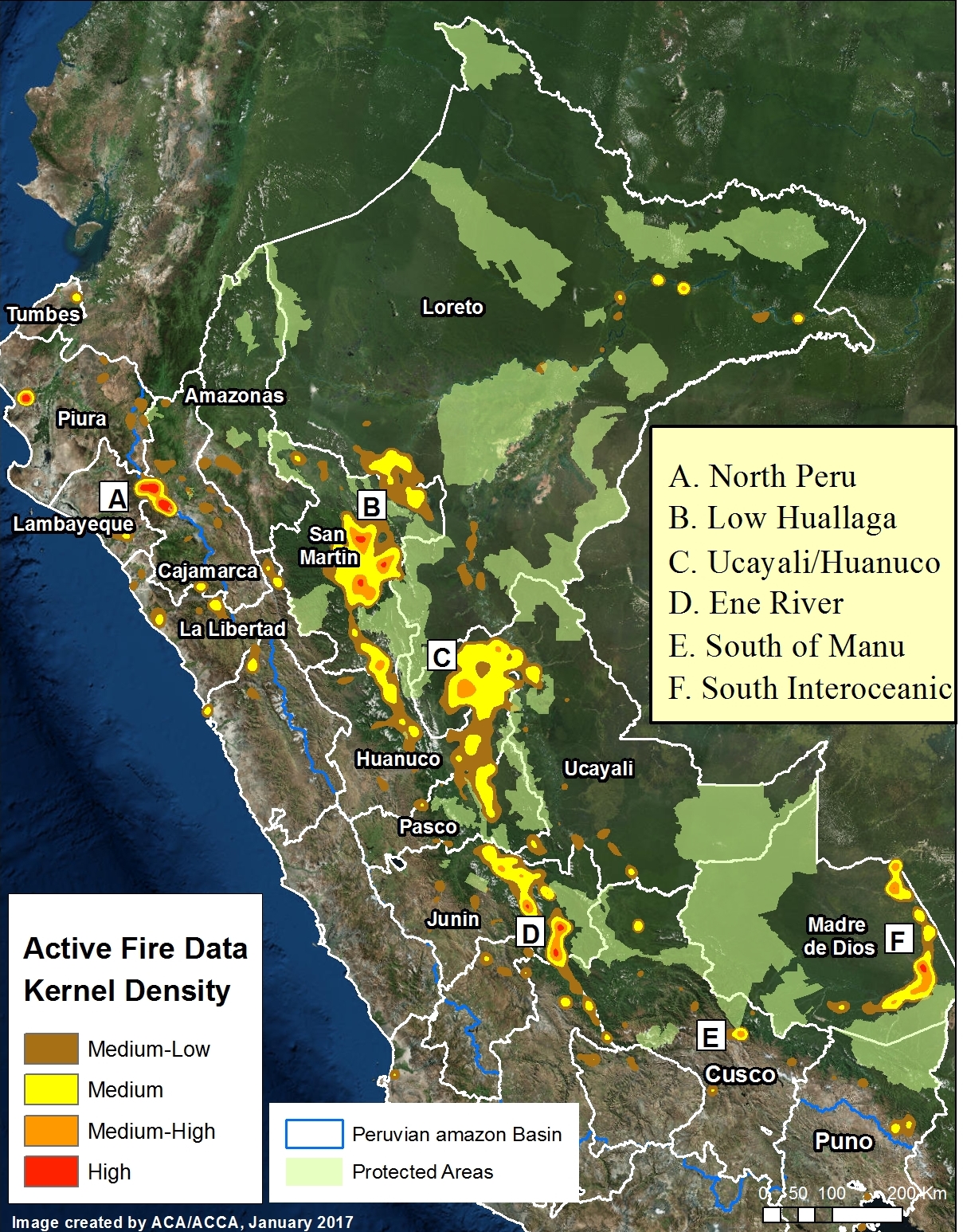
The base map (Image 53, to the left) shows the 2016 fire alert hotspots.
These alerts are generated from a moderate-resolution (375 meters) satellite sensor (VIIRS) that detects significant new heat sources.
Although there has not yet been a comprehensive evaluation of the causes of these fires, evidence indicates that many are linked to agricultural practices that allow fires to escape to surrounding natural habitats.
In the image, we highlight 5 significant fire hotspots in the Amazon basin, labeled A-E (A. Northern Peru; B. Lower Huallaga; C. Huánuco/Ucayali, D. Ene River, E. Southern Manu, F. Interoceanic Highway).
These areas are described in more detail below.
A. Northern Peru
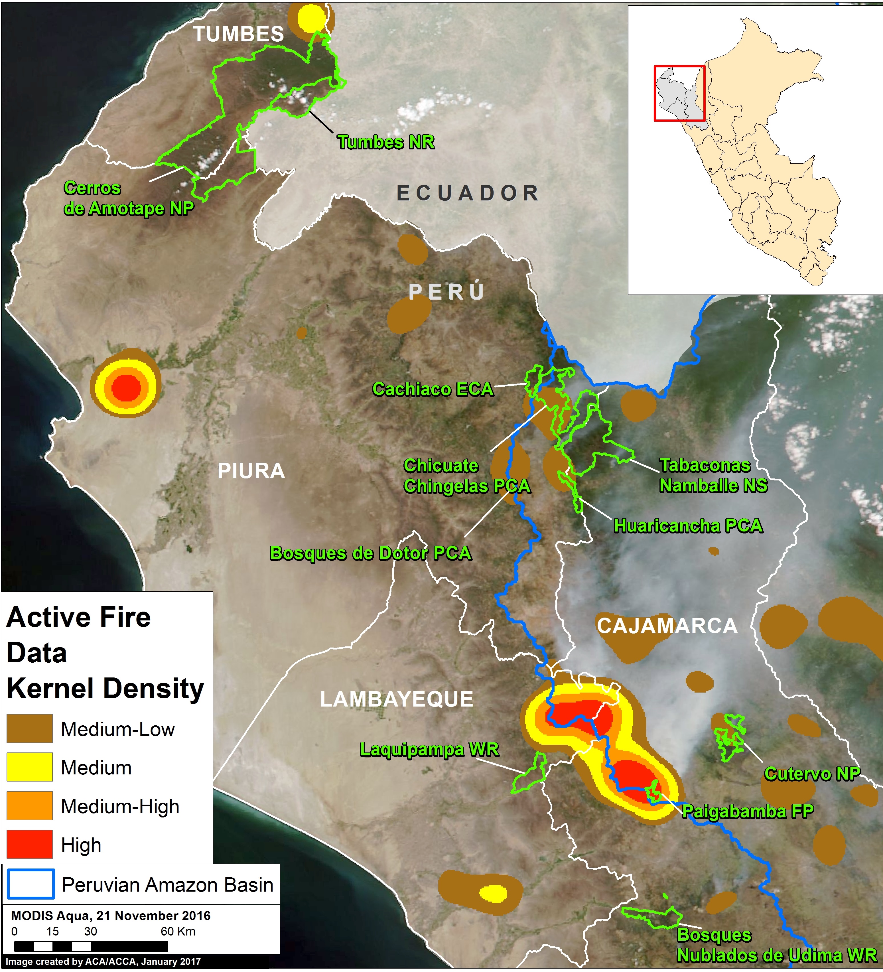
Hotspot A indicates the area in northern Peru that experienced a wave of intense fires in late 2016. Most of the fires occurred in the headwaters of the Amazon, in the Cajamarca and Lambayeque regions.
As previously reported, we estimate that 6,594 acres were burned within 11 Protected Areas (see MAAP #51 and MAAP #52).
Image 53a shows where the concentrations of heat sources were recorded.
B. Lower Huallaga
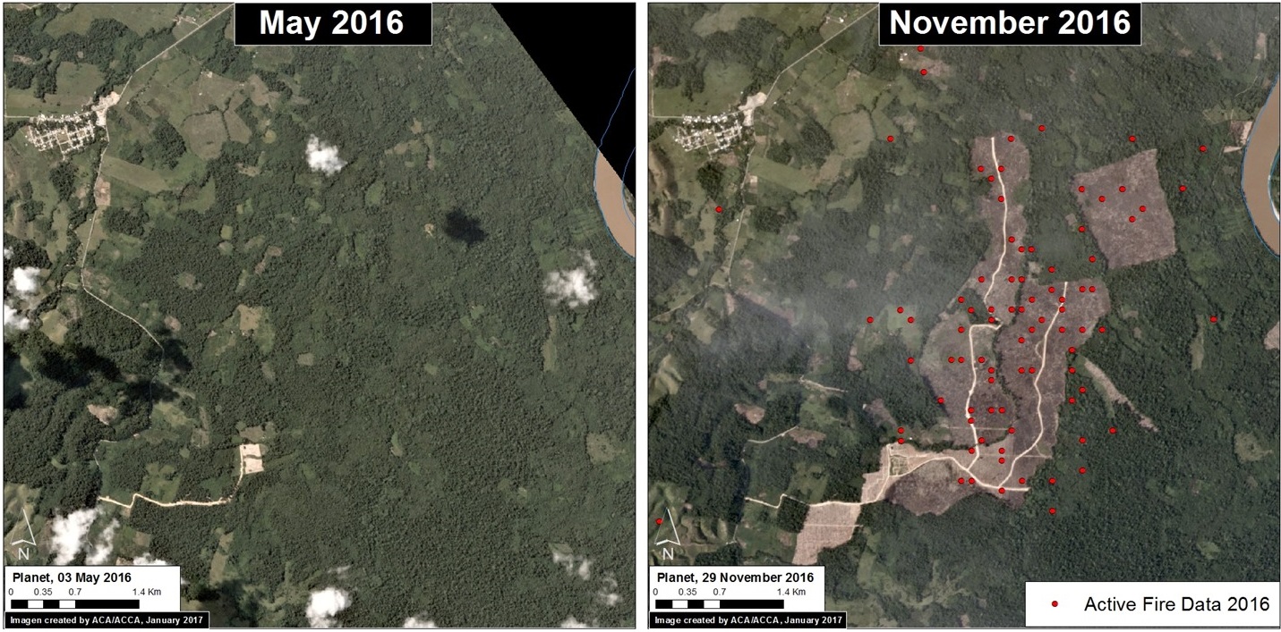
Hotspot B corresponds to the area along the lower Huallaga river basin, between the regions of Loreto and San Martín. Although most of the fires were in established agricultural areas, some impacted forest and secondary vegetation for the opening of new agricultural areas (Image 53b).
C. Huánuco/Ucayali
Hotspot C overlaps with one of the primary deforestation hotspots in the country. As previously reported, one of the primary drivers of deforestation in this area is cattle pasture (see MAAP #37). Therefore, there may be a relationship between the use of fire in agricultural activities and the high deforestation rates in this area.
D. Ene River
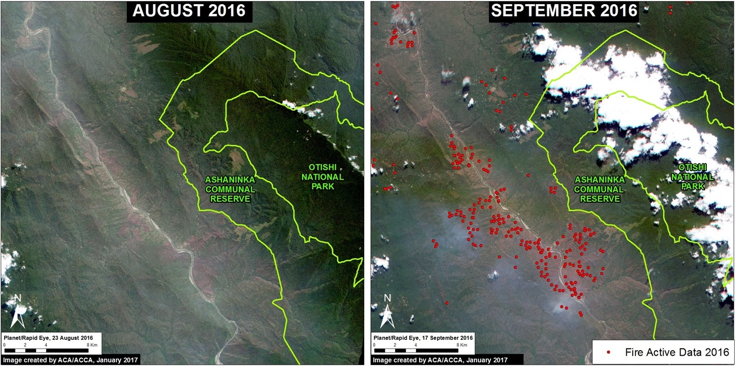
Hotspot D highlights an area that generated national and international attention in 2016, when fires along the Ene River threatened two national protected areas (Asháninka Communal Reserve and Otishi National Park) in the Junin region. Image 53d shows a comparison of before (left panel) and during (right panel) the fires. We did not document any fires entering the protected areas.
E. South of Manu
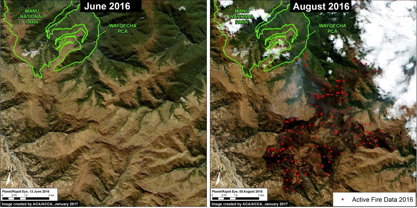
Hotspot E corresponds to an area of grassland, inter-Andean valley, and cloud forest in the buffer zone of Manu National Park and surrounding the Wayqecha Private Conservation Area. According to estimates of local officials, around 3,000 hectares burned.
F. Interoceanic Highway
Hotspot F indicates an area in southern Peru experiencing increasing deforestation along the Interoceanic Highway in the Madre de Dios region. We previously documented a correlation between the areas with high concentrations of fires and areas of elevated deforestation (see MAAP #47).
References
Citation
Novoa S, Finer M, Samochuallpa E (2017) Wildfire Hotspots in Peruvian Amazon in 2016. MAAP: 53.
