MAAP #157: New and Proposed Roads Across the Western Amazon
Extensive deforestation, especially along the major road networks, has shockingly turned the eastern Brazilian Amazon into a net carbon source (see MAAP #144). Fortunately, the greater Amazon across all nine countries is still a net carbon sink, largely thanks to…
MAAP #84: New Threats to the Peruvian Amazon (Part 1: Yurimaguas-Jeberos Road)
The efforts and international commitments of the Peruvian Government to reduce deforestation may be compromised by new projects do not have adequate environmental assessment. In this series, we address the most urgent of these projects, those that threaten large areas…
MAAP #80: Amazon Beauty, in High-Resolution
MAAP tracks the most urgent deforestation cases in the Andean Amazon, thus it can be a bit depressing. However, it is important to remember why we do it: the Amazon is spectacular. Here, we present a series of high-resolution satellite…
MAAP #76: Proposed Road would cross Primary Forest along Peru-Brazil Border
In December 2017, the Peruvian Congress approved a bill that declared it in the national interest to construct new roads in the border zone of Ucayali region, which shares a remote border with Brazil. The main proposed road in this…
MAAP Interactive: Deforestation Drivers in the Andean Amazon
Since its launch in April 2015, MAAP has published over 70 reports related to deforestation (and natural forest loss) in the Andean Amazon. We have thus far focused on Peru, with several reports in Colombia and Brazil as well. These…
MAAP SYNTHESIS #2: PATTERNS AND DRIVERS OF DEFORESTATION IN THE PERUVIAN AMAZON
We present our second synthesis report, building off our first report published in September 2015. This synthesis is largely based on the 50 MAAP reports published between April 2015 and November 2016. The objective is to synthesize all the information…
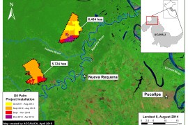
MAAP #42: Papaya – New Deforestation Driver in Peruvian Amazon
In the previous MAAP #26, we published a preliminary map of Deforestation Hotspots in the Peruvian Amazon for 2015. Subsequently in 2016, we have been compiling information to improve understanding on the potential causes (drivers) of deforestation in the identified…
MAAP #29: Construction of New Road between Manu National Park and Amarakaeri Communal Reserve (Madre de Dios)
Here in MAAP #29, we describe the Nuevo Eden-Boca Manu-Boca Colorado road project in the southern Peruvian Amazon (Madre de Dios region). The objective of this article is to show the current state of construction and quantify the direct and…
MAAP #28: New Deforestation Hotspot along Interoceanic Highway in Southern Peruvian Amazon (Madre de Dios)
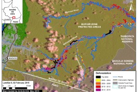
We have previously detailed the extensive illegal gold mining problem in the southern Peruvian Amazon (Madre de Dios region), but here in MAAP #28 we detail the emergence of another deforestation hotspot in the region. Image 28a shows the intensification…
MAAP Synthesis #1: Patterns and Drivers of Deforestation in the Peruvian Amazon
We present a preliminary analysis of current patterns and drivers of deforestation in the Peruvian Amazon. This analysis is largely based on the first 15 articles published on MAAP between April and September 2015, but also incorporates information from other…