MAAP #10 detailed the extensive deforestation between 2000 and 2014 (538 hectares or 1,329 acres) in the Colorado sector of Bahuaja Sonene National Park, an important protected area in the southern Peruvian Amazon. Additionally, we described how this sector has a high density of coca plantations, one of the main drivers of the observed deforestation. Coca has many traditional uses in Andean cultures, but is also used to produce cocaine.
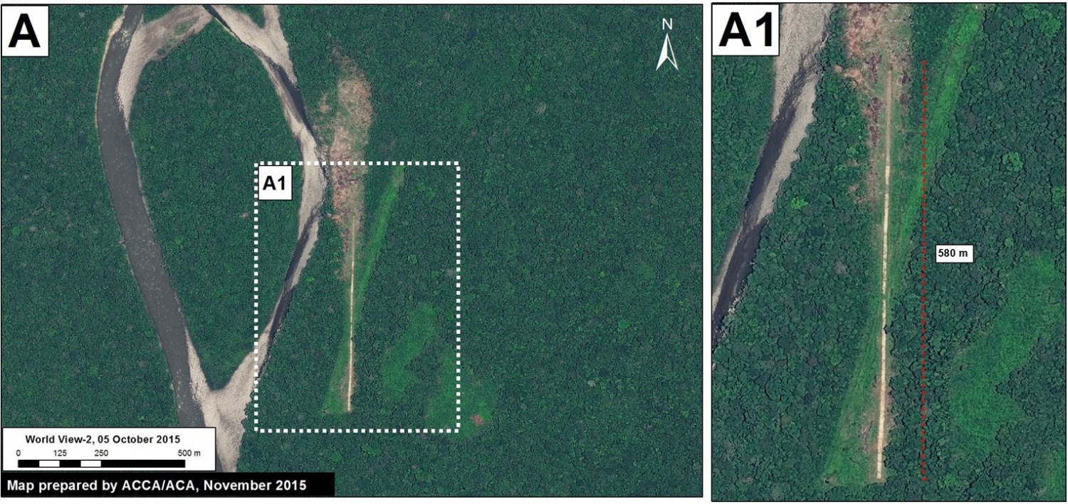
Here in MAAP #20, we show that in 2015 the deforestation has continued in this sector of the park. Moreover, as seen in Image 20a, we detected the construction of a new airstrip in a nearby remote area part of the park that is likely being used for transporting coca.

Airstrip
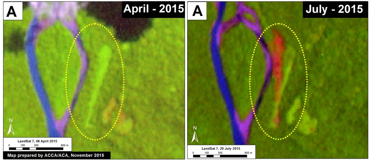
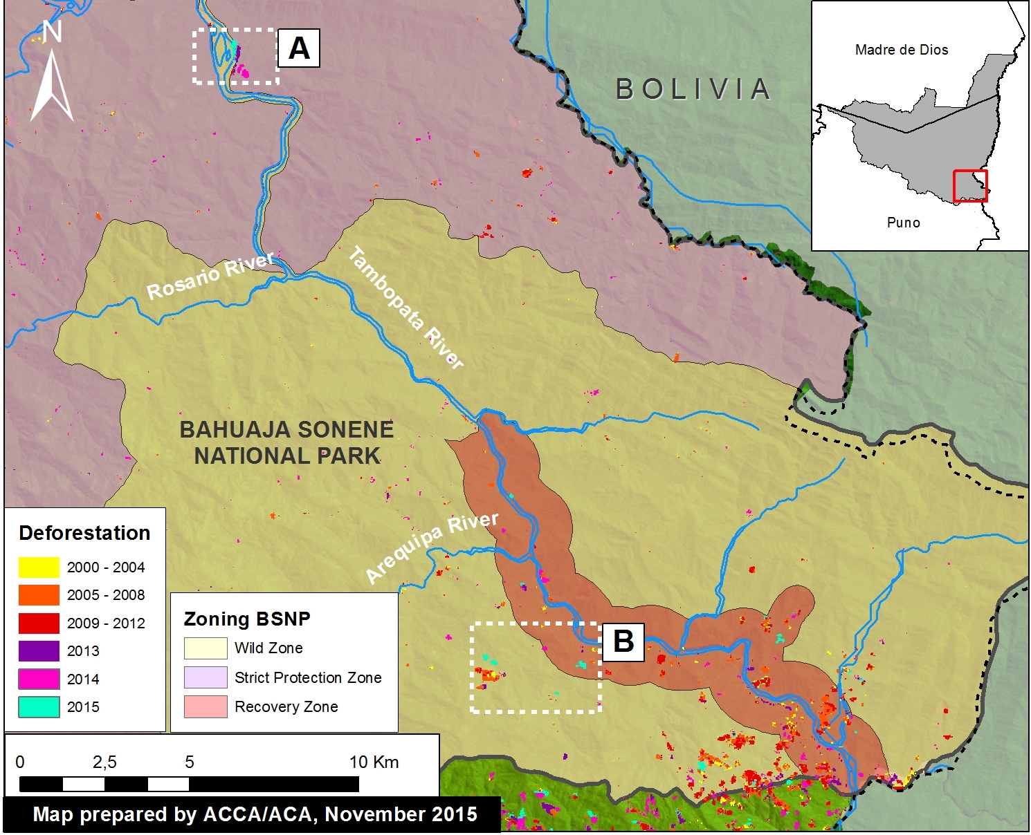
Image 20a shows a high-resolution (0.5 m) image of the new airstrip, which is 580 meters long and 8 meters wide (in addition, see Zoom A in Image 20c for context). It is characteristic of an airstrip designed for a single-engine plane. As seen in Image 20b, the airstrip was constructed between May and June 2015. In addition, Image 20c, shows that the airstrip is located within the zones of strict and wildlife protection. It appears that a previous airstrip was constructed in this same area in 2013, but became overgrown 2014. It is worth noting that there are no native communities in this area.

Reference Map
Image 20c shows the reference map for this article. It shows the Colorado sector of Bahuaja Sonene National Park. Zoom A corresponds to the airstrip described above, while Zoom B corresponds to the new deforestation analysis described below.

New Deforested Areas associated with Coca Cultivation
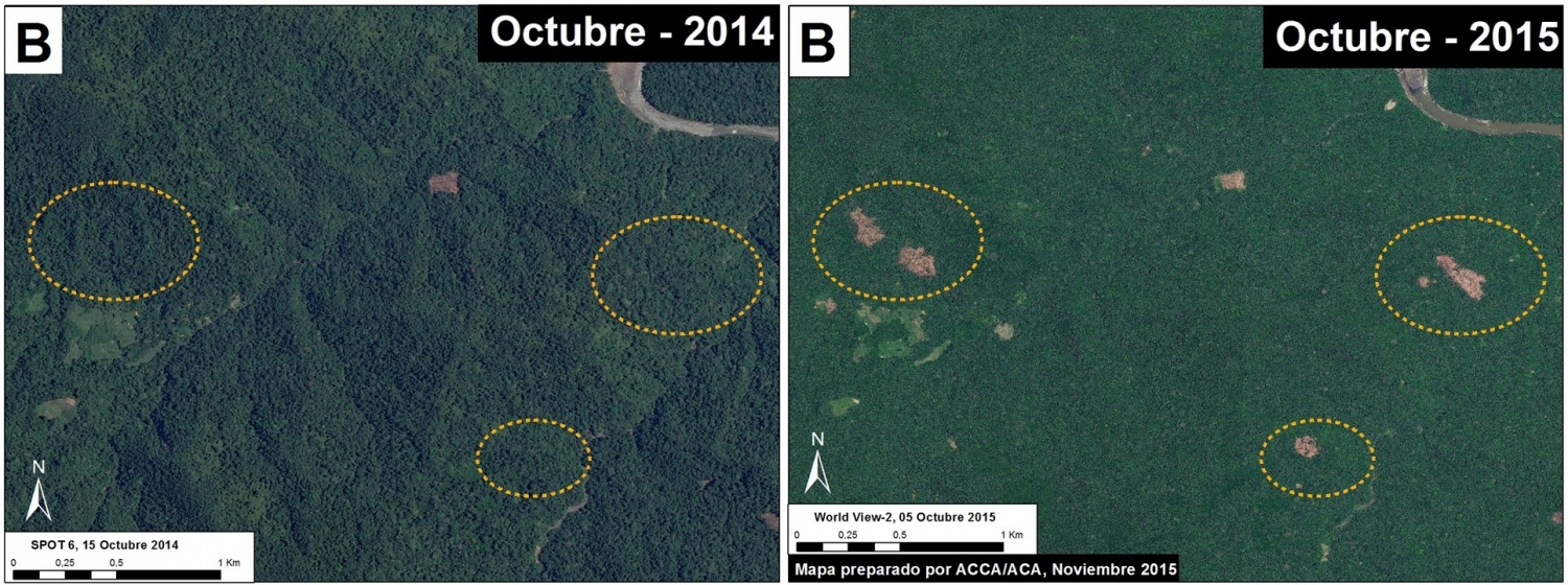
Image 20d shows a comparison of two high-resolution images showing the deforestation of 40 hectares (99 acres) between October 2014 (left panel) and October 2015 (right panel). The yellow dashed circles indicate the newly deforested areas, which are near previous coca plantations. In addition, Image 20c shows that these newly deforested areas are located within the zones of strict and wildlife protection.

Citation
Novoa S, Finer M (2015) New Airstrip in Coca-growing Area within Bahuaja Sonene National Park (Puno, Peru). MAAP: 20.


