NASA’s GEDI mission uses lasers to provide cutting-edge estimates of aboveground biomass and related carbon on a global scale.
Launched in late 2018 and installed on the International Space Station, GEDI’s lasers return an estimate of aboveground biomass density at greater accuracy and resolution than previously available.
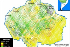
Here, we zoom in on the Amazon and take a first look at the recently available Level 4B data: Gridded Aboveground Biomass Density measured in megagrams per hectare (Mg/ha) at a 1-kilometer resolution.
See the GEDI homepage for more background information on the mission, which extends until January 2023. Be sure to check out this illustrative video.
Base Map – Aboveground Biomass in the Amazon
The Base Map displays the GEDI data for the nine countries of the Amazon biome, displaying aboveground biomass for the time period April 2019 to August 2021.
We highlight the following initial major findings:
- The data is not yet comprehensive as there are some areas the lasers have not yet recorded data (indicated in white).
h - The areas with the highest aboveground biomass and related carbon (indicated in dark green and purple) include:
- Northeast Amazon: Corner of Brazil, Suriname, & French Guiana.
- Southwest Amazon: Southwest Brazil and adjacent Peru (see zoom below).
- Northwest Amazon: Northern Peru, Ecuador, and southeast Colombia.
Zoom In – Southwest Amazon
To better visualize the GEDI laser data, we also present a zoom of the Southwest Amazon. Although deforested areas (and natural savannahs) are illustrated in yellow and orange, note the surrounding presence of high carbon forest (green and purple).
Zoom Out – Global Scale
Note that tropical forests, including the Amazon, have the highest levels of aboveground biomass globally.
Acknowledgements
This work was supported by NORAD (Norwegian Agency for Development Cooperation) and ICFC (International Conservation Fund of Canada).
Citation
Finer M, Ariñez A (2022) Lasers Estimate Carbon in the Amazon – NASA’s GEDI Mission. MAAP: 160.