In a series of previous reports, we warned about the emergence and expansion of illegal mining deforestation in the heart of the Ecuadorian Amazon, in the area surrounding the Punino River, located between the provinces of Napo and Orellana (MAAP #182, MAAP #151).
In the most recent report, we informed that this mining impact had reached 1,000 hectares (MAAP #206).
Here, we provide an update on the growing mining activity in and around the Punino River basin during the first half of 2024.
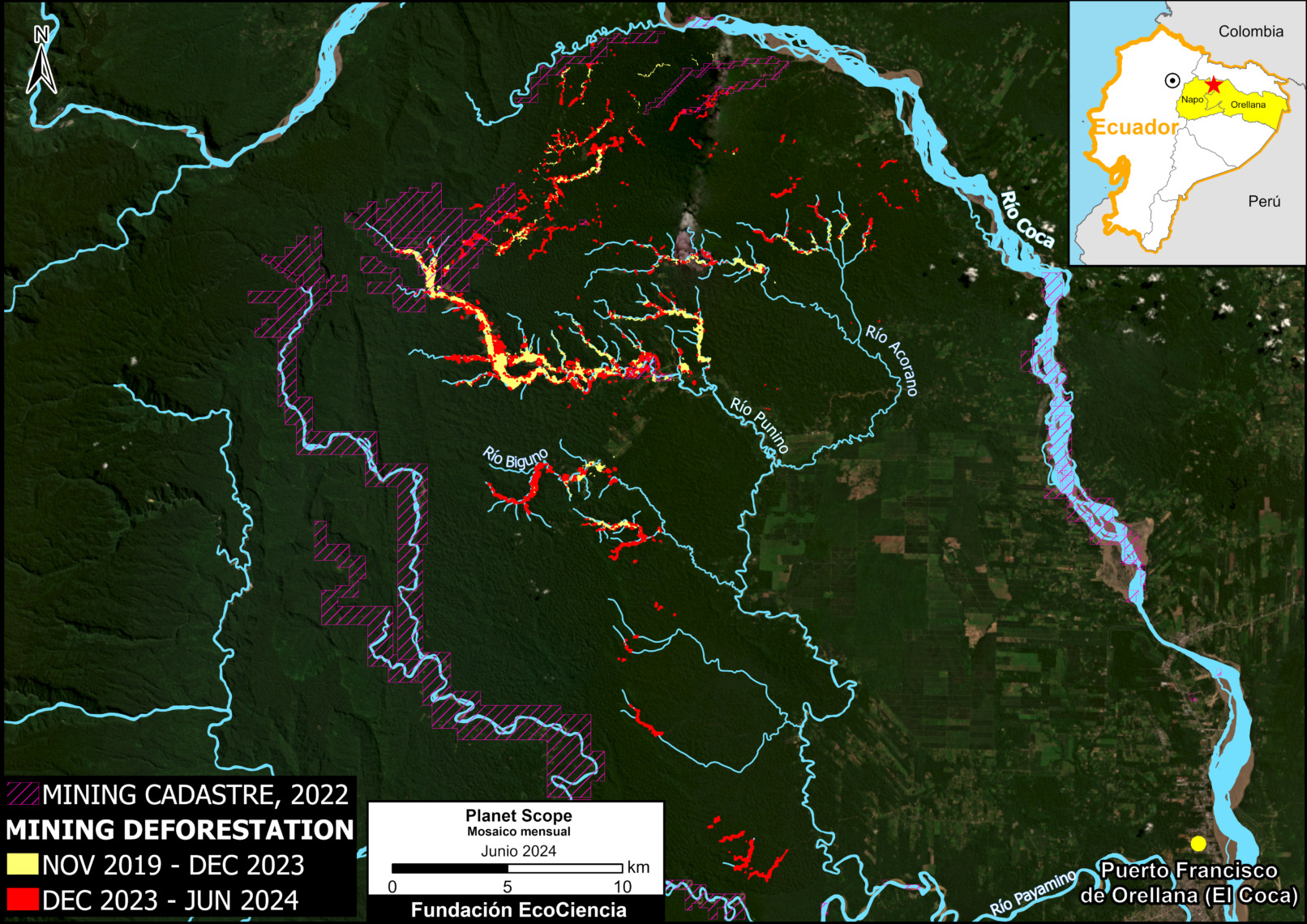
The Base Map shows an increase of 420 hectares in 2024 (indicated in red), bringing the total impact to 1,422 hectares (3,500 acres) since its inception in 2019 (yellow and red combined). This total is equivalent to more than 2,000 professional soccer fields.
The Base Map also shows that the vast majority (90%) of the mining deforestation is located outside the limits of the areas authorized for such activity (according to the mining registry updated to 2022). In other words, the vast majority of mining is likely illegal.
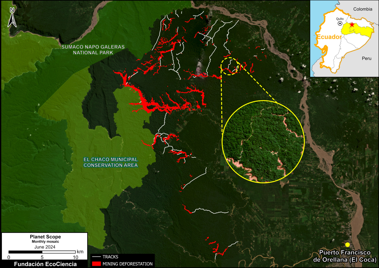
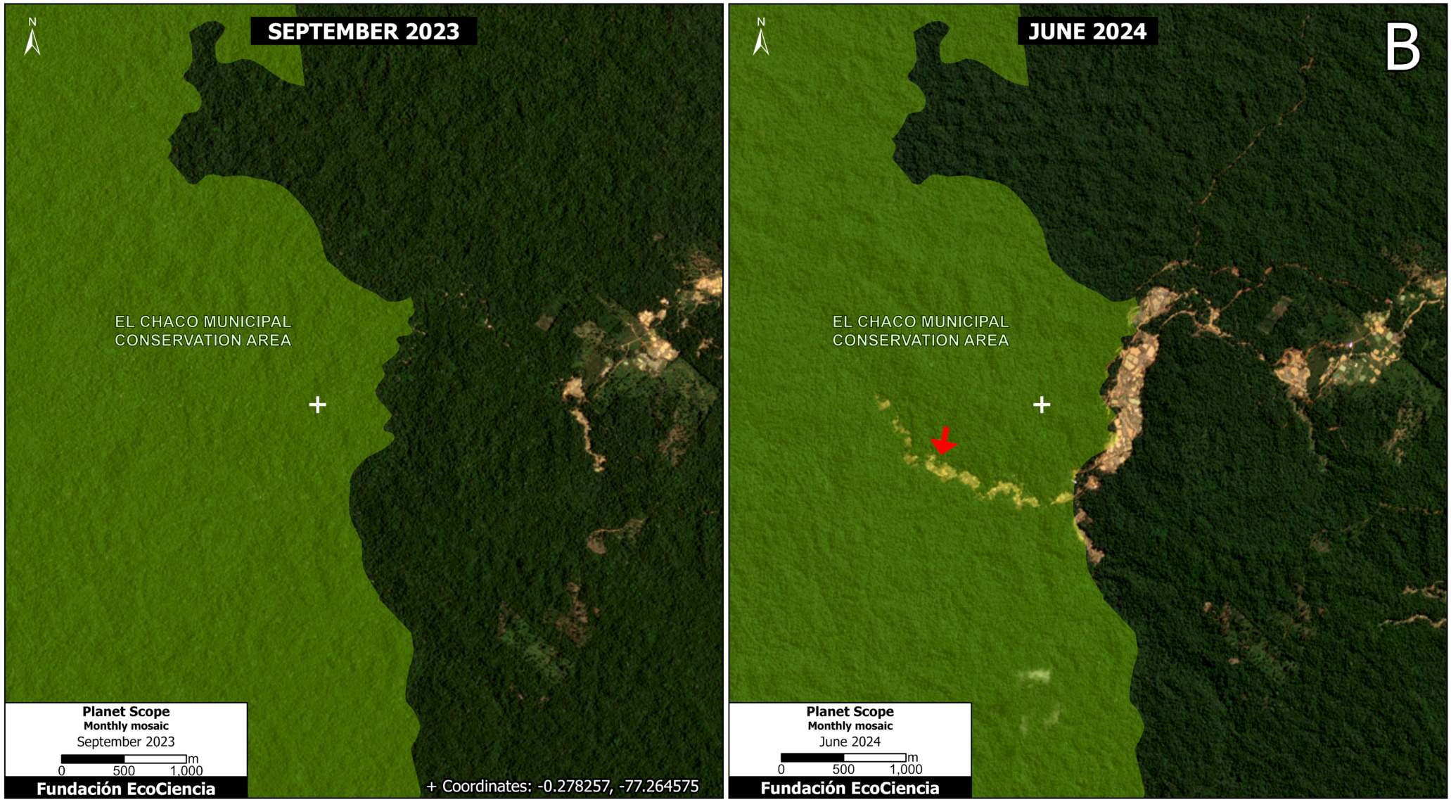
We emphasize that the mining deforestation has rapidly expanded to enter the limits of two protected areas: Sumaco-Napo Galeras National Park and El Chaco Municipal Conservation Area (see Figure 1, below).
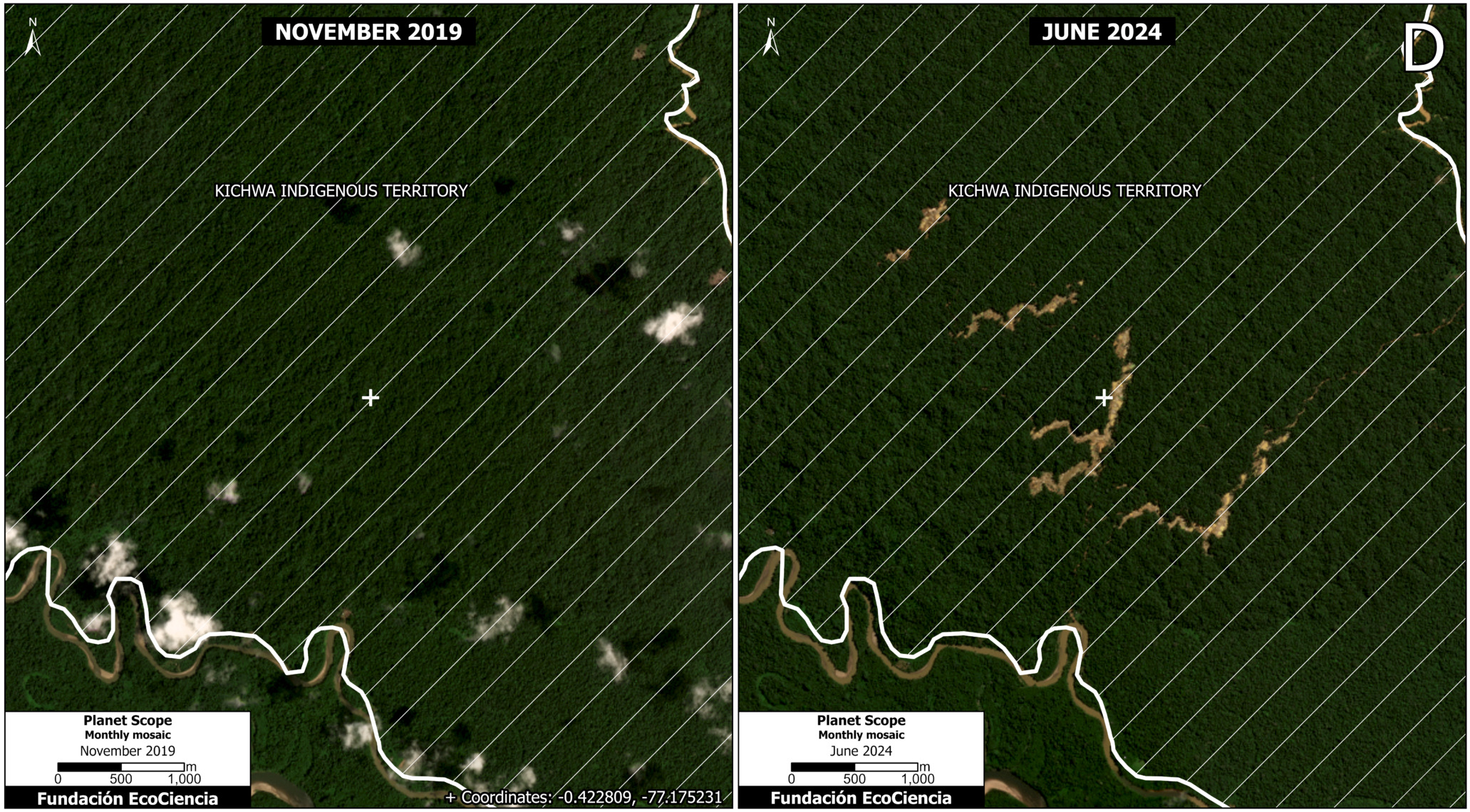
In addition, the mining deforestation is actively expanding within the boundaries of Indigenous territories of the Kichwa nationality (see Figure 2, below).
Below we illustrate in more detail the rapid increase in mining deforestation, especially in these protected areas and Indigenous territories.
Mining expansion in the Punino area, 2019-2024
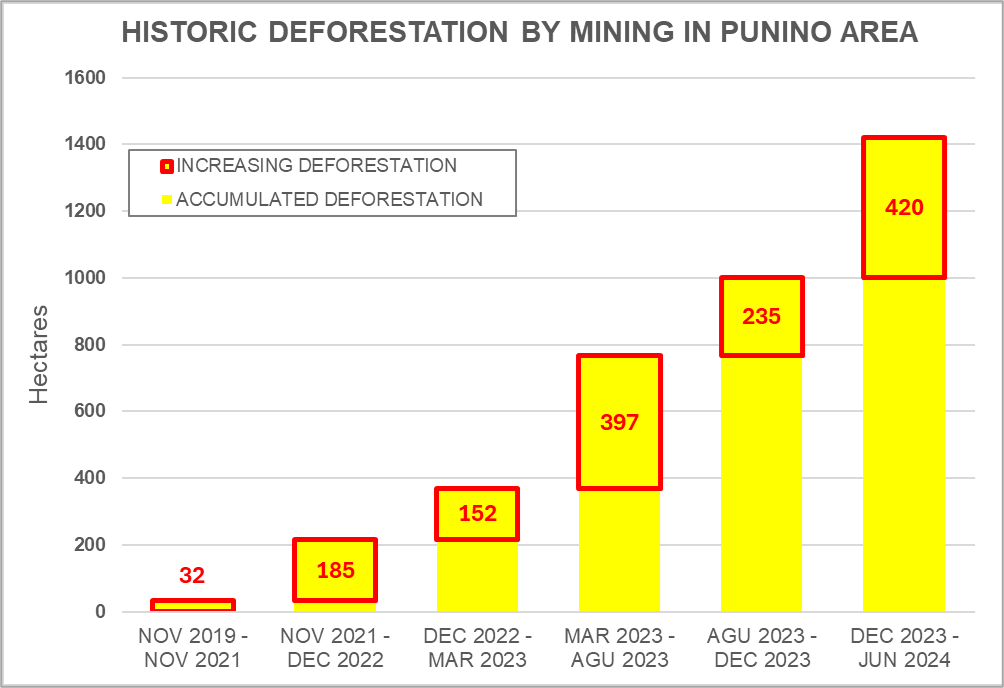
Chart 1 illustrates the steadily increasing mining deforestation in the Punino area over the past 5 years. The impact began in 2019, reaching 1,000 hectares by the end of 2023, and more recently reaching 1,422 hectares in June 2024.
Expansion of illegal mining in protected areas
Figure 1 shows the expansion of mining deforestation in and around the two protected areas of the Punino zone. Note that mining has recently penetrated the boundaries of both Sumaco-Napo Galeras National Park (0.32 hectares) and El Chaco Municipal Conservation Area (144 hectares).
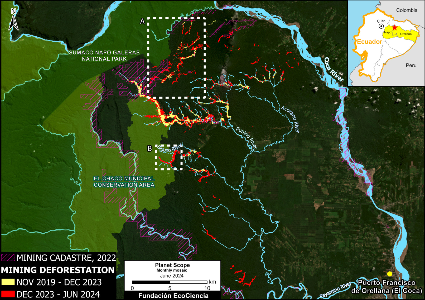
Figure 2 shows the initial encroachment (0.32 hectares) of mining deforestation in the boundaries of Sumaco Napo-Galeras National Park between September 2022 (left panel) and June 2024 (right panel).
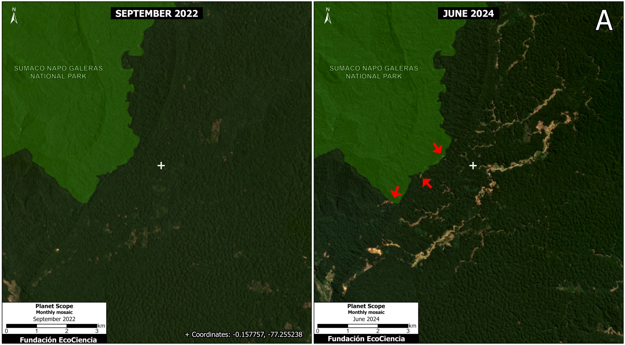
Figure 3 shows the invasion and expansion of deforestation due to mining (144 hectares) within the boundaries of El Chaco Municipal Conservation Area between September 2023 (left panel) and June 2024 (right panel).
Expansion of illegal mining in indigenous territories
Figure 4 shows the expansion of mining deforestation (300 hectares) in relation to the Indigenous territories of the Kichwa nationality in the Punino area.
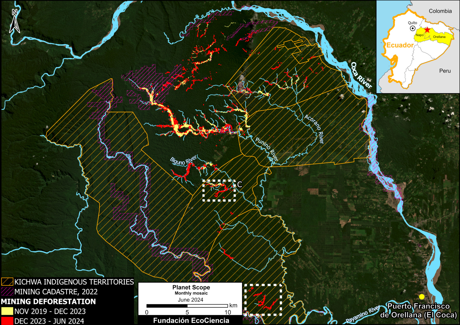
Figure 5 shows the expansion of deforestation due to mining in the indigenous territories of the Kichwa nationality between September 2023 (left panel) and June 2024 (right panel).
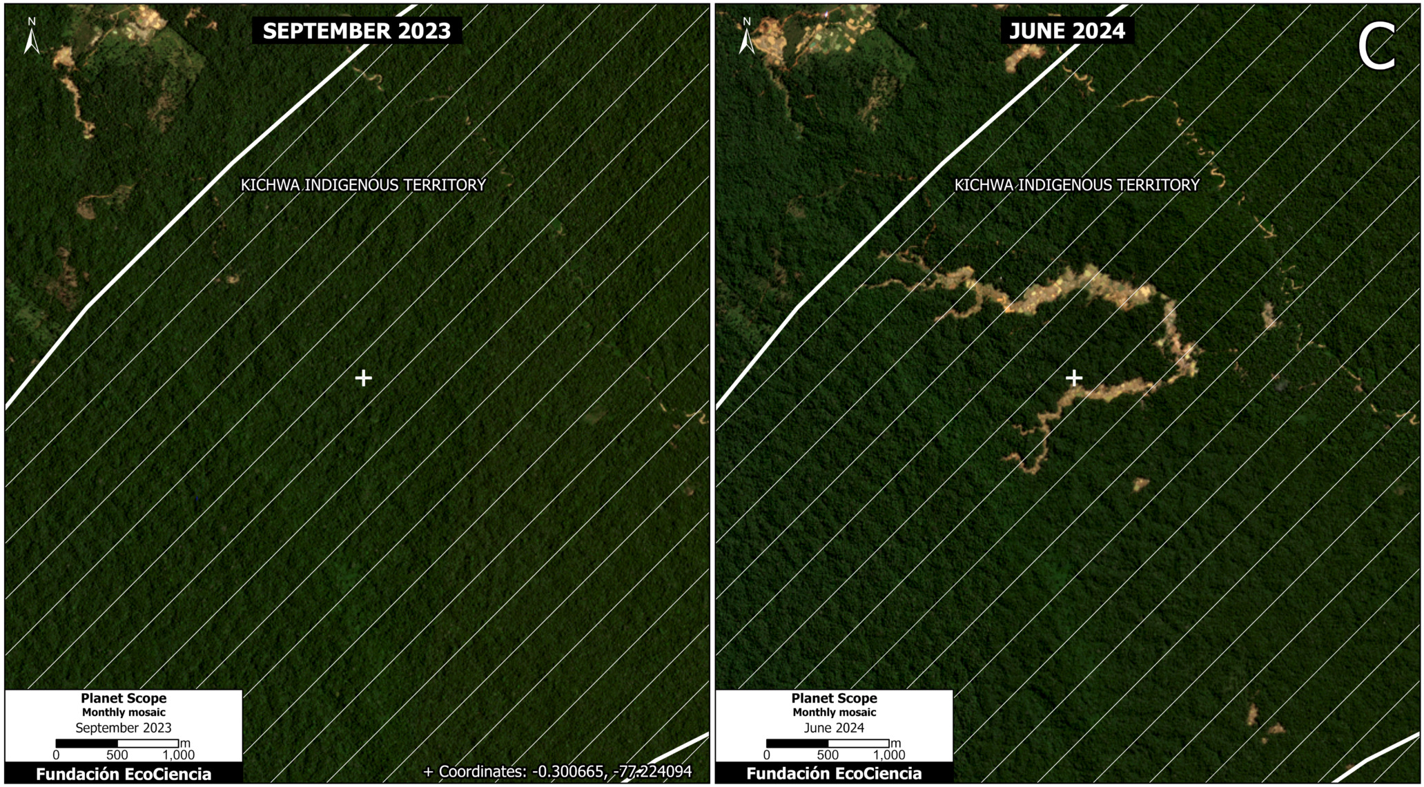
Figure 6 shows the expansion of deforestation due to mining in indigenous territories of the Kichwa nationality south of the study area between November 2019 (left panel) and June 2024 (right panel).
Annex 1
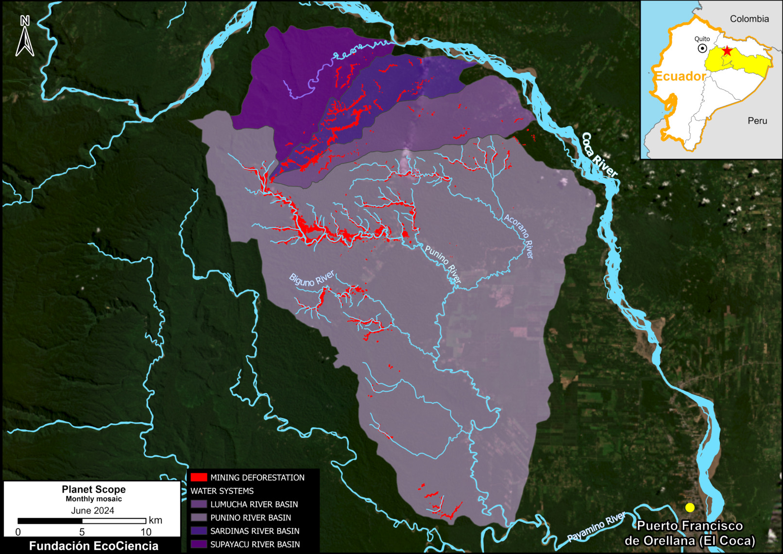
Annex 1 shows the four watersheds impacted by mining activity: the Punino River basin and also the Sardinas River, Lumucha River and Supayacu River basins, which in turn form part of the Coca River macro-water system.
Annex 2
Annex 2 shows the construction of 91 kilometers of roads due to mining activity.
Acknowledgements
This report is part of a series focused on the Ecuadorian Amazon through a strategic collaboration between the EcoCiencia Foundation and Amazon Conservation, with the support of the Norwegian Agency for Development Cooperation (Norad).
