MAAP #39: Gold Mining Deforestation Within Tambopata National Reserve Exceeds 350 Hectares
August 1, 2016
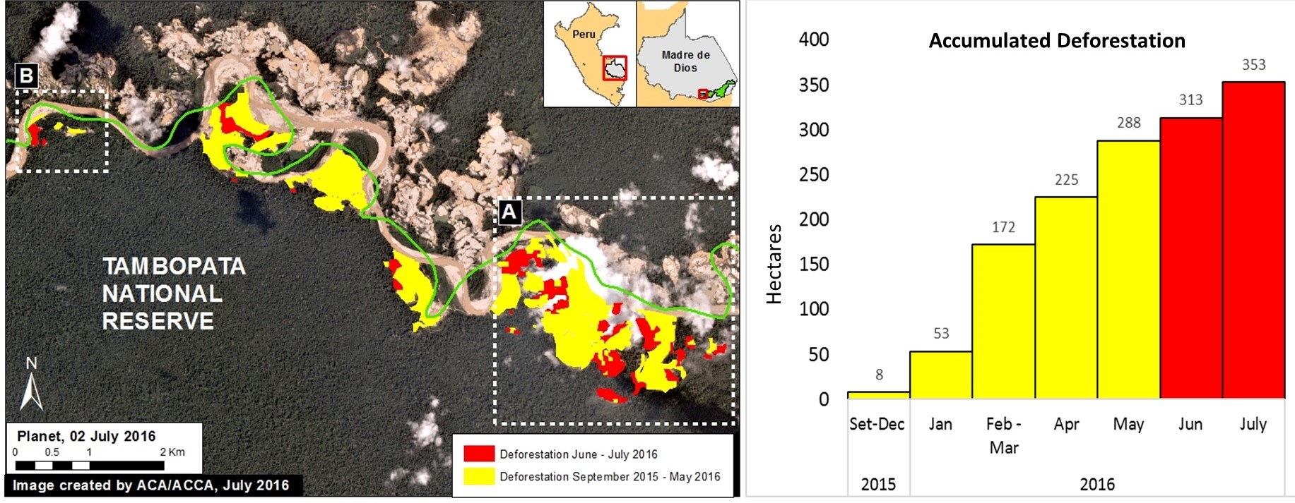
Based on analysis of satellite imagery, we have documented that the deforestation due to illegal gold mining activities within Tambopata National Reserve (Madre de Dios region) now exceeds 350 hectares (872 acres) since the initial invasion in late 2015 (see Image 39a). Although the rate of deforestation has decreased since April, when the Peruvian government installed a permanent control post* in the area, it is clear that the deforestation continues to expand. In the Image, we highlighted the most recent deforestation (June and July 2016) in red to emphasize the current fronts. Insets A and B indicate the areas detailed in the zooms below.
*A recent article in the New York Times highlighted the extreme difficulty faced by the Peruvian government in cracking down on the illegal mining. Yesterday, the leading Peruvian newspaper El Comercio reported that the control post has been abandoned due to lack of resources.
Zoom A
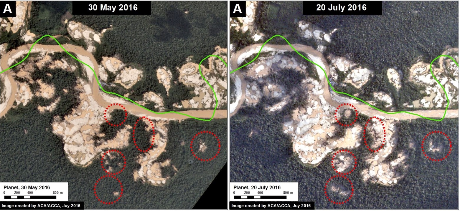
In the following images, we show high-resolution examples of the recent deforestation within the reserve. Image 39b shows the deforestation that occurred between May 30 (left panel) and June 20 (right panel), 2016 in the area indicated by Inset A. The red circles indicate primary zones of new deforestation between these dates.
Zoom B
Image 39c shows the deforestation between May 3 (left panel) and July 21 (right panel), 2016 in the area indicated by Inset B. The red circles indicate primary areas of new deforestation between these dates.
Citation
Novoa S, Finer M, Olexy T (2016) Gold Mining Deforestation within Tambopata National Reserve exceeds 350 Hectares. MAAP: #39


