MAAP #192: Confirming Deforestation by Mennonites in the Peruvian Amazon


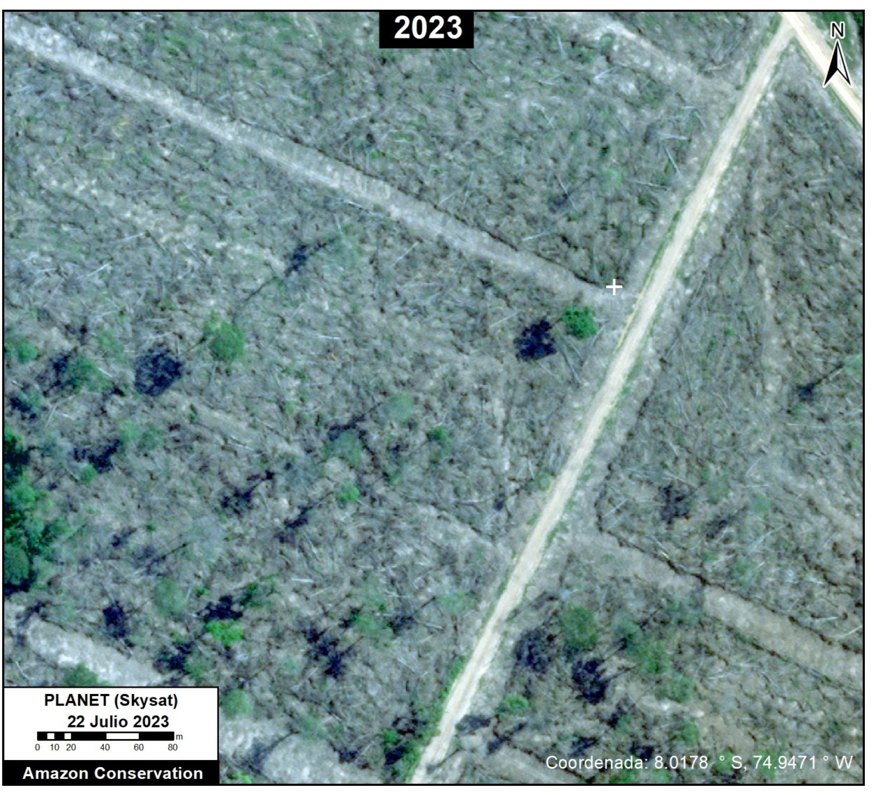
Example of recent 2023 deforestation of primary Amazon forest by Mennonite colony. Data: Planet (Skysat).
In a series of reports, we have documented the recent massive deforestation by Mennonite colonies in the Peruvian Amazon (see MAAP #188).
Here, we present additional evidence that Mennonites are currently clearing primary Amazon forests: very high-resolution satellite imagery (0.5 meters from Planet’s Skysat fleet).
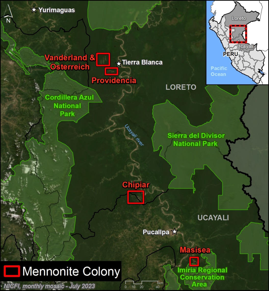
Specifically, we compare a series of very high-resolution satellite images tasked over the same area on different dates across three different Mennonite colonies (Chipiar, Providencia, and Vanderland), located in the regions of Loreto and Ucayali (see Base Map in the Annex).
These images conclusively confirm that Mennonites are actively clearing primary forest across multiple sites in the Peruvian Amazon during recent weeks in 2023.
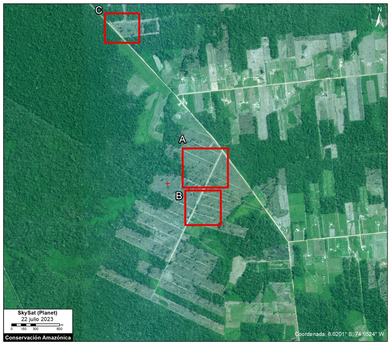
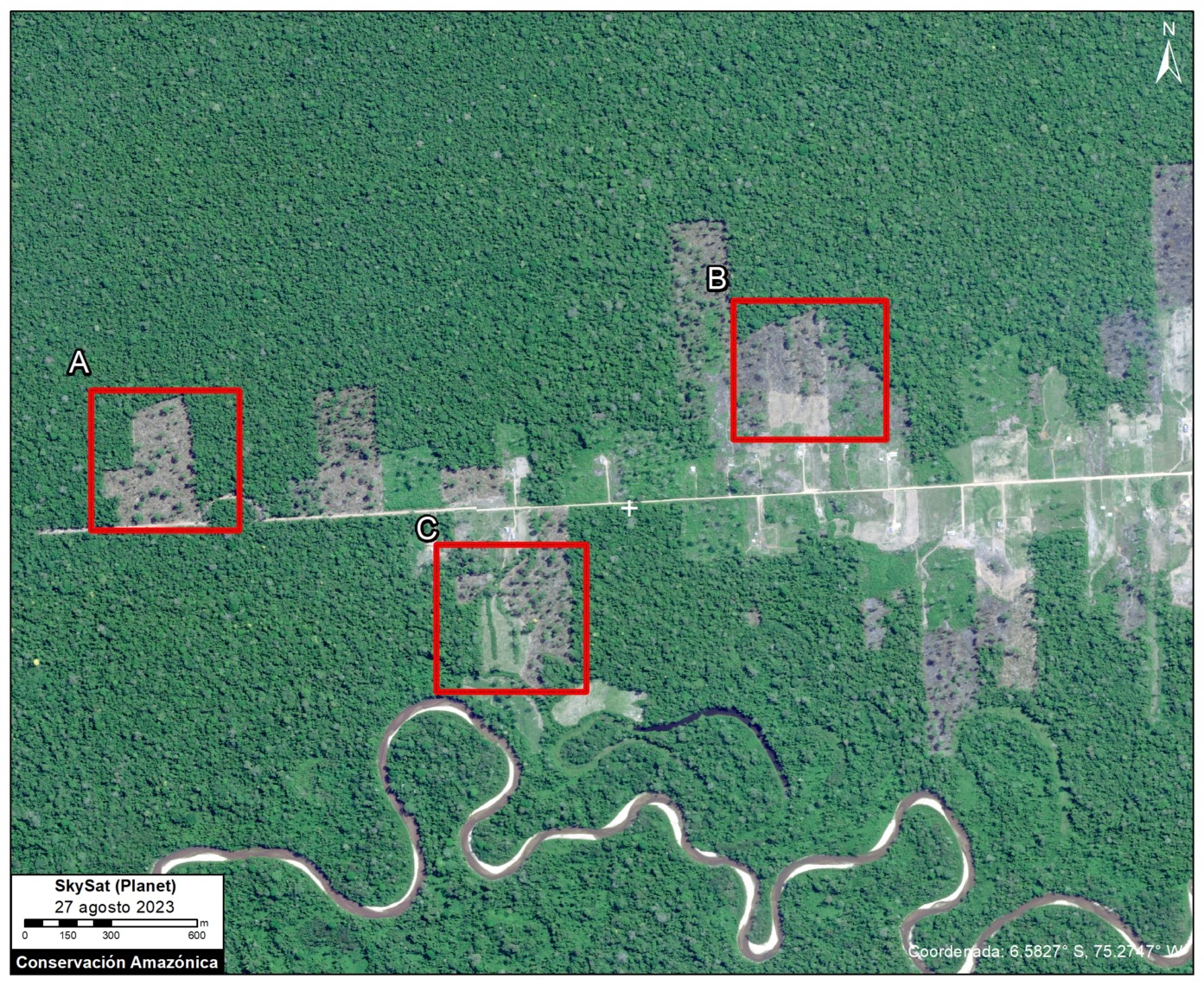
Base Map – Chipiar Mennonite Colony. Data: Planet (Skysat), ACA (MAAP)
Chipiar Colony
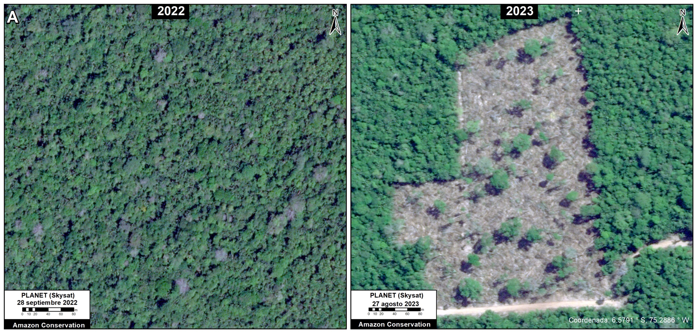
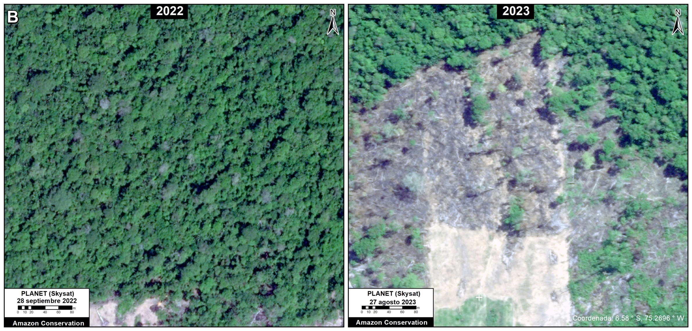
The following image serves as a base map of the recent deforestation in the Chipiar Mennonite colony, located on the border between Loreto and Ucayali.
Insets A-C correspond to the zooms below.
In each of these zooms, we compare very high-resolution images (0.5 meters) obtained in August 2022 (left panels) and July 2023 (right panels).
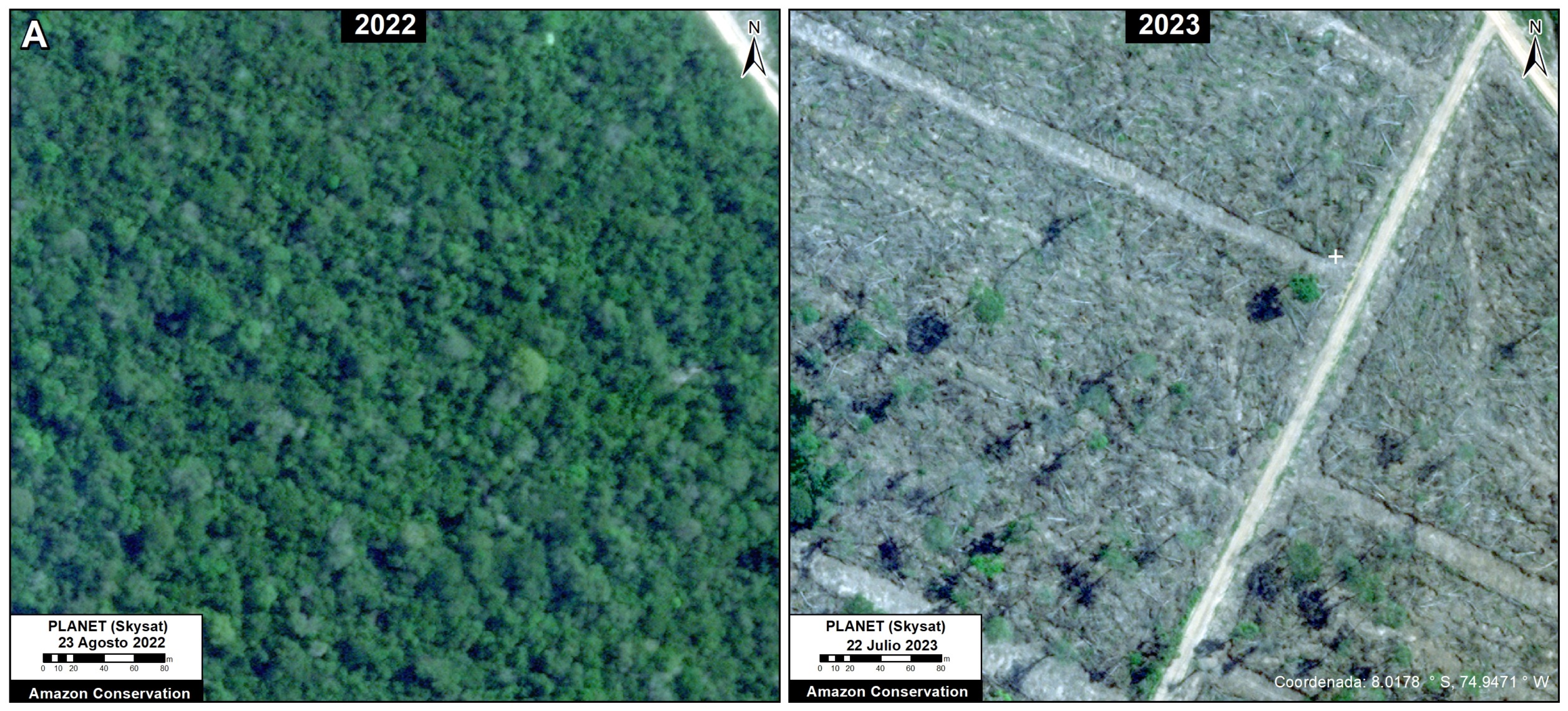
Zoom A. Chipiar Mennonite Colony. Data: Planet (Skysat)
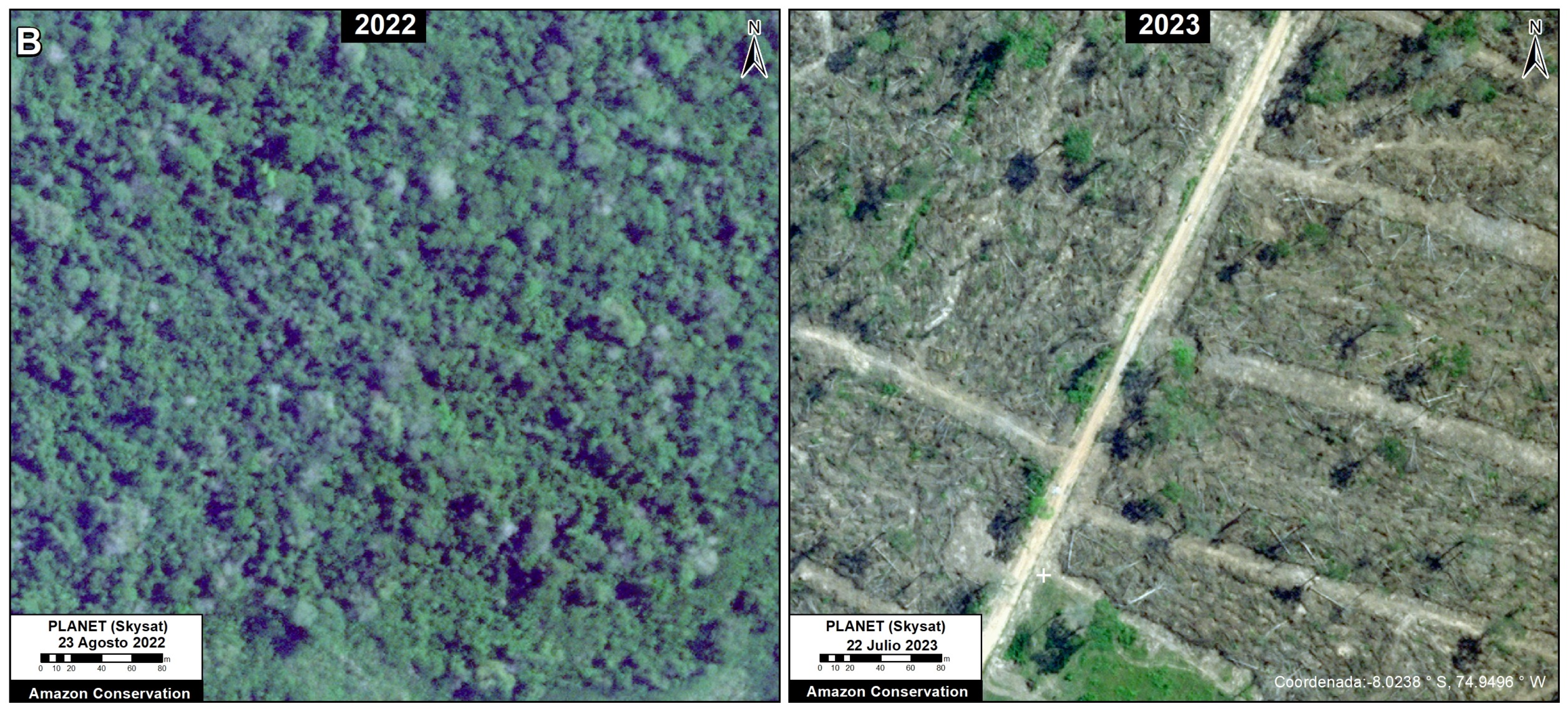
Zoom B. Chipiar Mennonite Colony. Data: Planet (Skysat)
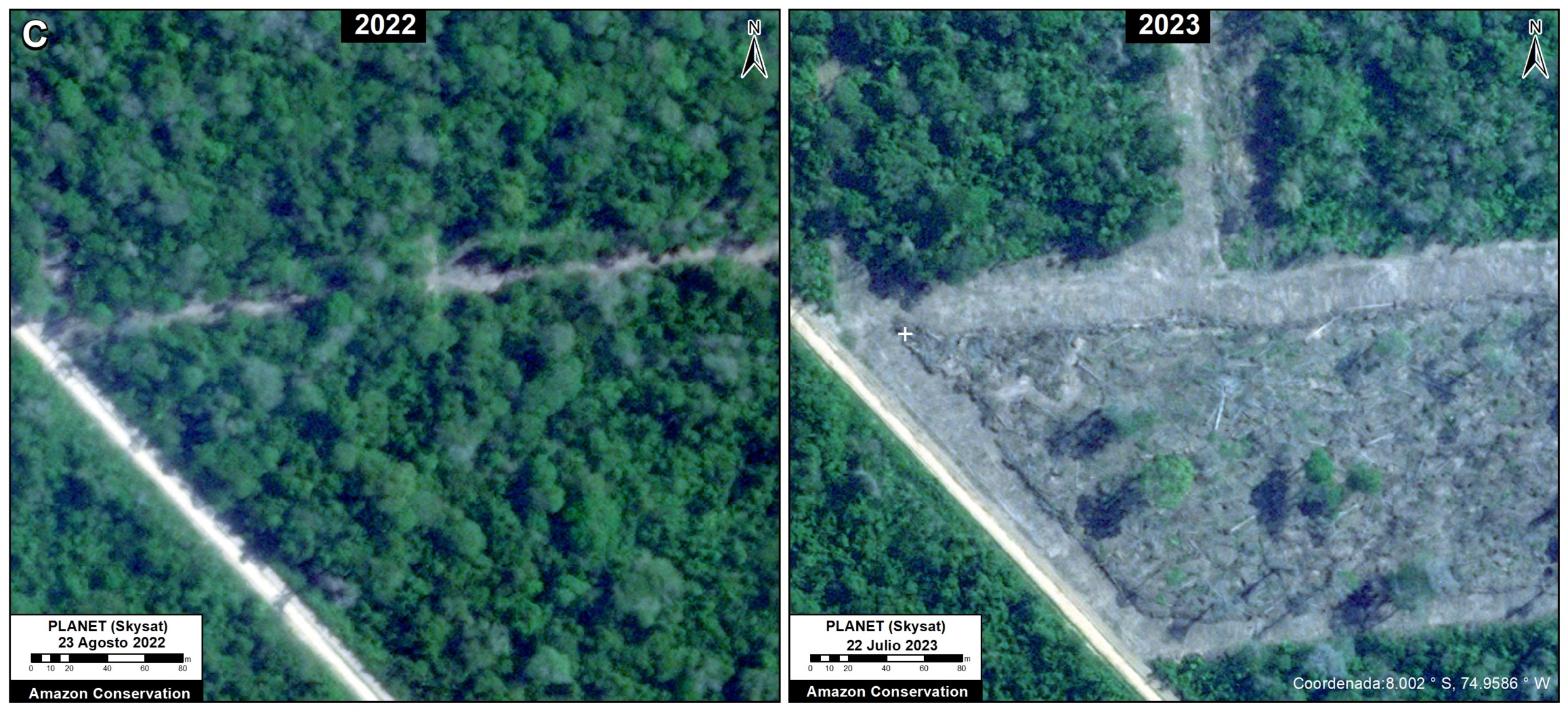
Zoom C. Chipiar Mennonite Colony. Data: Planet (Skysat)
Base Map – Providencia Mennonite Colony. Data: Planet (Skysat), ACA (MAAP)
Providencia Colony
The following image serves as a base map of the recent deforestation in the Providencia Mennonite colony, located in Loreto.
Insets A-C correspond to the zooms below.
In each of these zooms, we compare very high-resolution images (0.5 meters) obtained in September 2022 (left panels) and August 2023 (right panels).
Zoom A. Providencia Mennonite Colony. Data: Planet (Skysat)
Zoom B. Providencia Mennonite Colony. Data: Planet (Skysat)
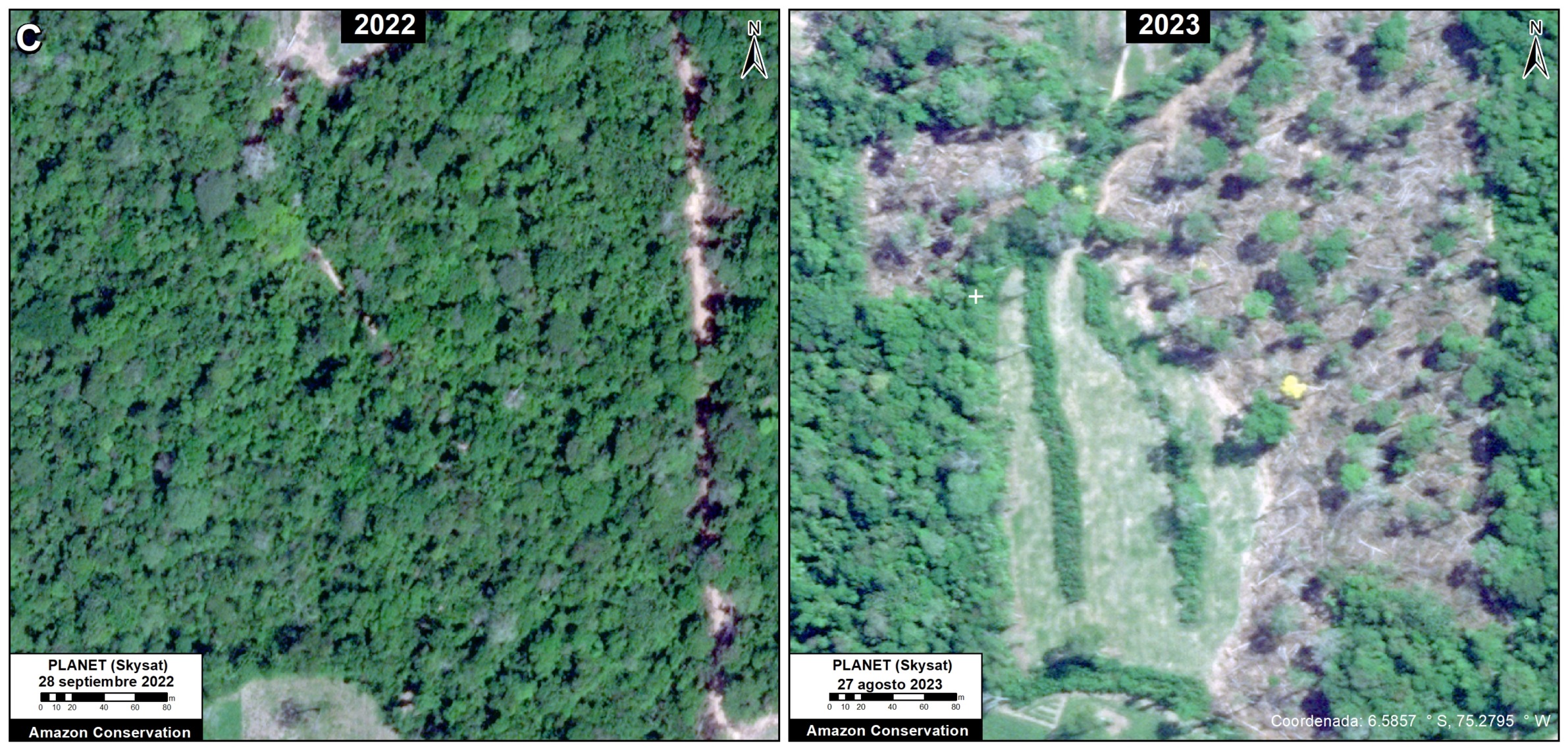
Zoom C. Providencia Mennonite Colony. Data: Planet (Skysat)
Base Map – Vanderland Mennonite Colony. Data: Planet (Skysat), ACA (MAAP)
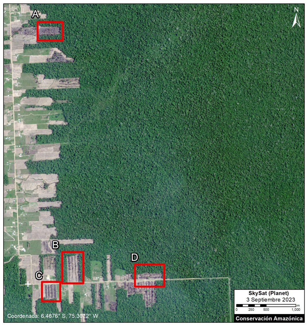
Vanderland Colony
The following image serves as a base map of the recent deforestation in the Vanderland Mennonite colony, also located in Loreto. Insets A-D correspond to the zooms below. In each of these zooms, we compare very high-resolution images (0.5 meters) obtained in July 2023 (left panels) and September 2023 (right panels).
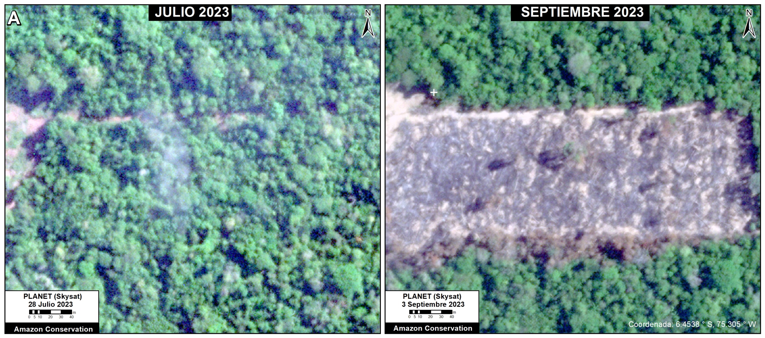
Zoom A. Vanderland Mennonite Colony. Data: Planet (Skysat)
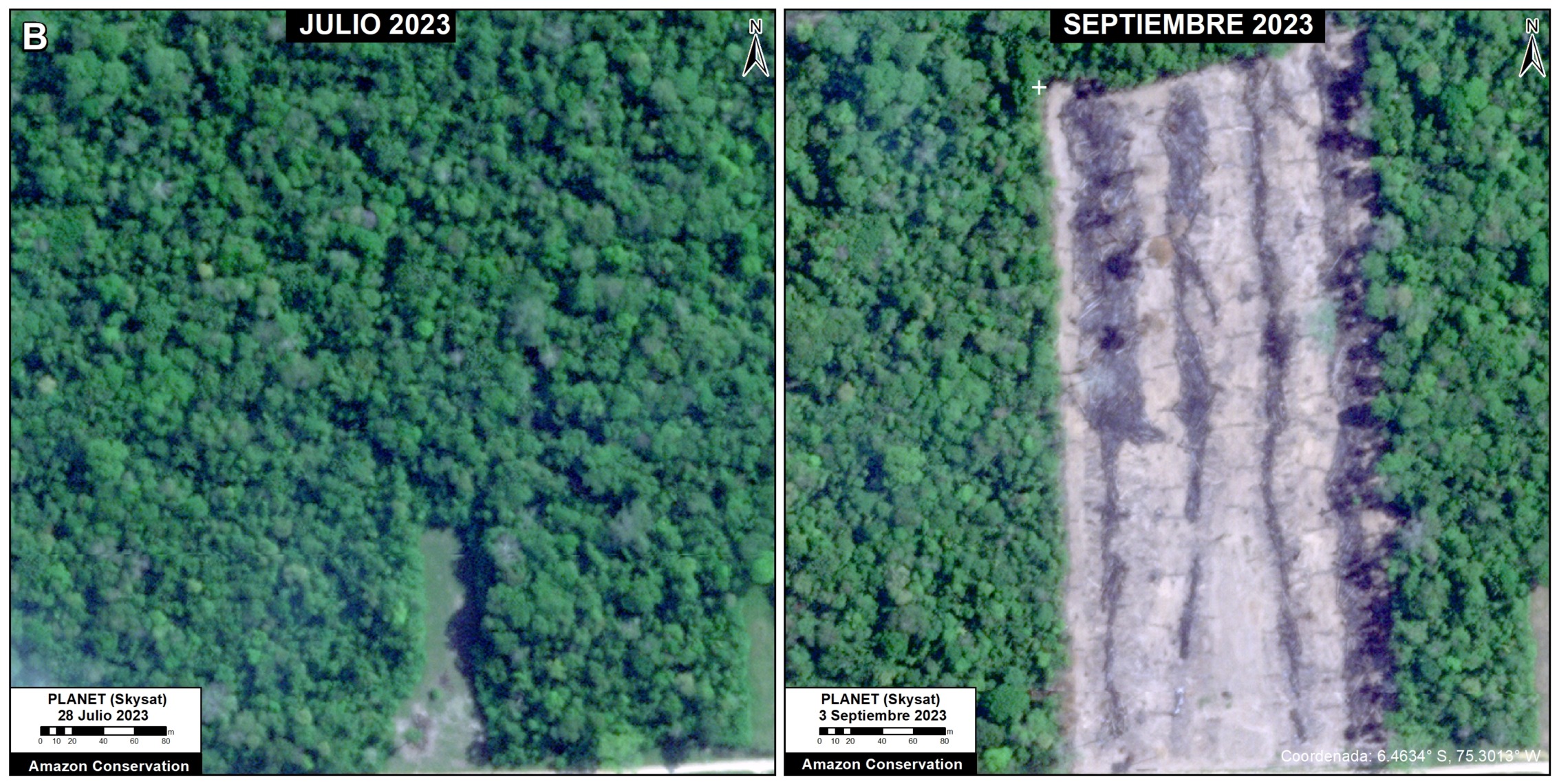
Zoom B. Vanderland Mennonite Colony. Data: Planet (Skysat)
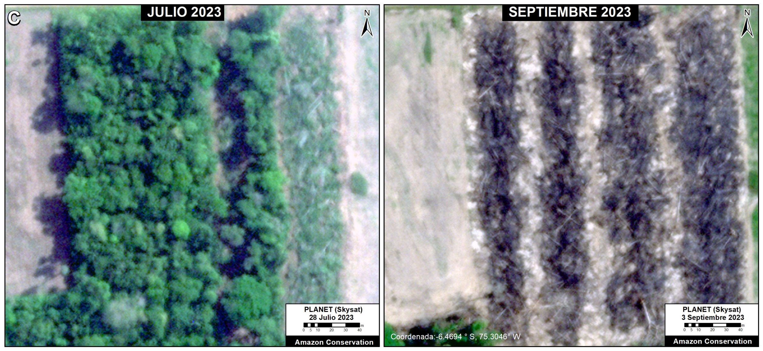
Zoom C. Vanderland Mennonite Colony. Data: Planet (Skysat)
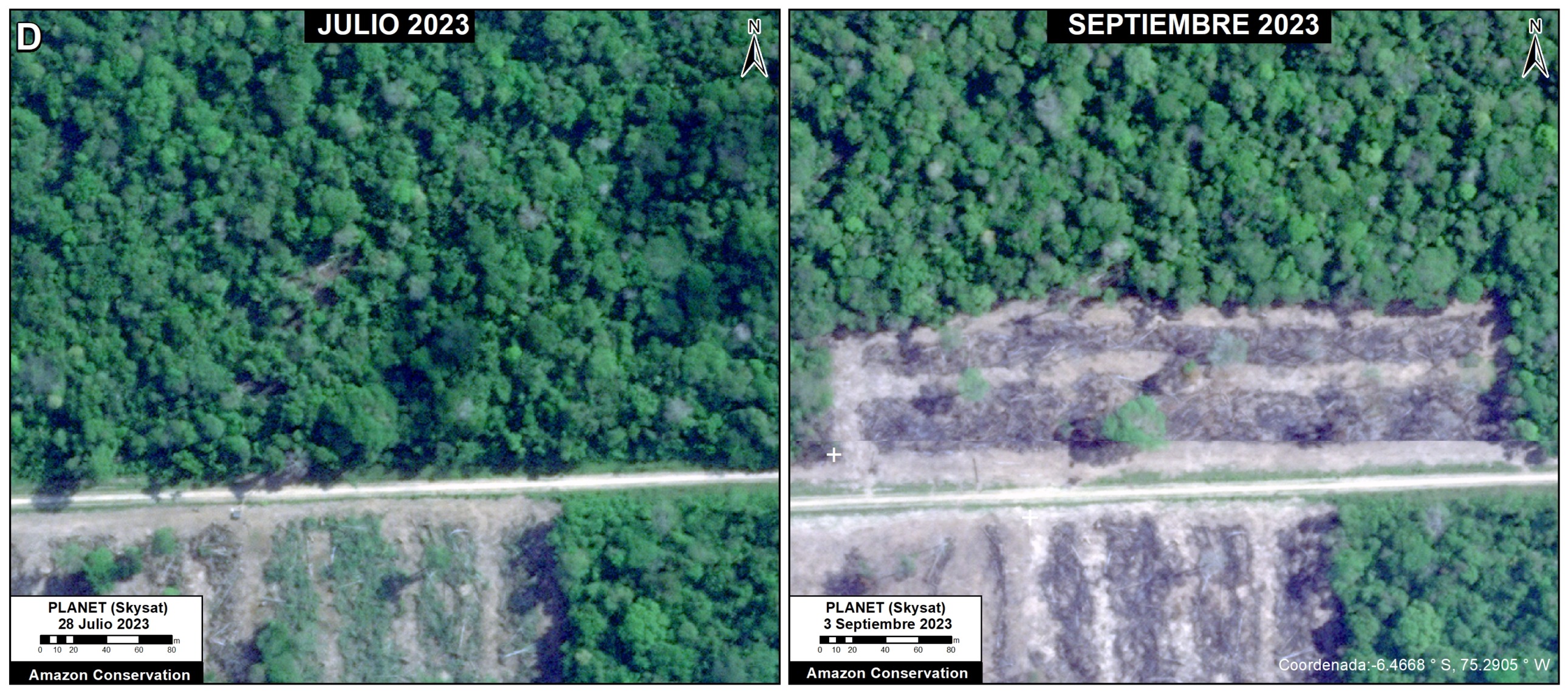
Zoom A. Vanderland Mennonite Colony. Data: Planet (Skysat)
Annex – Base Map of Mennonite Colonies in the Peruvian Amazon
Citation
Finer M, Ariñez A, Mamani N (2023) Confirming Deforestation by Mennonites in the Peruvian Amazon. MAAP: 192.
Download PDF of this article