MAAP #211: Illegal roads and Deforestation in Indigenous Reserves & National Parks of the Colombian Amazon

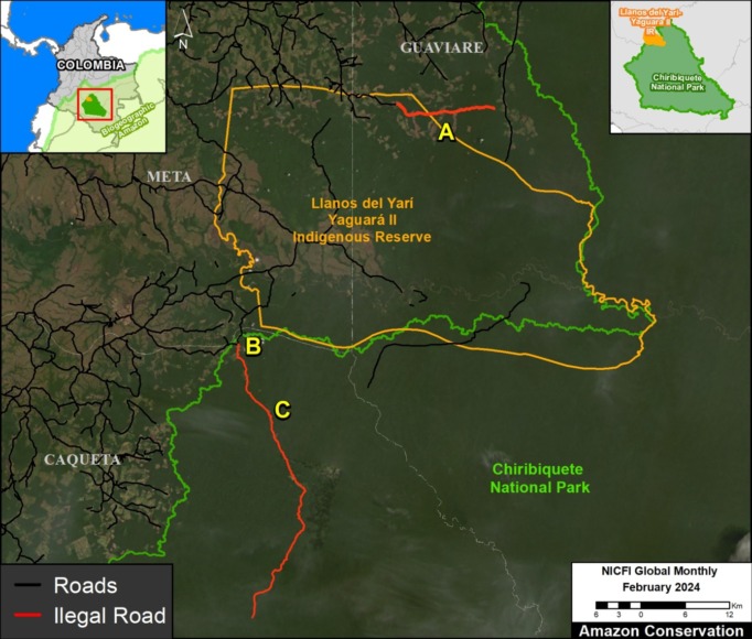
Base Map. Illegal roads causing recent deforestation in the Llanos del Yari-Yaguara II Indigenous Reservation and the adjacent Chiribiquete National Park. Data: MAAP/ACA, FCDS.
Illegal roads are a major threat to the Colombian Amazon, often opening remote primary forests to the main drivers of deforestation: cattle pastures, land grabbing and coca production.
These illegal roads threaten protected areas (including national parks) and indigenous territories (known as Resguardos in Colombia).
In 2024, in collaboration with our Colombian partner FCDS, we have documented these impacts in two important areas in the heart of the Colombian Amazon: the Llanos del Yari-Yaguara II Indigenous Reserve and the adjacent Chiribiquete National Park (see Base Map).
Most notably, in the Llanos del Yari-Yaguara II Indigenous Reserve, we see the construction of a new road, causing massive deforestation of primary forests, both within and adjacent to the territory (856 hectares, or 2,115 acres, in total).
In Chiribiquete National Park, we see the expansion of deforestation of 64 hectares (158 acres) along an illegal road penetrating the northwest sector of this important protected area.
Below, we show satellite images for both cases.
Llanos del Yari- Yaguara II Indigenous Reserve
Since March 2023, a new 14-kilometer illegal road has been built in this area, of which 5.3 km is within the northeastern sector of the Llanos del Yari- Yaguara II Indigenous Reserve, located in the department of Guaviare. Figures 1 and 2 show that this construction has caused massive deforestation: 856 hectares (2,115 acres), of which 394 hectares are within the Reserve, between February 2023 (left panel) and March 2024 (right panel). This deforestation is presumably for new cattle pasture, facilitated by the new road. Note that Figure 1 shows the satellite images without markings, while Figure 2 adds markings for the illegal road construction and associated deforestation.
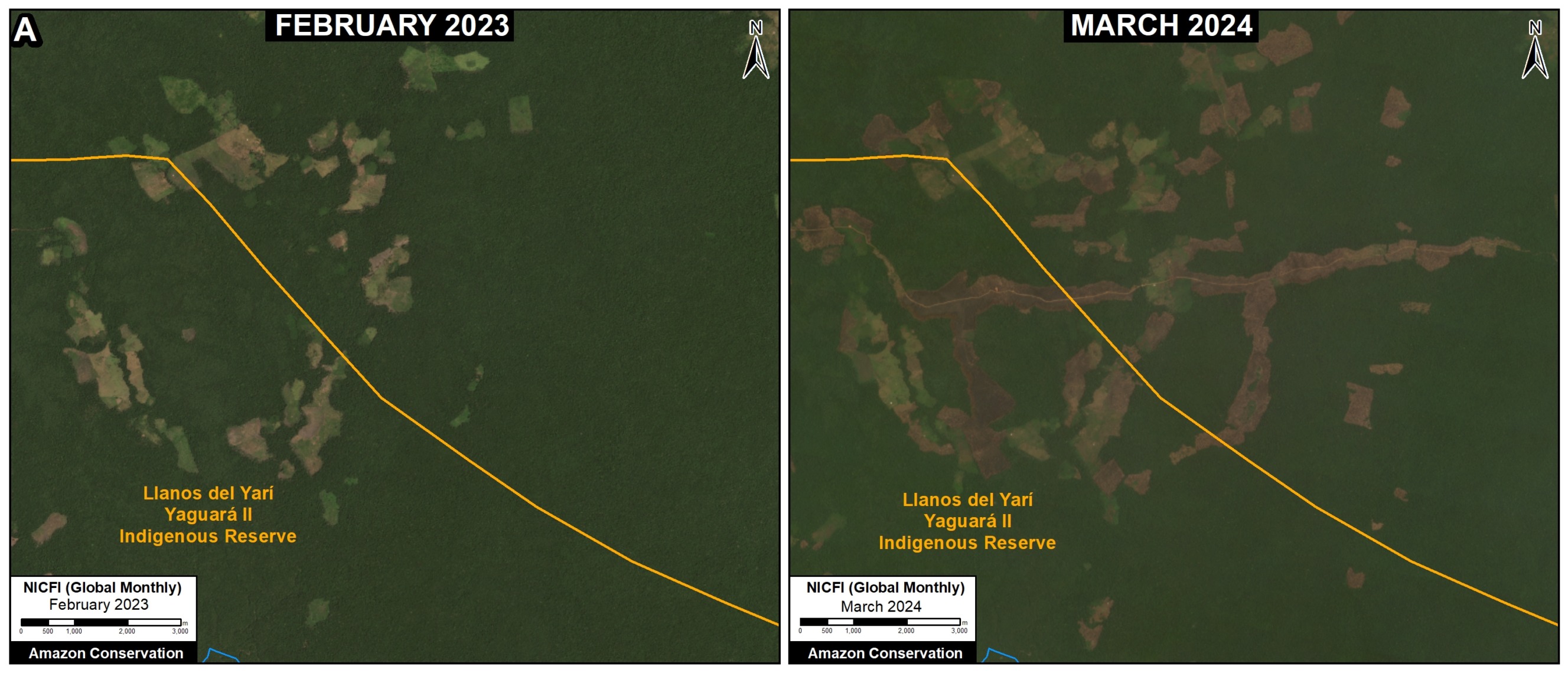
Figure 1. Deforestation along the new illegal road in the Llanos del Yari- Yaguara II Indigenous Reserve, without markings. Data: Planet, NICFI.
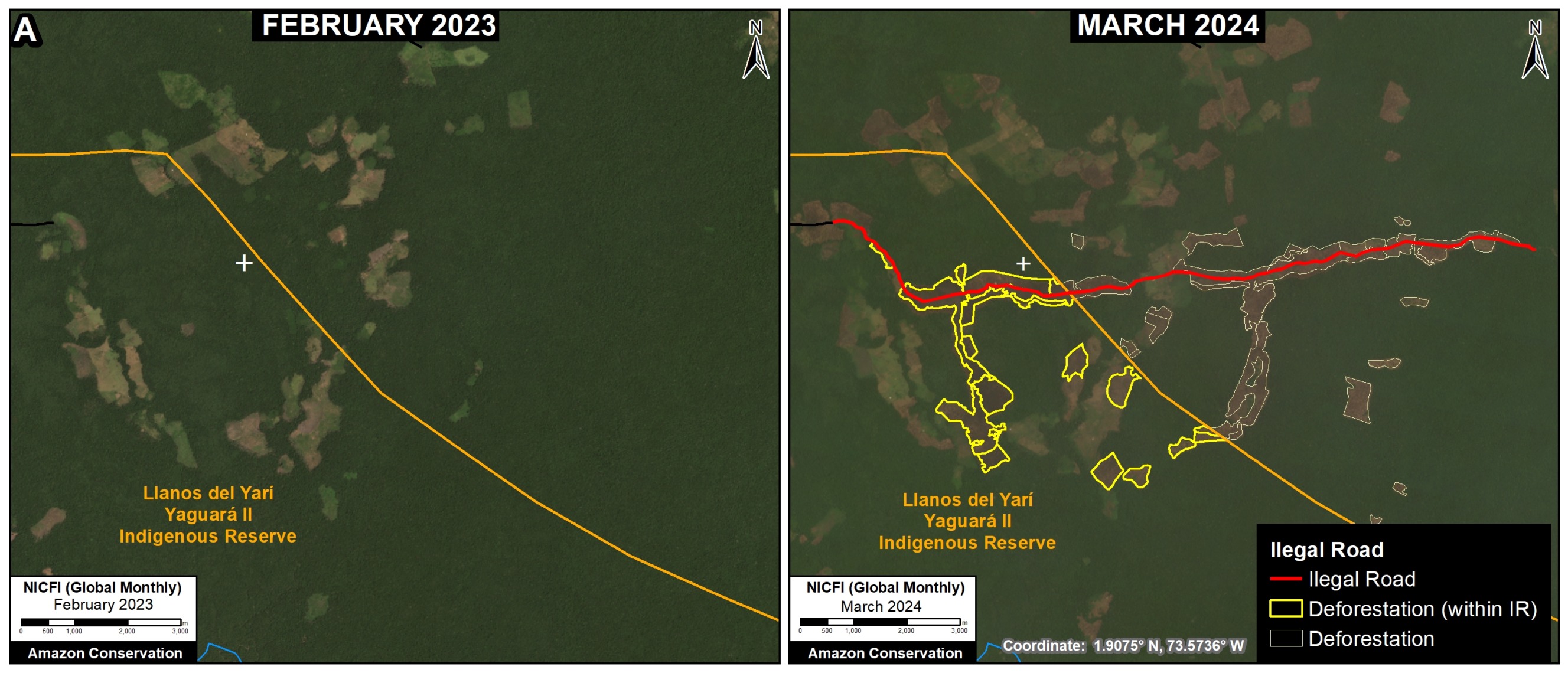
Figure 2. Deforestation along the new illegal road in the Llanos del Yari- Yaguara II Indigenous Reserve, with markings. Data: Planet, NICFI.
Chiribiquete National Park
In the adjacent northwest sector of Chiribiquete National Park, deforestation continues to expand along an existing illegal road, known as the Tunia-Ajaju road, located in the department of Caquetá. Figures 3-6 show the deforestation of 64 hectares (56 hectares in zone B and 8 hectares in zone C) along this road inside the national park, between March 2023 (left panel) and March 2024 (panel right). This deforestation is presumably for new cattle pastures, facilitated by the road. Note that Figures 3 and 5 show the satellite images without markings, while Figures 4 and 6 add markings for the illegal road construction and associated deforestation.
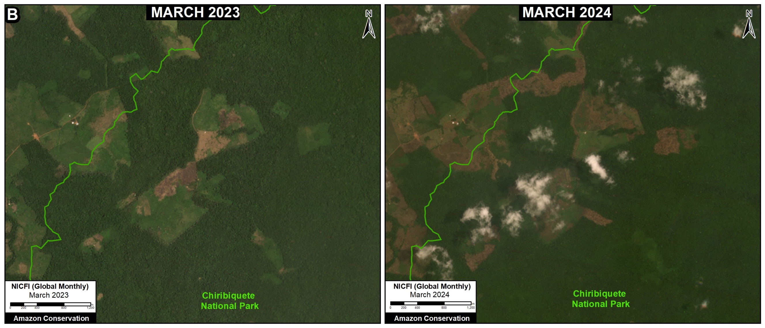
Figure 3. Deforestation along the new illegal road in Chiribiquete National Park (zone B), without markings. Data: Planet, NICFI.
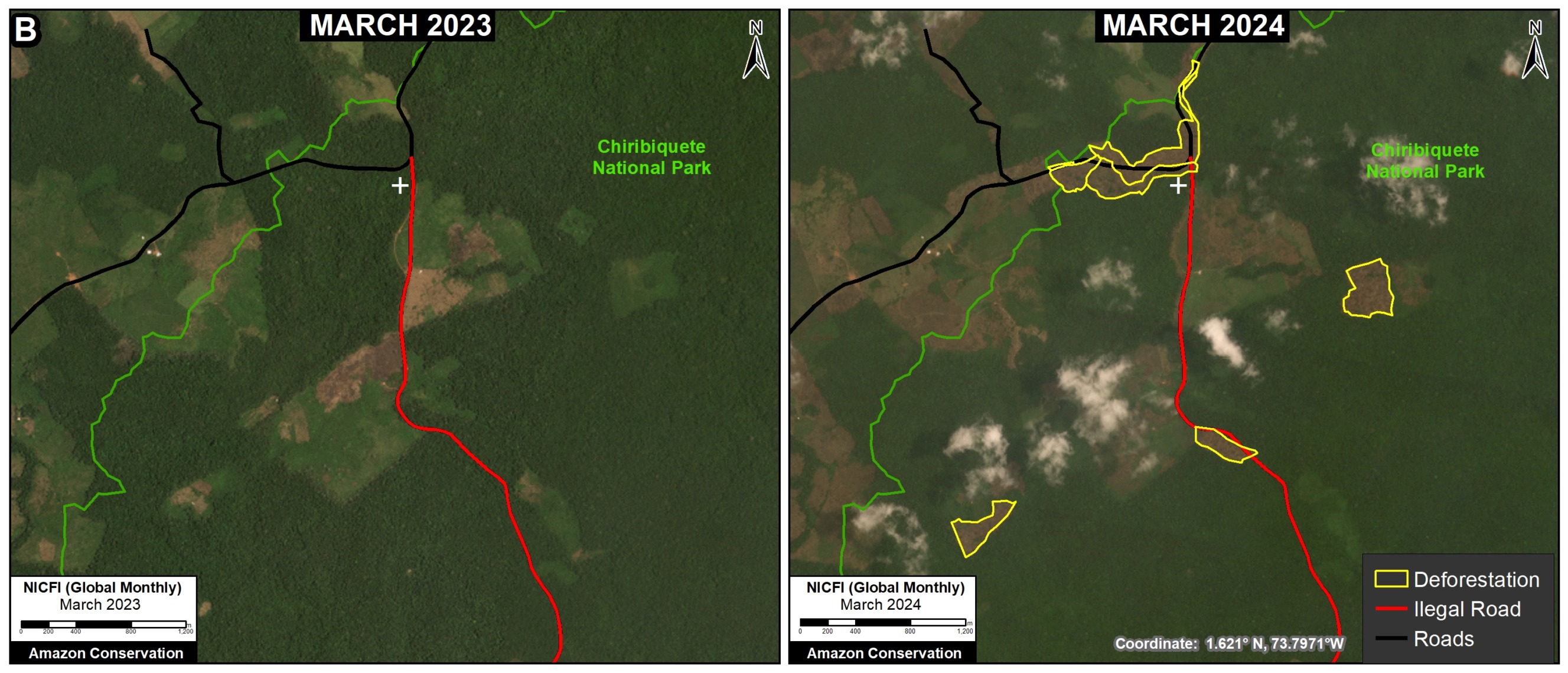
Figure 4. Deforestation along the new illegal road in Chiribiquete National Park (zone B), with markings. Data: Planet, NICFI.
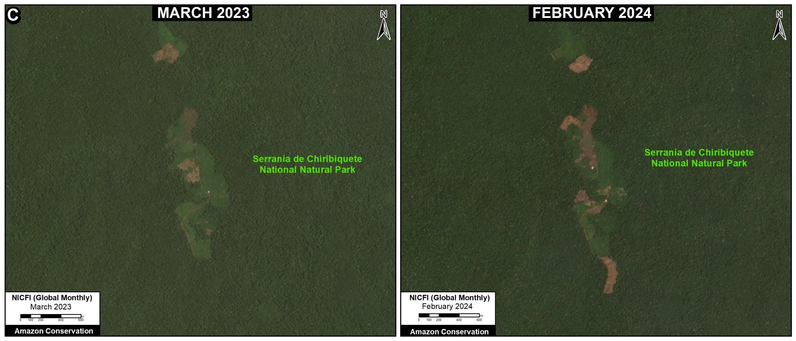
Figure 5. Deforestation along the new illegal road in Chiribiquete National Park (zone C), without markings. Data: Planet, NICFI.
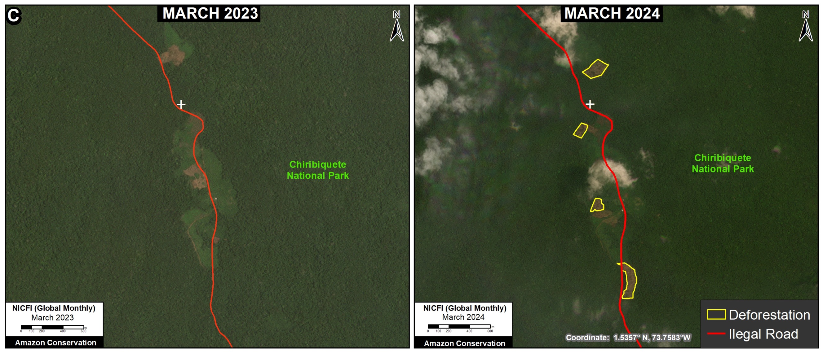
Figure 6. Deforestation along the new illegal road in Chiribiquete National Park (zone C), with markings. Data: Planet, NICFI.
Citation
Finer M, Ariñez A (2024) Illegal roads and Deforestation in Indigenous Reserves & National Parks of the Colombian Amazon. MAAP: 211.
Download PDF of this article


