MAAP #203: Massive Planned Deforestation in Amazon of Suriname


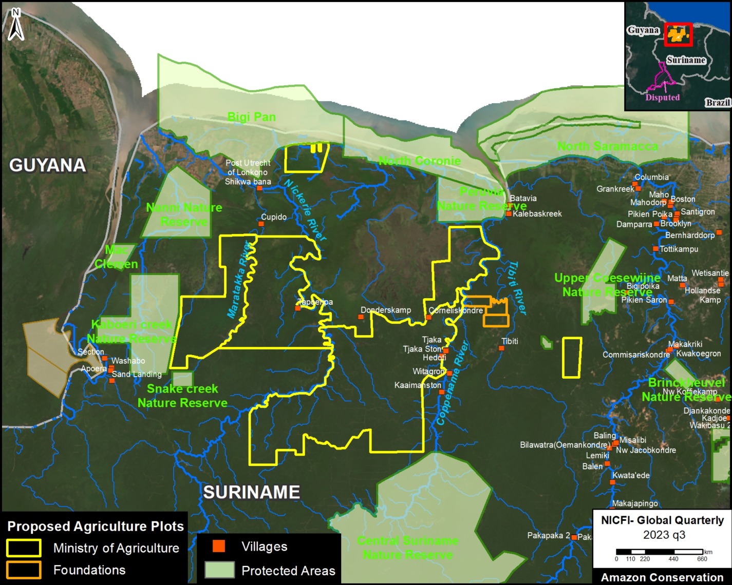
Base Map. Proposed agriculture plots in Amazon of Suriname. Data: Mongabay, ACA/MAAP.
In a recent article, the environmental science news platform Mongabay reported that, according to their review of official documents, the government of Suriname is preparing to clear large tracts of Amazon rainforest for agriculture.
Mongabay reported that a massive amount of land (365,704 hectares, or 903,674 acres) was being targeted for new agriculture plots being established for the Ministry of Agriculture (354,836 hectares) and private land developers (10,868 hectares).
This is additionally noteworthy because large-scale agriculture is not historically or currently a deforestation driver in Suriname, so these new plots would likely trigger unprecedented forest loss in one of the world’s few remaining countries dominated by primary rainforest.
Intertwined with this issue are additional reports indicating that groups of Mennonites are planning to relocate to Suriname. This news has also raised alarms given the extensive deforestation caused by Mennonites in the Amazon regions of both Peru (7,032 hectares) and Bolivia (210,980 hectares).
In their article, Mongabay gathered information from the government documents to create a map of the proposed agriculture plots. We then digitized this map, calibrated it with coordinates in the documents, and then conducted our own analysis.
The Base Map shows our digitized map of the agricultural plots, with the inclusion of protected areas and Indigenous & Tribal Peoples villages, all overlayed on top of a recent satellite image.
We estimate 467,000 hectares in the proposed new agricultural plots (456,238 ha for the Ministry of Agriculture and 10394 ha for Foundations backed by private land developers). Note this is substantially higher than the estimate reported by Mongabay. Additional analysis of the documents indicates that the actual total could rise to 560,000 hectares.
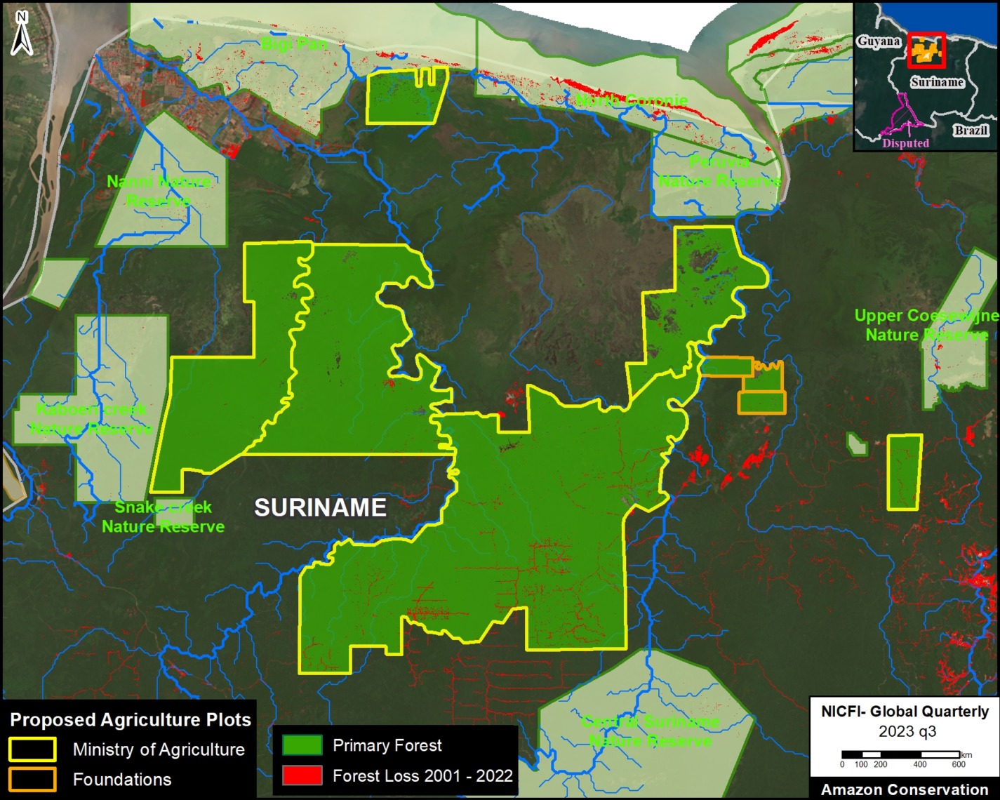
Potential Primary Forest Loss
We performed an additional analysis looking at how much primary forest is contained and threatened in these proposed agriculture plots. This analysis was based on data from the University of Maryland and Global Forest Watch.
In Figure 2, we estimate 451,000 hectares of threatened primary forest in the proposed agriculture plots (441,362 ha for the Ministry of Agriculture and 9,958 ha for Foundations backed by private land developers).
This would result in a shocking amount of primary forest loss for a country that has experienced an average annual deforestation of 6,560 hectares over the past 21 years (137,746 hectares in total since the year 2002).
Citation
Finer M, Goedschalk J, Arinez Z (2024) Massive Planned Deforestation in Amazon of Suriname. MAAP: 203.
Download PDF of this article